This article presents insights from the new IDTechEx report titled “Lidar 2020-2030” IDTechEx report.| Geography Realm
GIS Data| Geography Realm
This article reviews some of terminology and types of elevation based datasets available to GIS.| Geography Realm
In recent decades, mapping underground features, such as physical structures or even sounds, has substantially improved.| Geography Realm
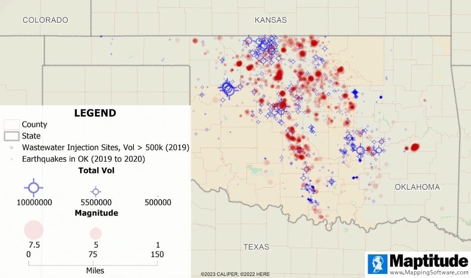
Mapping software can help us observe trends in earthquakes, identify areas of high earthquake prevalence, and explore relationships between earthquakes and other phenomena.| Geography Realm
Lidar is a technology developed to map the elevation of features on and below the surface of the Earth.| Geography Realm
Changes in how archaeologists study the past are being brought about by advances in LiDAR technology.| Geography Realm
ICESat-2's purpose is to collect detailed measurements of the Earth's surface using its Advanced Topographic Laser Altimeter System (ATLAS).| Geography Realm
Google is using artificial intelligence to develop maps of tree canopy from its aerial imagery.| Geography Realm
Few tools have helped change and improve data collection within the field of Geographic Information Systems (GIS) more than Global Positioning System (GPS).| Geography Realm
Geography is the science that studies the Earth and the physical and human influences that shape it.| Geography Realm