
New BGS GeoIndex viewer released for user testing - British Geological Survey
The premium map-viewing application has been given a major upgrade and made available as a beta release.| British Geological Survey
The premium map-viewing application has been given a major upgrade and made available as a beta release.| British Geological Survey
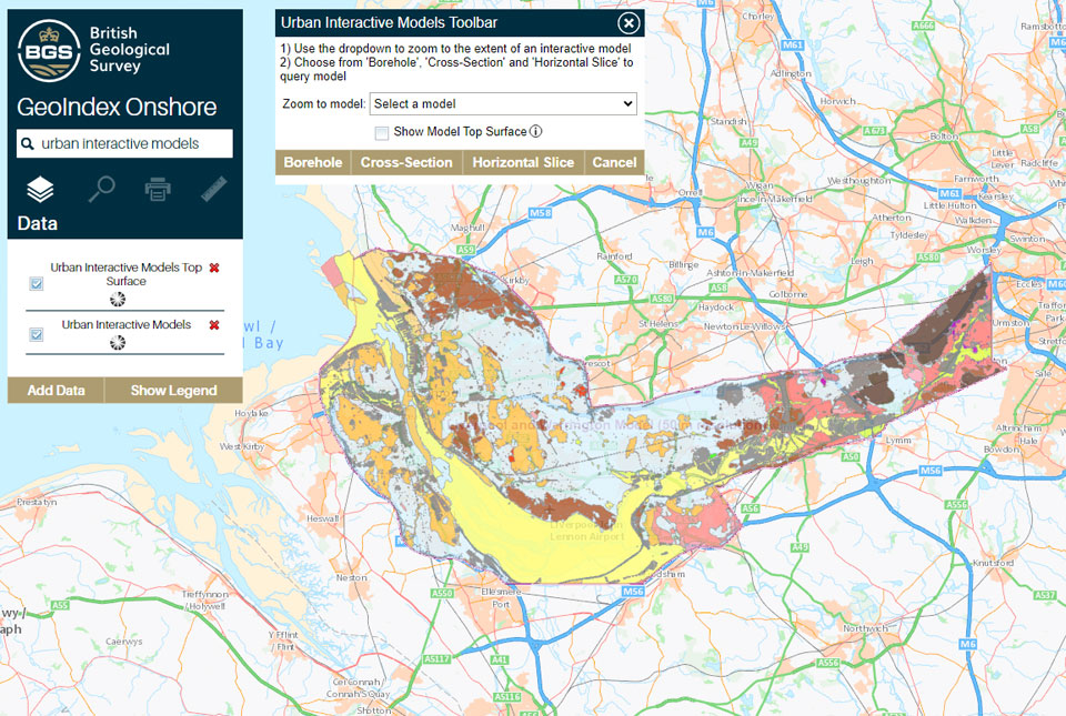
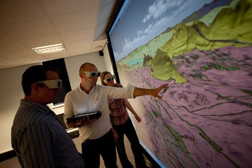
The geological secrets lying under the surface of Liverpool and Warrington have been unveiled for the first time on a new 3D interactive tool.| British Geological Survey
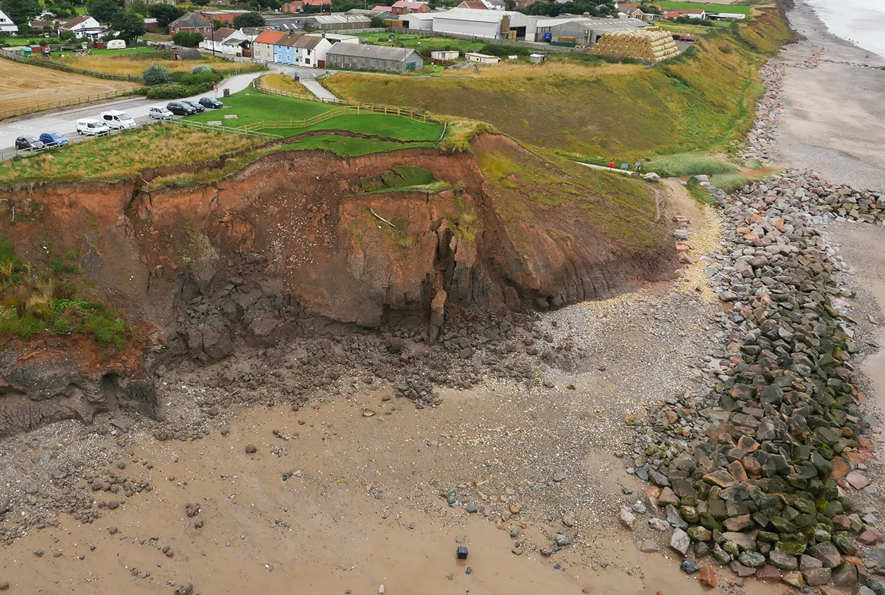
A new tool is now available which has been designed for coastal engineers and practitioners to better manage the compound risk of coastal erosion and flooding.| British Geological Survey

Marine ecosystem science and offshore infrastructure will be boosted by a new dataset showing sediment composition across the UK continental shelf.| British Geological Survey
BGS is seeking user feedback on artificial ground data – how you use it, what information do you consider, and what we can do to improve our services.| British Geological Survey
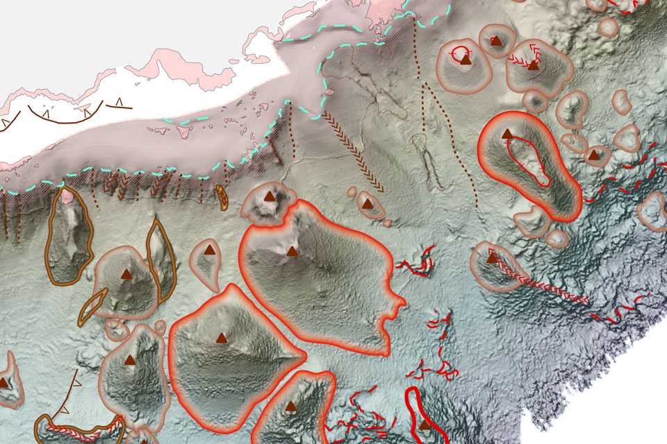
BGS deliver the first marine geology and habitat maps for one of the World’s largest marine protected areas.| British Geological Survey
From sinkholes to radon: new maps highlight Britain's most geologically at-risk regions| British Geological Survey
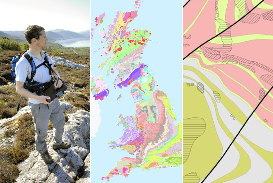
BGS are seeking user feedback on our geological map digital datasets to improve data content and delivery.| British Geological Survey
Geology doesn’t stop at international borders, so BGS is working with neighbouring geological surveys and research institutes to solve common problems with the geology they share.| British Geological Survey
The partnership will focus on research on multi-hazard preparedness within the country.| British Geological Survey

Professor Jonathan Chambers has been appointed as the new BGS Chief Scientist for multi-hazards and resilience (MHR).| British Geological Survey
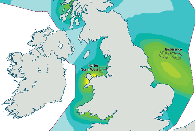
An essential geological model detailing seismic hazard has been published as pursuit of new renewable energy infrastructure intensifies.| British Geological Survey
