
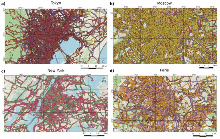
The paper addresses the global shortage of detailed road surface data by leveraging street-view imagery from Mapillary and advanced deep learning techniques. Traditional datasets like OpenStreetMap (OSM) often lack comprehensive road surface attributes—with only about 30–40% coverage—hindering applications such as travel time estimation, disaster response routing, urban planning, and environmental assessments. To fill this gap, the paper proposes a novel approach that utilizes heterogen...| GIScience Blog
The full article was originally published on geoawesome.| GIScience Blog
We’re excited to share the release of the ohsome-planet – a new software library on GitHub, marking a significant step toward the development of ohsome 2.0. This tool is designed to facilitate the transformation of raw OpenStreetMap (OSM) history data into the GeoParquet format, making it more accessible and efficient for spatial data analysis.| GIScience Blog
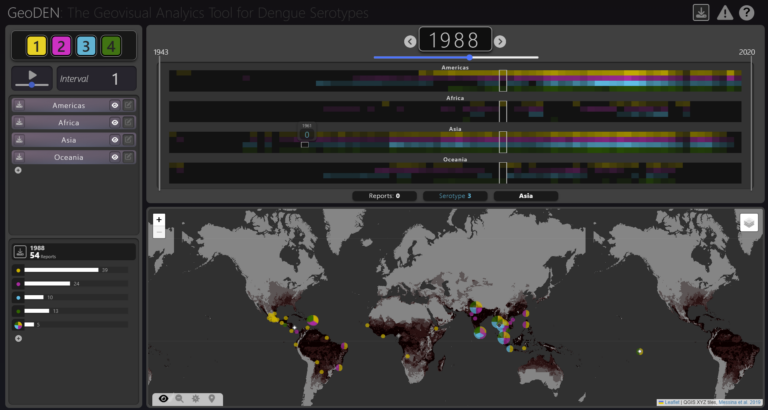
With the increasing availability of global disease datasets, Visual Analytics (VA) has emerged as a valuable tool in spatial epidemiology, particularly for studying serotype interactions in diseases like dengue. Dengue, caused by four serotypes (DENV1-DENV4), poses a significant global health threat exacerbated by urbanization and climate change. Traditional approaches rely on static mapping or animation of serotype incidence, but there remains a gap in utilizing VA tools for dynamic and inte...| GIScience Blog
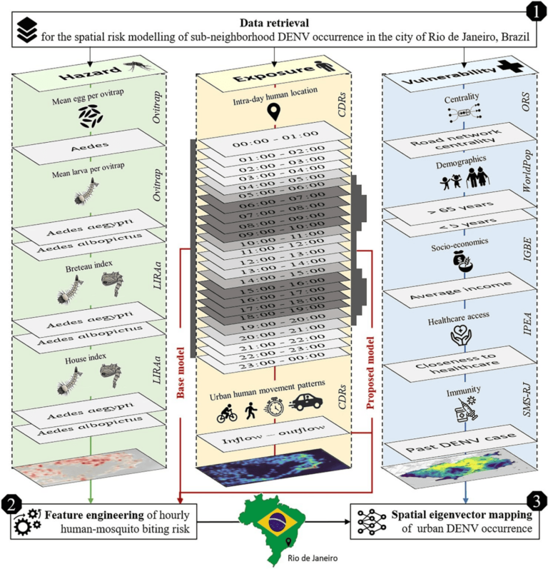
Scientific Reports publishes a paper by Steffen Knoblauch et al. that underscores the critical importance of integrating vector ecology and human behavior into advanced disease modeling frameworks.| GIScience Blog
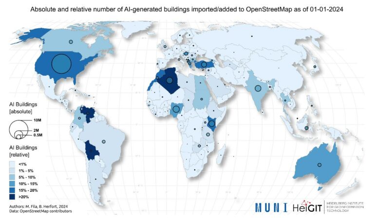
The concept of a “Digital Earth” has long envisioned a future where technological advancements enable the large-scale collection and visualization of spatial and environmental data. Today, open data sources such as OpenStreetMap (OSM) provide crucial spatial information for diverse applications, including urban planning, disaster management, and public health. However, many regions remain insufficiently mapped, particularly in less developed areas. AI-assisted mapping has emerged as a pot...| GIScience Blog
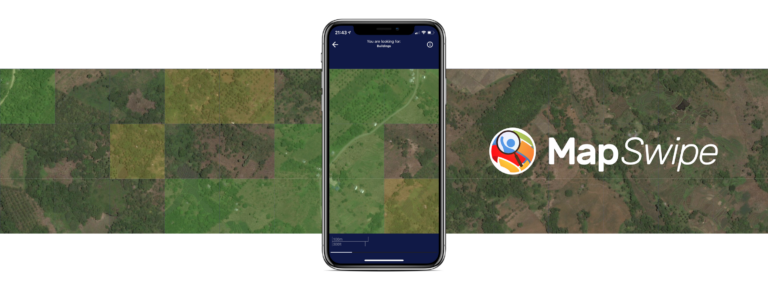
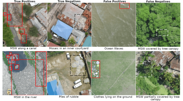
The crowdmapping app MapSwipe now integrates also street-level imagery. This new feature enables even mapping efforts that require the highest level of detail, such as detecting waste on the street.| GIScience Blog
Geospatial technologies offer significant opportunities to address sustainability and resilience challenges by integrating Volunteered Geographic Information (VGI) and remote sensing with environmental science to tackle critical climate-related issues. With the accelerating impacts of rising global temperatures and extreme weather events, communities face increasing demands to manage vital resources, including water, energy, and land. The combined use of VGI and remote sensing holds great pot...| GIScience Blog
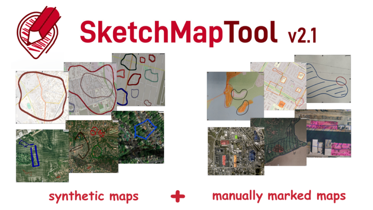
The newly released Sketch Map Tool v2.1 features a higher accuracy in digitizing hand-sketched markings on Sketch Maps, thanks to a larger training dataset and an updated machine learning model for sketch detection. New user metrics show that thousands of Sketch Maps are created every month all over the world.| GIScience Blog
This article was originally published on the website of 510, the data and digital unit of The Netherlands Red Cross: Unleashing the Power of GIS, Together: The IFRC Network GIS Training Platform – 510| GIScience Blog