
Landsat at Work: Preparing Residents Where Hurricanes Threaten
Landsat-based National Land Cover Database (NLCD) helps predict hurricane wind risk to homes and other structures.| Landsat Science | A joint NASA/USGS Earth observation program.
Landsat-based National Land Cover Database (NLCD) helps predict hurricane wind risk to homes and other structures.| Landsat Science | A joint NASA/USGS Earth observation program.
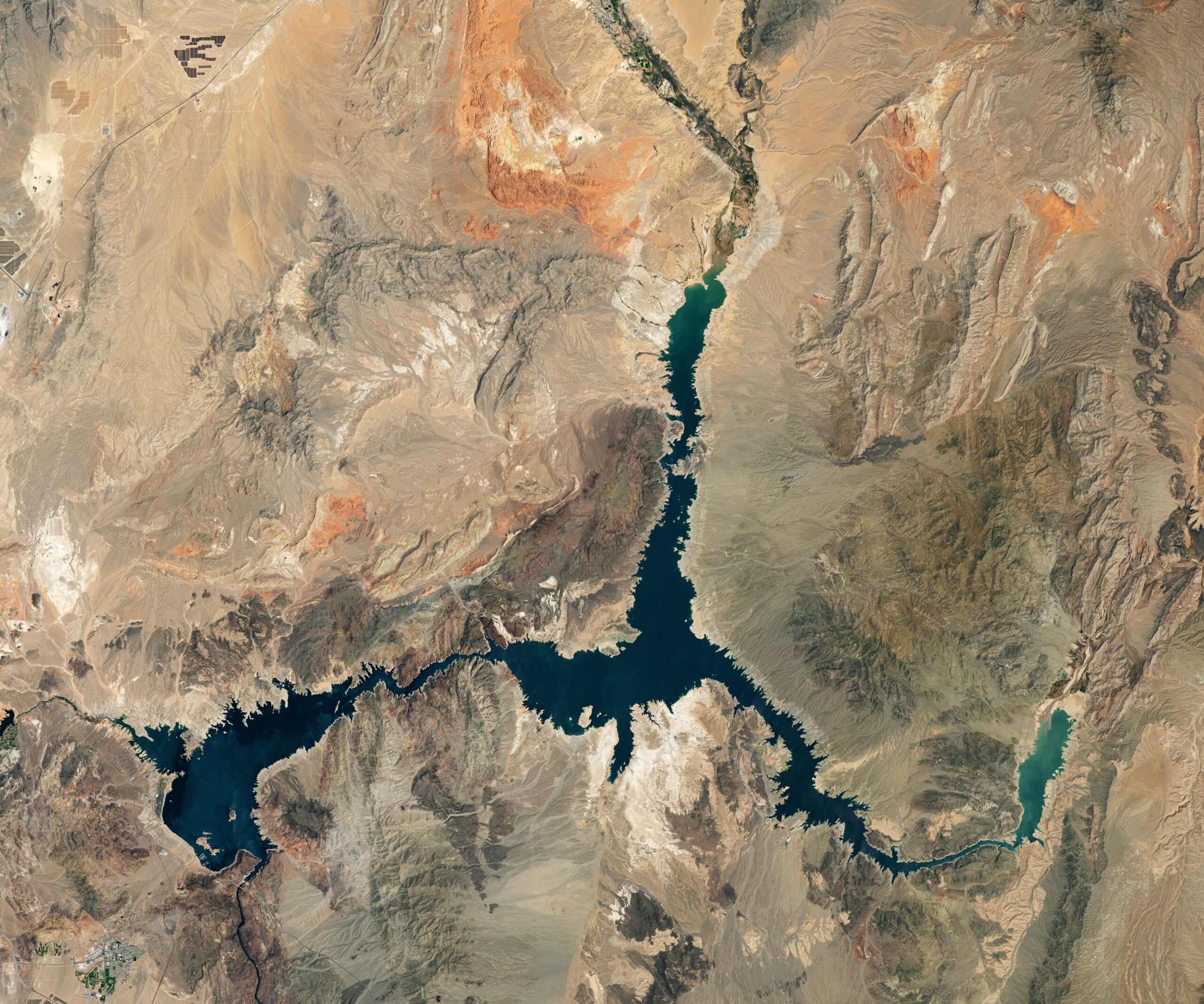
Using data from Harmonized Landsat and Sentinel-2 (HLS), researchers developed a new algorithm to better monitor reservoir water levels in the contiguous U.S.| Landsat Science | A joint NASA/USGS Earth observation program.

The Landsat satellite program, with its unparalleled 53-year historic record, can reveal changes through the Annual National Land Cover Database (NLCD).| Landsat Science | A joint NASA/USGS Earth observation program.
When the first Landsat satellite launched in 1972, it posed the following question: could we manage our natural resources using remotely–sensed data? The answer, 53 years on, is a resounding “yes.”| Landsat Science | A joint NASA/USGS Earth observation program.

Landsat satellites have begun regularly acquiring images of ice at the poles during the winter, with enlightening results.| Landsat Science | A joint NASA/USGS Earth observation program.
