
Test Driven Development with OpenGL · Jan Wedekind
Test Driven Development with OpenGL| www.wedesoft.de
Test Driven Development with OpenGL| www.wedesoft.de
These color and elevation maps are designed for use in 3D rendering software. They are created from data assembled by the Lunar Reconnaissance Orbiter camera and laser altimeter instrument teams.Color ||| NASA Scientific Visualization Studio
Learn OpenGL . com provides good and clear modern 3.3+ OpenGL tutorials with clear examples. A great resource to learn modern OpenGL aimed at beginners.| learnopengl.com
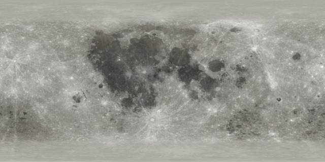
Using LWJGL’s OpenGL bindings and Fastmath to render data from NASA’s CGI Moon Kit| Clojure Civitas

