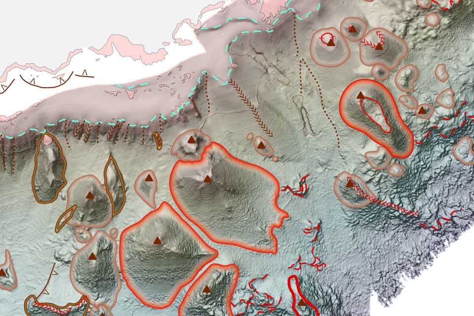
BGS has released significantly extended high-resolution maps that will support offshore green-energy initiatives in the area. The post Extended seabed geology map of the Bristol Channel published appeared first on British Geological Survey.| British Geological Survey
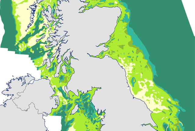
Marine ecosystem science and offshore infrastructure will be boosted by a new dataset showing sediment composition across the UK continental shelf.| British Geological Survey
For the first time scientists managed to take water and sediment samples from beneath the ocean on the New England Shelf with the intention of understanding this offshore aquifer system.| British Geological Survey
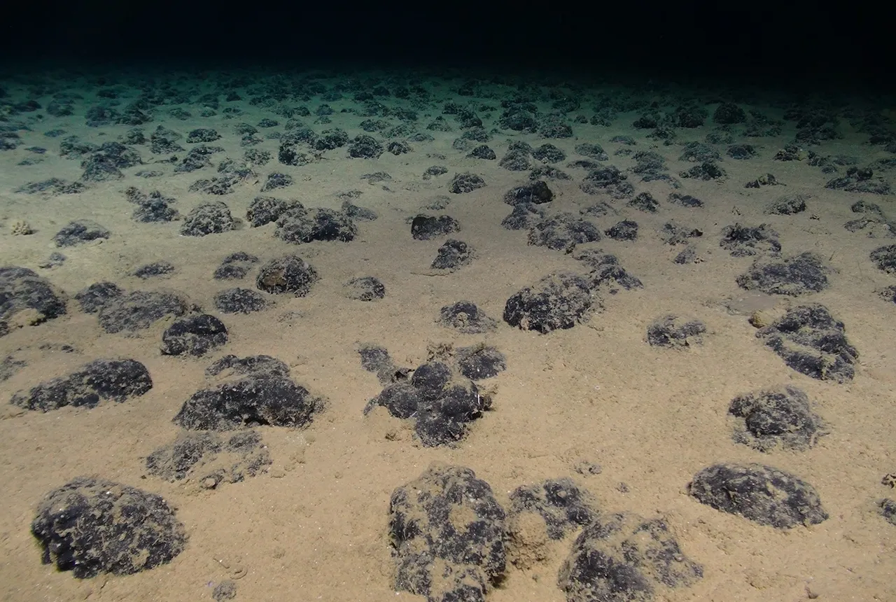
BGS geologists were involved in new study revealing the long-term effects of seabed mining tracks, 44 years after deep-sea trials in the Pacific Ocean.| British Geological Survey
BGS and The Crown Estate are seeking stakeholder feedback in order to improve understanding of national-scale seabed geology requirements| British Geological Survey
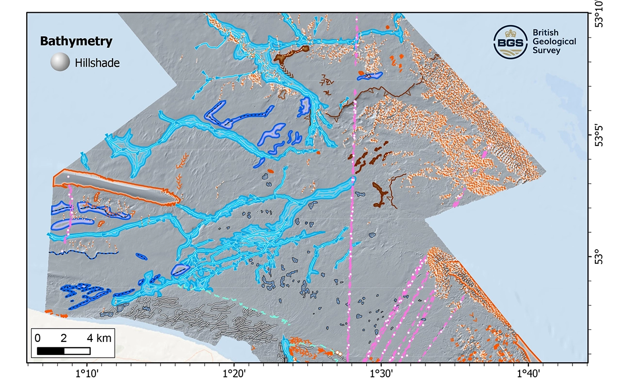
New geological map will help in the hunt for new renewable energy opportunities whilst protecting delicate marine ecosystems.| British Geological Survey