
The figure-ground diagram - MORPHOCODE
A figure-ground diagram is a mapping technique used to illustrate the relationship between built and unbuilt space in cities.| MORPHOCODE
A figure-ground diagram is a mapping technique used to illustrate the relationship between built and unbuilt space in cities.| MORPHOCODE
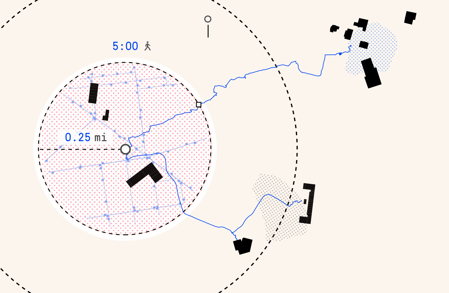
The 5-minute walk, also known as the “pedestrian shed” is considered to be the distance people are willing to walk before opting to drive.| MORPHOCODE
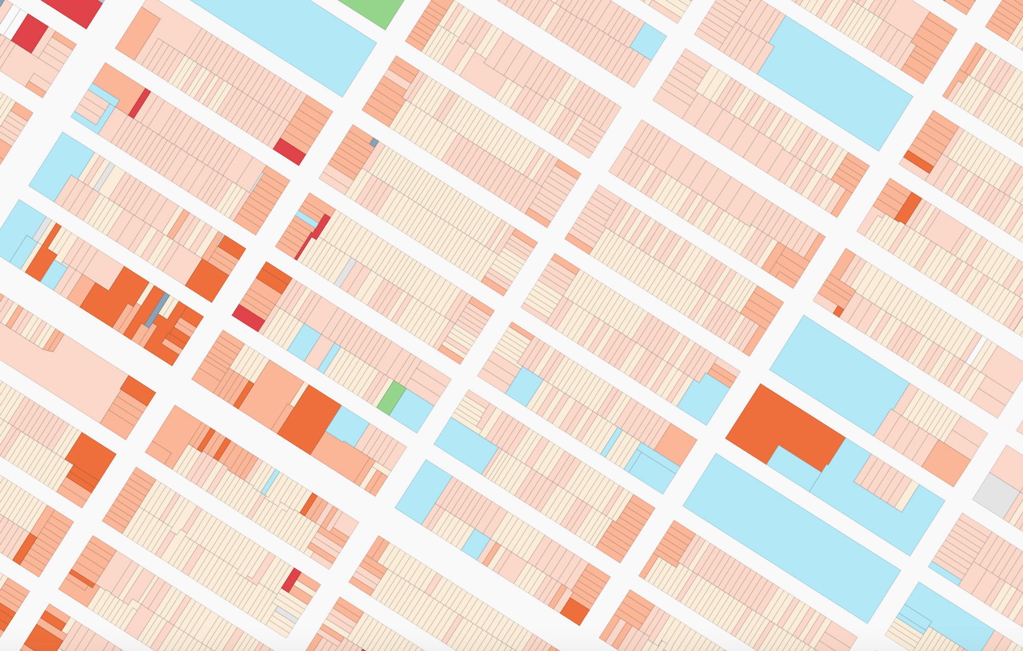
The use of color in maps and data visualizations has a long tradition. Color is one of the primary means to encode data graphically.| MORPHOCODE
