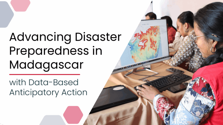
Acting Before the Disaster Happens: a Risk Assessment for Cyclones in Madagascar
Anticipatory Action for Disaster Management| HeiGIT
Anticipatory Action for Disaster Management| HeiGIT
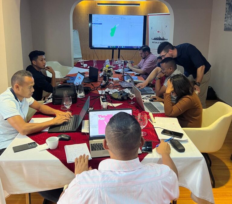
Anticipatory Action (AA) is becoming an increasingly vital approach in humanitarian and disaster risk management. By leveraging forecasts and risk data, AA enables timely interventions before extreme events occur. Geoinformation technologies play a key role in operationalizing this approach. In Madagascar, where cyclones regularly cause widespread damage, HeiGIT has been working with Croix-Rouge Malagasy (CRM, the Malagasy Red Cross) and the German Red Cross (GRC) and with the financial suppo...| HeiGIT
Open-source geoinformation, | heigit.org
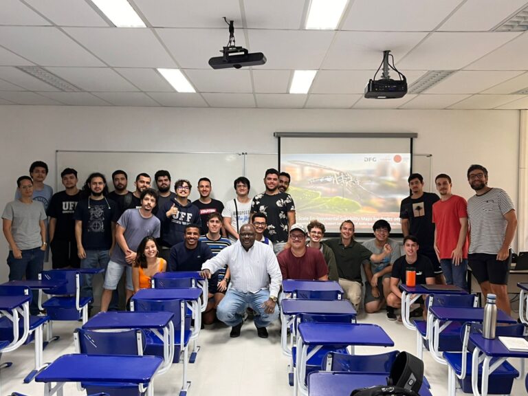
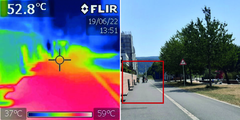
Building on ongoing efforts to enhance urban health management and mosquito-borne disease monitoring in the municipality of Rio de Janeiro, PhD candidate Steffen Knoblauch returned to the city for a second visit deepen collaborations and explore further applications of his research findings. He delivered lectures at several research institutions such as Universidade Federal do Rio de Janeiro (UFRJ), Instituto Nacional de Matemática Pura e Aplicada (IMPA), and Universidade Federal Fluminense ...| HeiGIT
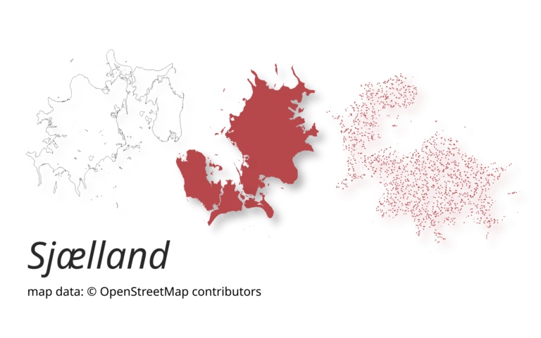
A new version of ohsome-planet (codename “Sjælland”) has been released. It is the newest version of HeiGIT´s command line tool, which transforms OpenStreetMap (history) PBF files into into an analysis-ready data format. We illustrate what ohsome-planet can do by assessing how many OSM edits used Bing Imagery as reference source.| GIScience Blog
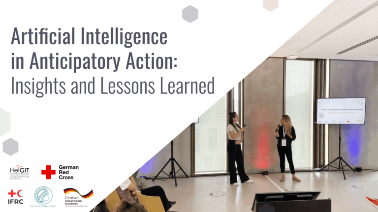
Artificial Intelligence holds great promise for strengthening Anticipatory Action by improving hazard forecasting, vulnerability mapping, and decision support, but must be tailored to real-world humanitarian contexts to really be of benefit. A recent workshop brought together practitioners, researchers, and tech experts to identify gaps, share learnings, and explore how AI can be responsibly and effectively integrated into anticipatory humanitarian efforts.| GIScience Blog
We’re excited to share the release of the ohsome-planet – a new software library on GitHub, marking a significant step toward the development of ohsome 2.0. This tool is designed to facilitate the transformation of raw OpenStreetMap (OSM) history data into the GeoParquet format, making it more accessible and efficient for spatial data analysis.| GIScience Blog
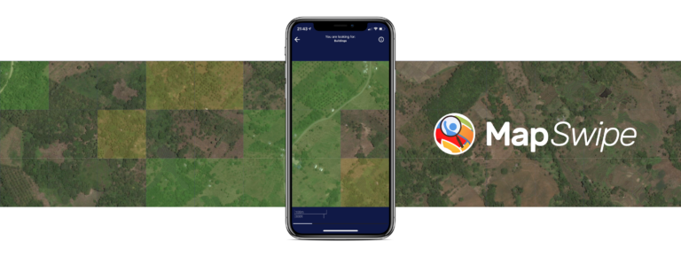
The crowdmapping app MapSwipe now integrates also street-level imagery. This new feature enables even mapping efforts that require the highest level of detail, such as detecting waste on the street.| GIScience Blog
August 19th marks World Humanitarian Day (WHD) to recognize the efforts of humanitarian workers and to advocate for the survival, well-being and dignity of people affected by crises, and for the safety and security of aid workers. One of many factors that are essential for effective humanitarian response and the security of people on site is the availability of reliable maps and up-to-date geodata of crisis areas. This is usually ensured through crowdsourcing and there are many tools and proj...| GIScience Blog
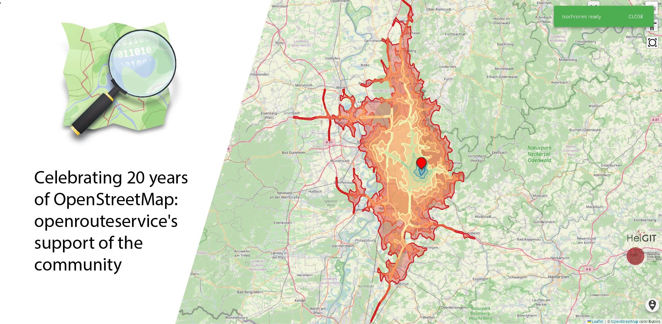
August 9 marks a turning point for the global mapping community: the 20th anniversary of OpenStreetMap (OSM). For two decades, OSM has revolutionized the way we perceive and interact with maps, transforming them from static representations to dynamic, community-driven resources. OpenStreetMap began as a visionary project aimed at creating a free, editable map of the world. What started as a small initiative has grown into a global movement with millions of contributors. These volunteers, rang...| GIScience Blog

HeiGIT and PLANUM, are happy to announce their cooperation in the field of climate action. PLANUM is committed to driving positive change through innovative engineering solutions. The company specializes in sustainable planning, making them a crucial partner in our pursuit of creating impactful and practical solutions to combat climate change.| GIScience Blog
The research team of the transdisciplinary project HEAL (Heat Adaptation for Vulnerable Population Groups), focusing on providing heat adaptation measures for vulnerable groups in Heidelberg, has published a research paper titled “How to assess the needs of vulnerable population groups towards heat-sensitive routing? An evidence-based and practical approach to reducing urban heat stress”. The paper delves into the comprehensive methodologies employed to understand local heat stress and id...| HeiGIT
