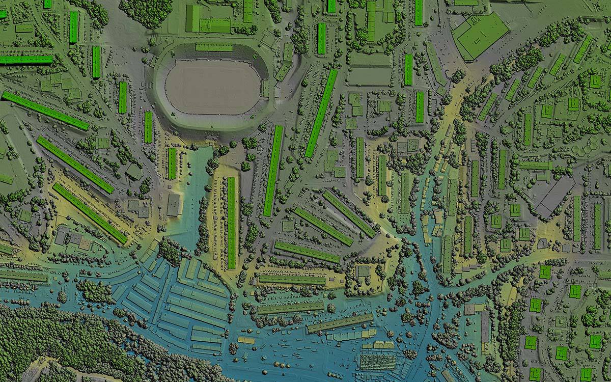
LiDAR Transforms Urban Development Mapping: Insights from a Client Perspective | FlyGuys
How LiDAR is transforming urban development and 3D mapping, pushing boundaries and setting new industry standards.| FlyGuys
How LiDAR is transforming urban development and 3D mapping, pushing boundaries and setting new industry standards.| FlyGuys
We are a nationwide drone services provider that acquires aerial imaging data so you can make more informed decisions at an affordable cost.| FlyGuys
We offer drone data collection services for surveyors and mappers. Start saving time, money and resources today. Deployed nationwide.| FlyGuys
We provide industrial photogrammetry, inspections & data collection for industrial applications. Contact us for a free consult.| FlyGuys
