New Paper “AI-Generated Buildings in OpenStreetMap: Frequency of Use and Differences from Non-AI-Generated Buildings”
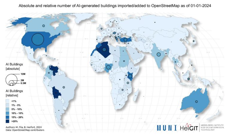
The concept of a “Digital Earth” has long envisioned a future where technological advancements enable the large-scale collection and visualization of spatial and environmental data. Today, open data sources such as OpenStreetMap (OSM) provide crucial spatial information for diverse applications, including urban planning, disaster management, and public health. However, many regions remain insufficiently mapped, particularly in less developed areas. AI-assisted mapping has emerged as a pot...| GIScience Blog
