Protecting your boat during a flood. – Creating a better place
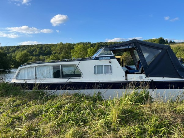
Protecting your boat during a flood. Environment Agency staff member Jon Naylor reflects on his experience of owning a boat, and what to do in a flood.| environmentagency.blog.gov.uk
Protecting your boat during a flood. Environment Agency staff member Jon Naylor reflects on his experience of owning a boat, and what to do in a flood.| environmentagency.blog.gov.uk
MCLEAN, VA., April 29, 2025 – Iridium Communications Inc. (Nasdaq: IRDM) today announced that Rohit Braggs has joined as Vice President of Positioning, Navigation & Timing (PNT). In his ...| Iridium Satellite Communications
Two Iridium® employees are going from satellites to sand dunes as they prepare for the 2024 Rebelle Rally. The first women’s off-road navigation rally in the United ...| Iridium Satellite Communications
In this Microsoft Office tutorial, we’ll use Excel to demonstrate a handy, simple feature to get around with just the keyboard that’s been available for a long time–the KeyTips. Want to learn more about this and other abilities in Excel? Check out our Excel Training ... Read More| SkillForge
A practical way to parse and route universal links using enums and type-safe navigation.| iOS development by tanaschita.com
How do some birds, turtles, and insects possess navigational abilities that rival the best manmade navigational technologies? Who or what taught the honey bee its dance, or its hive mates how to read the complex message of the dance? In Animal Algorithms, Eric Cassell surveys recent evidence and concludes that the difficulty remains, and indeed, is a far more potent challenge to evolutionary theory than Darwin imagined. Source| Books – Discovery Institute
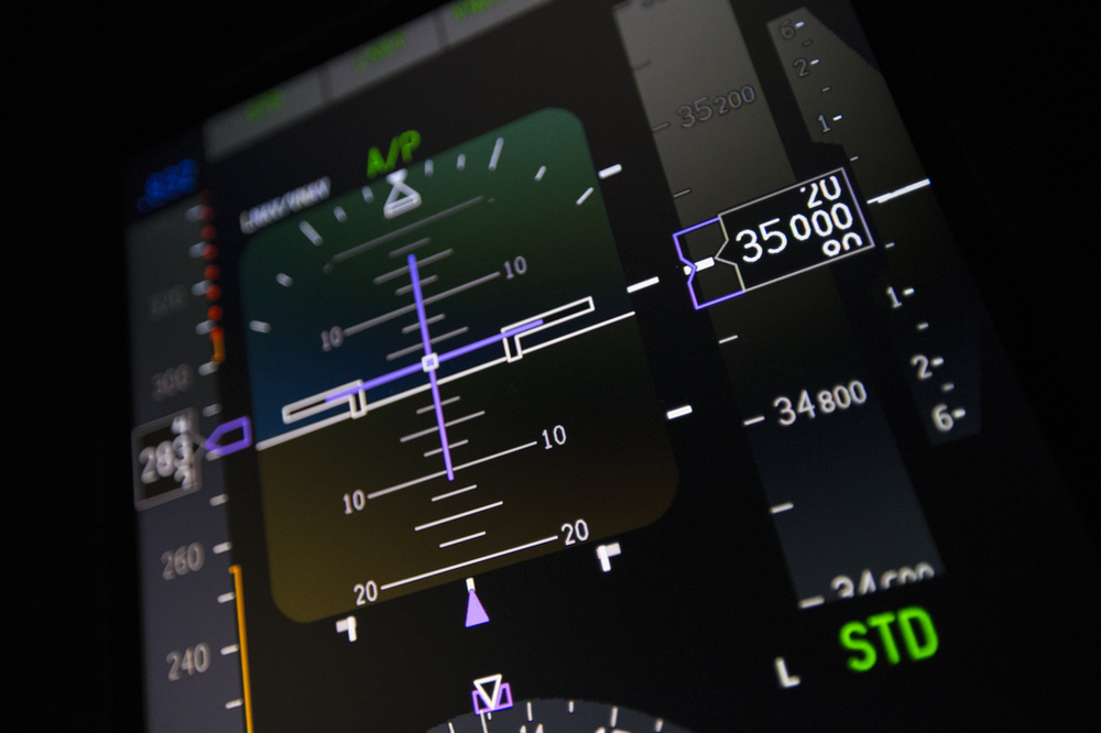
This article describes air data malfunctions that are less known than the basic "pitot blockage".| Engineering Pilot

This article covers the typical TAWS architectures on transport aircraft, and demonstrates, why knowledge is key.| Engineering Pilot

This article aims to make the content of PANS-OPS and ICAO PBN manual more accessible, covering error budgets and obstacle clearance of PBN.| Engineering Pilot

This article covers the obstacle assessment of PAPI installations and provides information about the relevant regulatory guidance.| Engineering Pilot
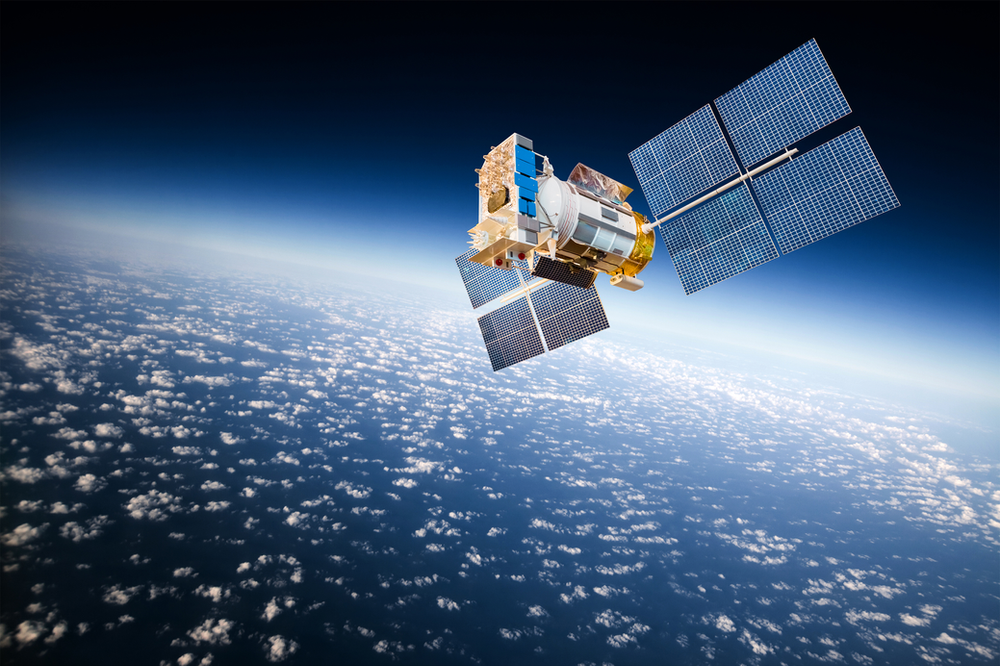
The ever-increasing impact of GNSS interference on aviation needs to be addressed also from a technical perspective. This is today's topic.| Engineering Pilot

As we are in the midst of winter, many places have seen a decent amount of snow fall. In this article we look at how the trustworthy ILS...| Engineering Pilot
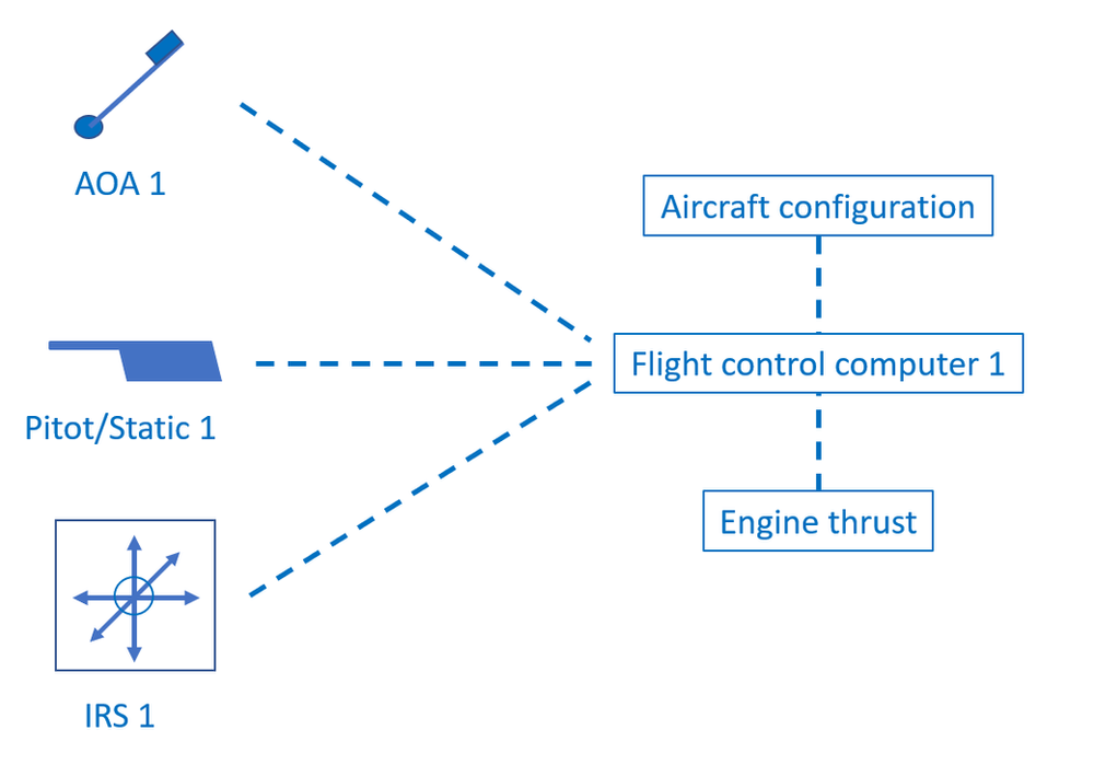
A description of different methods to make flight control computers more resilient against misleading sensor data.| Engineering Pilot

A radically different method to optain air data, based on optical measurements.| Engineering Pilot

A discussion about GLS and its associated challenges.| Engineering Pilot

Radar altimeters are used on aircraft to measure the height above the surface. They have been in use for decades onboard large airliners...| Engineering Pilot
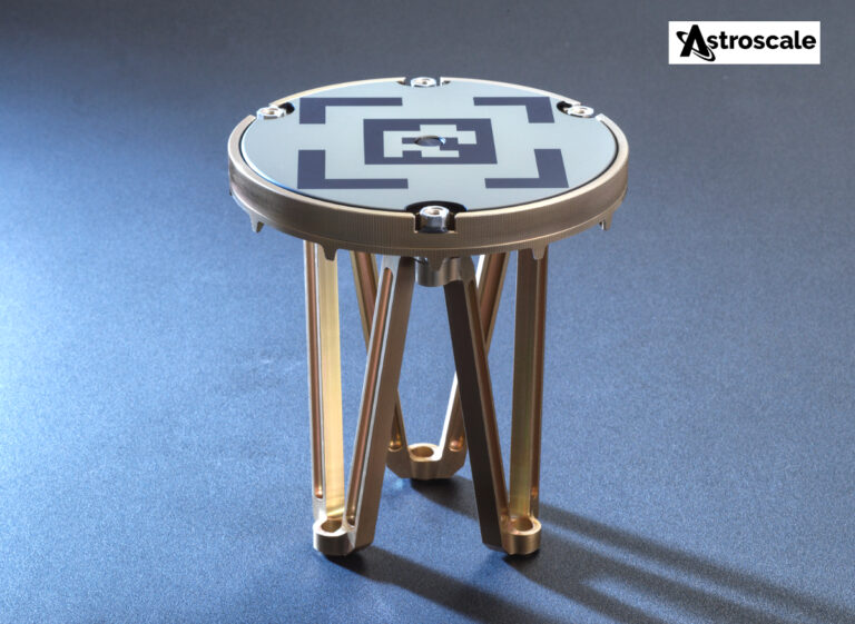
Astroscale Ltd. (“Astroscale UK”), the UK subsidiary of Astroscale Holdings Inc., has agreed to provide Xona Space Systems with next-generation docking plates for integration into Xona’s growing constellation of LEO satellites.| SatNews
Workshop to learn the basics of navigation with NZ Navy experts - next workshop late 2025. The post Navigate with the Navy appeared first on National Museum of the Royal New Zealand Navy.| National Museum of the Royal New Zealand Navy

In the fabric of modern life, few technologies are as deeply woven yet as frequently overlooked as the Global Positioning System, or GPS. For billions of people, it is the simple dot on a map, the …| New Space Economy
Routing in Flutter is a vast topic as it can be executed in many different ways. Having a logical and simple to navigate routing setup will directly translate into a better user experience. It will also make the code a lot more maintainable for the developers. Configuring routing in Flutter, specifically with Navigator 2.0 can be […] The post Flutter Bottom Navigation with Nested Routing appeared first on Reso Coder.| Reso Coder

Simplify and streamline your logistics. So, whether you’re leveraging Walmart Fulfillment Services (WFS), importing with Walmart Cross Border, or shipping on your own through Seller Fulfillment Services, it’s now easier than ever to get the most out of our suite of services.| Walmart Marketplace
Learn how to save and restore NavigationPath to maintain user context across app launches.| iOS development by tanaschita.com
Learn how to integrate NavigationPath with TabView in SwiftUI to manage independent navigation flows.| iOS development by tanaschita.com

In the eCommerce world, fast and reliable shipping is often the deciding factor in whether customers complete their purchases or not.| Walmart Marketplace

We’ve made improvements to GOV.UK’s topic pages. Here’s what we’ve done and the positive impact it’s making for users.| insidegovuk.blog.gov.uk

Adrian Morgan's Monthly Boating Column: Musings on technology dependence, Vs the old and 'true' sailor... reading and navigating the elements.| Classic Boat Magazine
A shadow board is a non-magnetic compass that uses the sun as it’s principal way to determine direction. This discovery is believed to have originated with the Vikings of the eleventh-century and though isn’t practiced today it’s still a valid method. While it’s not as precise as a quality magnetic compass it has proven to … The post Using a Shadow Board Compass (Viking Sun Compass) first appeared on Element Bushcraft & Survival.| Element Bushcraft & Survival
Ranger beads are a set of 14 beads used to calculate the distance traveled between 2 points. They can greatly improve your travel accuracy when used in conjunction with a map. This useful navigation tool that can be used to create a map of coordinates when no map is available. Using Ranger Beads Ranger beads … The post DIY Ranger Beads (Pace Counting Beads) first appeared on Element Bushcraft & Survival.| Element Bushcraft & Survival
In this article, we'll learn about navigation and routing in a Flutter app.| tech&Life
In this article, I'll show you implementing "Settings" menu using PopupMenuButton Widget as Stateless vs Stateful widget in Flutter for Android, iOS and Web (Hummingbird).| tech&Life
The Vim jump list is a convenient list of navigation points, akin to a browser history. Read on to improve your use of the Vim jumplist.| vimtricks.com

In the digital-savvy era, having a great website is the key to offering excellent user experience and higher search engine rankings. When planning a web design project, there are key challenges to consider. Failing to address these challenges at the right stage can result in a waste of time, money, and effort. Apparently, you would| UX Pickle

Sharing reality with a phone is not what it used to be| HikingArtist.com by Frits Ahlefeldt
