Titus Sparrow: The Tennis Ace who Brought Courts Back to BostonYou are here:HomeHistoryTopicAfrican AmericansTitus Sparrow: The Tennis Ace… Renowned tennis player and Boston native, Titus Sparrow (1908-1974), recognized that a city owed its residents more than just roads and bridges. During a long career in which he taught hundreds of young tennis players, Sparrow advocated| The West End Museum – Boston's Neighborhood Museum
And I’m back online! Have you missed me? I’ve certainly missed all of you and your blogs, but I won’t miss waving my phone about on the balcony in the hope of better reception. Sa…| findingtimetowrite
Destruction and Disappointment: The Legacy of Boston’s Central ArteryYou are here:HomeHistoryTopicCity PlanningDestruction and Disappointment: The Legacy… Boston’s Central Artery promised relief to the city’s traffic dilemma, but as with most major building projects of the mid-20th century, it brought demolition, displacement, and ultimately disappointment. Less than 20 years after the first automobiles hit the dirt| The West End Museum – Boston's Neighborhood Museum
Discover how landscapes can act as living batteries and how to harness soil, biomass, water, and slope dynamics for energy storage & resilient NYC landscaping.| Eco Brooklyn
The European Commission JRC recently released a new 2023 update of the Global Human Settlement Layer (GHSL) data. This update has greatly improved the GHSL data, with a 10 metre scale built-up area…| CityGeographics
In this month’s issue of The Evidence newsletter, Josephine Lethbridge examines how city designs exacerbate gender inequalities – and what we can […]| Social Science Space
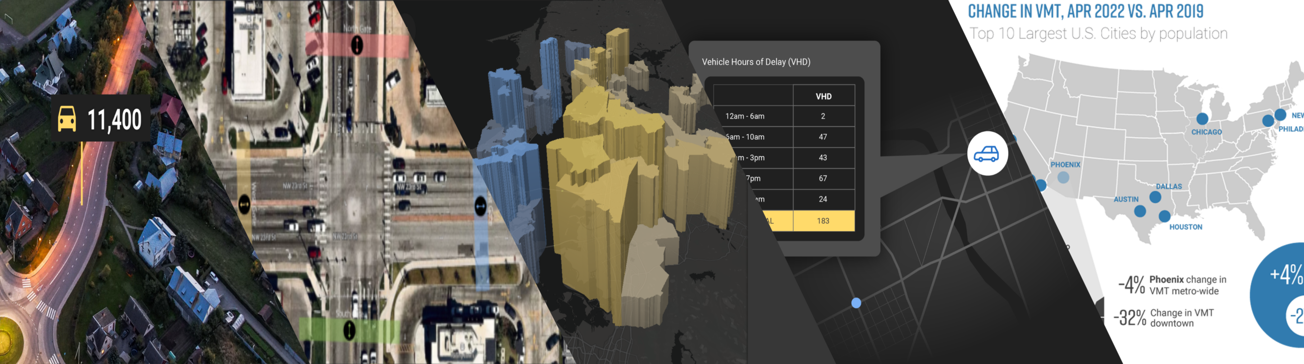
Big Data is changing transportation analytics and paving the way for more data-driven transport planning. Learn 6 critical traffic data metrics for every planner.| StreetLight
How accurate is StreetLight’s vehicle speed data? We compared our metrics to speed data from New York City’s OpenData portal so you can see for yourself.| StreetLight
To fix speeding on Roosevelt Blvd, Philadelphia installed speed cameras. Now, before-and-after analysis by StreetLight reveals where further measures may still be needed to save lives.| StreetLight
The housing crisis in London has become increasingly severe in the last decade with much higher prices, rents, and largely static incomes, while housing development volumes have remained consistent…| CityGeographics
The Office for National Statistics have started to publish the more detailed tables from the new 2021 census. Of particular interest for my research are the variables related to gentrification. In …| CityGeographics