New Earthquake Model Goes Against the Grain - Eos
Subducting plates are stronger in certain directions than others, which may be a factor in how earthquakes occur and how seismic waves propagate.| Eos
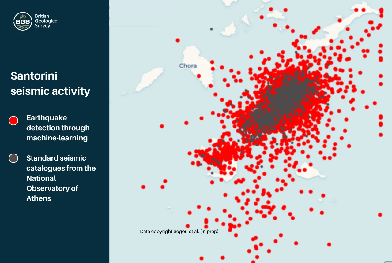
Machine learning is expanding scientists’ catalogs of quakes and refining maps of underground faults. It also promises to improve quake forecasts.| Eos
Subducting plates are stronger in certain directions than others, which may be a factor in how earthquakes occur and how seismic waves propagate.| Eos

Seismic-restrained Isolators The following is an edited response from ChatGPT. Resonant response of the equipment rack circuit boards should not be an issue, because circuit board fundamental frequ…| Vibrationdata
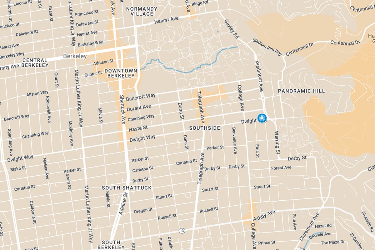
There have been just eight other quakes in or near Berkeley since Jan. 1, 2023, according to USGS data.| The Berkeley Scanner
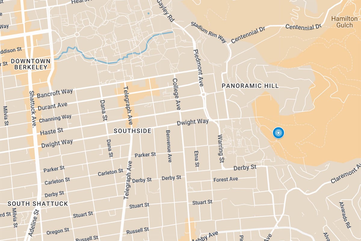
There have been just six other quakes in or near Berkeley since Jan. 1, 2023, according to USGS data.| The Berkeley Scanner

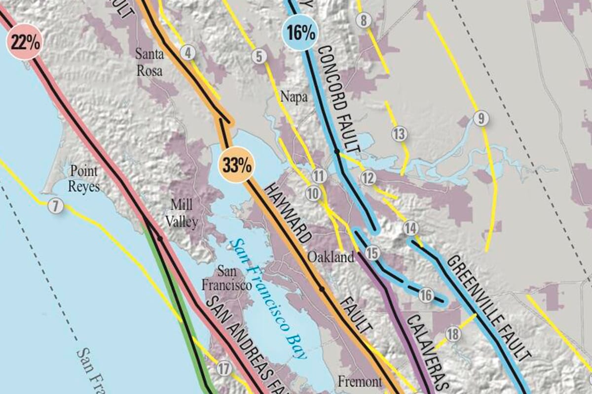
Southern California's water district installs a quake-resistant pipe along the Colorado River Aqueduct to prevent a major spill.| Los Angeles Times
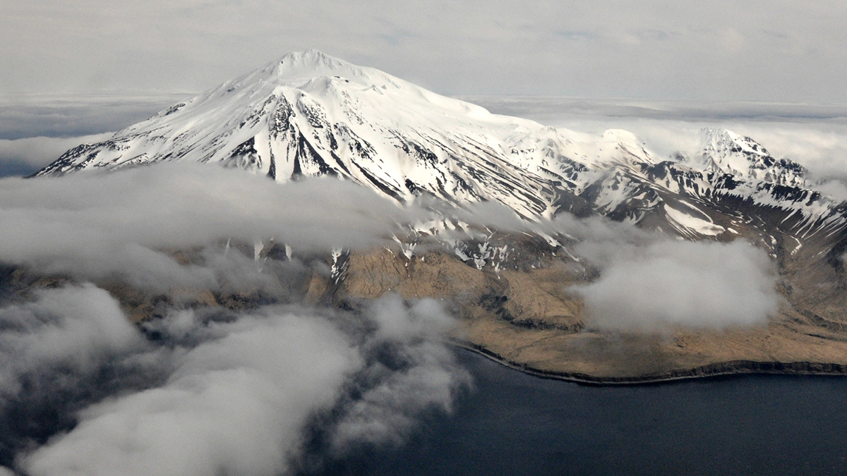
The 22 May 1960 earthquake-induced landslides and tsunami at Lake Rupanco in Chile, which killed about 120 people.| Eos
A new White Paper, co-developed by Indonesian and UK hazard experts, presents a strategic roadmap to significantly reduce the impacts of geological hazards in Indonesia. The post New report sets pathway to reduce the impacts of geohazards in one of the world’s most hazard-prone nations appeared first on British Geological Survey.| British Geological Survey
Don't delay: Learn how to react to an earthquake, create a disaster kit and secure objects in the home to prevent injury and damage.| The Berkeley Scanner
AGU News AGU prevails in case for probationary federal employees In a blistering decision last Friday, a federal judge ruled that the Trump Administration and the Office of Personnel Management acted illegally when it fired tens of thousands of probationary federal employees at NOAA, NSF, and other agencies “for cause” in February. AGU joined a […]| AGU Newsroom

Survey reveals how elite travelers use points for travel, avoid dangerous airports and stay unfazed by volcano eruptions and earthquakes.| Global Rescue
Aid agencies say the international community must increase funding to Afghanistan. That's after a deadly earthquake killed at least 1,400 and injured thousands more.| AP News
Tsunami early warning systems save lives not just when they are fast or accurate, but when they are trusted, understood and acted upon.| State of the Planet
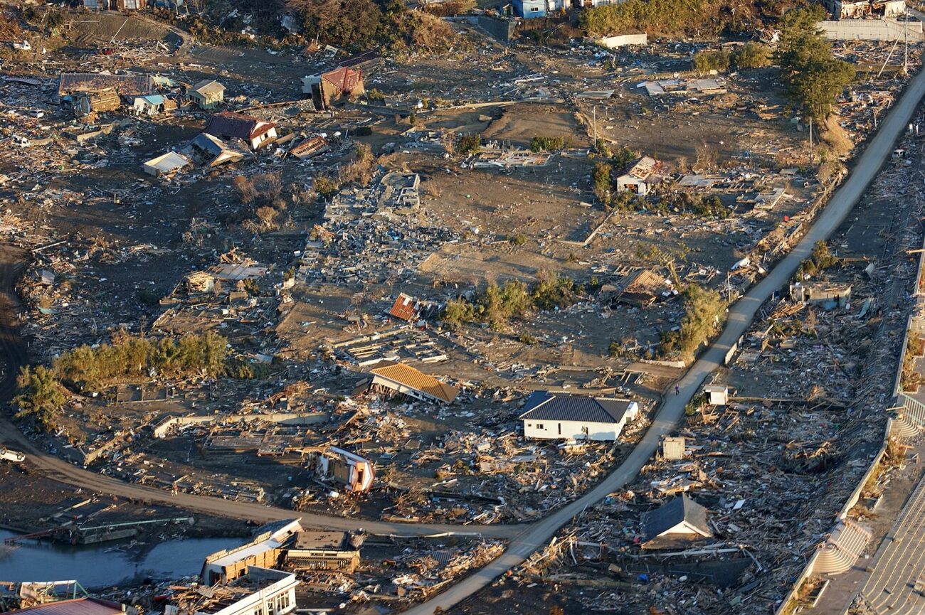
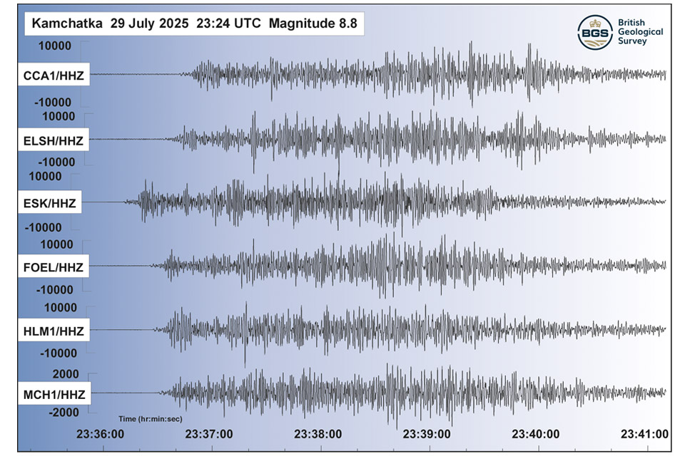
A massive magnitude 8.8 megathrust earthquake struck off the coast of Kamchatka, Russia, resulting from the subduction of the Pacific Plate beneath the Okhotsk Plate along the Kuril-Kamchatka Trench. As the largest earthquake globally in 2025, its shallow depth generated tsunami waves, prompting warnings across the Pacific, including Russia, Japan, and Hawaii.| Geology In

20 years of evidence from earthquake monitoring proves the Britpop legends are the most ‘ground shaking’ musical act to perform at Murrayfield Stadium| British Geological Survey
The response to the 8.8 magnitude earthquake in Russia has emphasised how far scientific understanding of tsunamis has come over the last two decades, and the improved mitigation measures that are now in place| British Geological Survey

University of Washington researchers showed that they can monitor seismic activity at the ocean floor using fiber optic cables without disrupting telecommunications. They developed this technique in Alaska and then tested it off the coast of Oregon.| UW News

Kendall Valentine, an assistant professor of oceanography at University of Washington, along with collaborators from the University of Rhode Island and the Desert Research Institute are traveling to Anchorage and the Copper River Delta to study marshes that formed in the years following the 1964 earthquake.| UW News

…the challenge is to use only ONE picture. One that you find important, meaningful to you, maybe sending a message – and then explain why you picked just that picture. ~ Ann-Christine O…| P.A. Moed
An online tool that shows which roads are most likely to cause river pollution is being expanded to assess pollution from agricultural areas.| British Geological Survey
Boxing Day 2024 marks 20 years since the Indian Ocean earthquake and tsunami. Prof David Tappin reflects on the disaster.| British Geological Survey
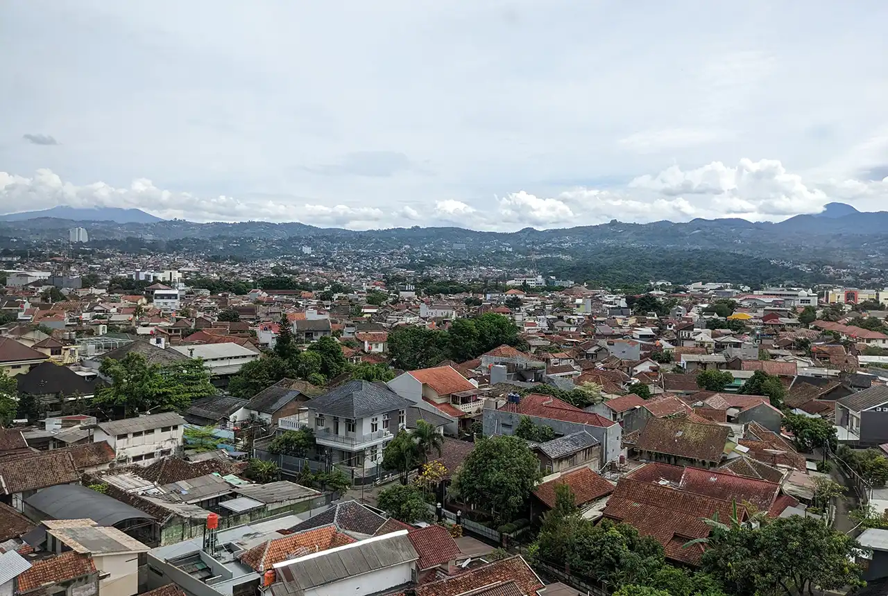
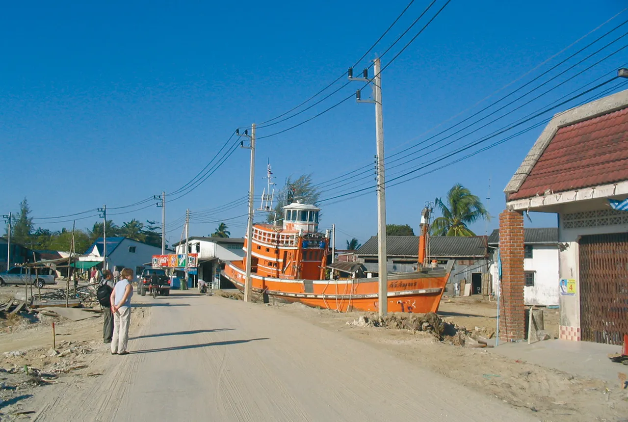
BGS-led research reveals the number of people in the Bandung metropolitan region who could be exposed to a major earthquake.| British Geological Survey
© www.viewsoftheworld.net A deeper understanding and better communication of earthquake risk has been a major challenge in geosciences for a long time. The Global Earthquake Model initiative aims to become the world’s most complete source of earthquake risk resources and works towards … Continue reading → The post Danger Zones: Mapping Europe’s Earthquakes was written by Benjamin Hennig and published on Views of the World. If you enjoyed this, you might want to follow me on Twitter o...| Views of the World
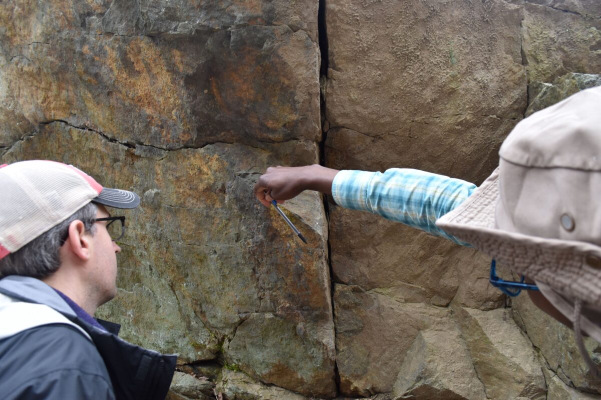
Geologists are combing the New Jersey countryside for signs of earthquakes past and present.| State of the Planet
SEE: ROBERT E. PEARY| Maine: An Encyclopedia
