Together with the German Federal Agency for Cartography and Geodesy (BKG) we released a new version of the ohsome dashboard, introducing a new indicator for assessing the thematic accuracy of land cover data in OpenStreetMap (OSM). This development is part of a broader project together with BKG on OSM data quality evaluation. New indicator: Thematic […]| GIScience Blog
The ENHANCE project explores how 15-minute city principles can be applied beyond dense urban hubs, using mapping, behavioral research, and simulation tools to design more sustainable and inclusive mobility systems. The ENHANCE project, funded by Driving Urban Transitions to a Sustainable Future (DUT) under JPI Urban Europe, addresses the challenges of implementing 15-minute city (15mC) […]| HeiGIT
State of the Map World is the annual event for all mappers and OpenStreetMap users. The program consists of talks, workshops, discussion rounds and more. HeiGIT is taking part with three different contributions. ORS-Tools – Beginner-friendly Mobility Analysis with OpenStreetMap and openrouteservice in QGIS – Julian Psotta, Benjamin Herfort Friday, 11:30 (60 minutes (plus Q&A)); Room: […]| GIScience Blog
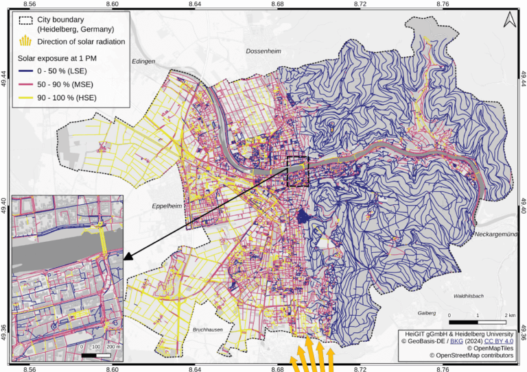
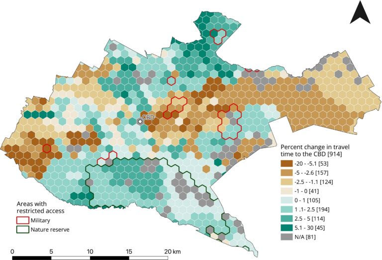
Using Heidelberg as a case study, researchers modeled time-dependent solar exposure for the entire pedestrian network by combining high-resolution DEM/DSM building and vegetation data with OpenStreetMap road data.| HeiGIT
Using Heidelberg as a case study, researchers modeled time-dependent solar exposure for the entire pedestrian network by combining high-resolution DEM/DSM building and vegetation data with OpenStreetMap road data.| GIScience Blog
Volunteered Geographic Information (VGI) is a valuable resource for an effective disaster management. This article presents five free tools to enhance humanitarian work using VGI. What is VGI and why it matters for disaster management Volunteered Geographic Information (VGI) refers to user-generated geographic content contributed voluntarily by the public. It represents a form of crowdsourcing […]| HeiGIT
As summer temperatures soar, being outdoors poses rising health risks, especially in urban areas and for vulnerable groups like the elderly, children, and citizen with pre-existing conditions. The HEAL project launched a routing app to help citizens avoid heat stress, supporting climate adaptation and public health during hot weather periods. Initially developed for Heidelberg, the […]| HeiGIT
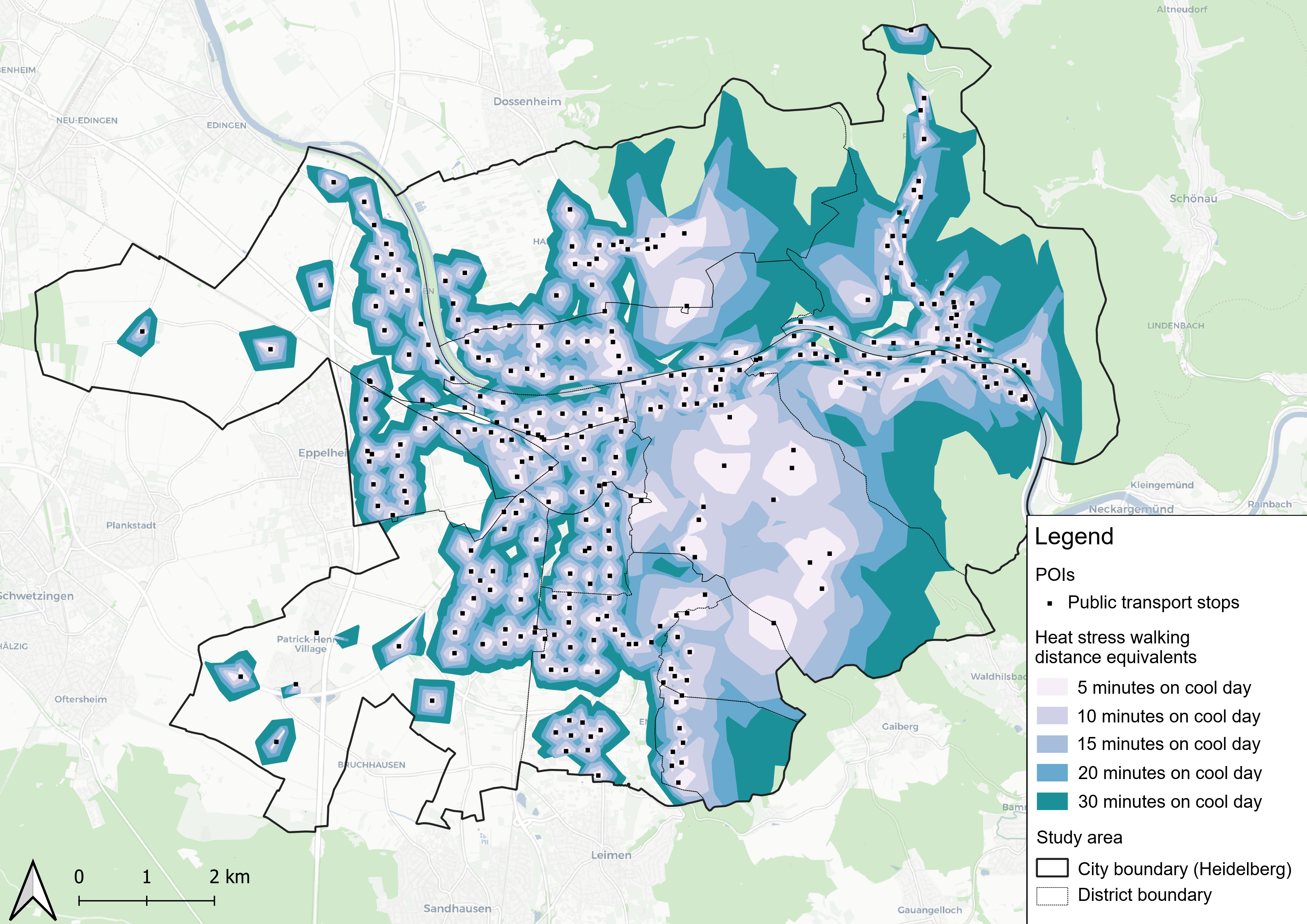
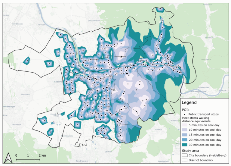
This study introduces the isocalor approach to assess how solar exposure and heat stress impact pedestrian access to essential services in Heidelberg, using OpenStreetMap data and a customized openrouteservice routing engine.| GIScience Blog
This study introduces the isocalor approach to assess how solar exposure and heat stress impact pedestrian access to essential services in Heidelberg, using OpenStreetMap data and a customized openrouteservice routing engine.| HeiGIT
This study, published at African Transport Studies, investigates the impact of school sessions on traffic congestion in Nairobi, highlighting how children’s mobility needs are often overlooked in transport planning.| HeiGIT