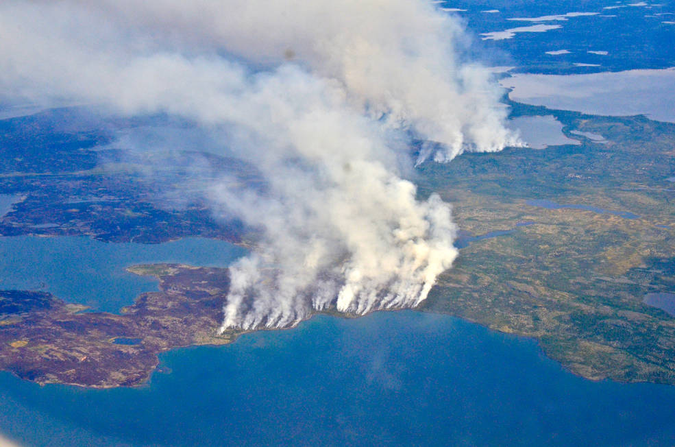
The 2014 megafires in Canada's Northwest Territories burned 7 million acres of forest, making it one of the most severe fire events in Canadian history.| Landsat Science | A joint NASA/USGS Earth observation program.
More water is taken from the Colorado River than it has to give. Better water use accounting made possible by Landsat provides needed guidance for difficult water use decisions.| Landsat Science | A joint NASA/USGS Earth observation program.
Warming global climate is changing the vegetation structure of forests in the far north. It’s a trend that will continue at least through the end of this century, according to NASA researchers.| Landsat Science | A joint NASA/USGS Earth observation program.
Landsat satellites have begun regularly acquiring images of ice at the poles during the winter, with enlightening results.| Landsat Science | A joint NASA/USGS Earth observation program.