The Landsat satellite program, with its unparalleled 53-year historic record, can reveal changes through the Annual National Land Cover Database (NLCD).| Landsat Science | A joint NASA/USGS Earth observation program.
The Gran Chaco—South America’s second largest forest—is disappearing. Watch decades of forest change, as captured by Landsat satellites. The post Deforestation in Paraguay’s Gran Chaco first appeared on Landsat Science.| Landsat Science
When the first Landsat satellite launched in 1972, it posed the following question: could we manage our natural resources using remotely–sensed data? The answer, 53 years on, is a resounding “yes.” The post Celebrating 53 Years Since Landsat 1’s Launch first appeared on Landsat Science.| Landsat Science
Landsat images show that in the past 40 years alone, Louisiana’s coastal wetlands have undergone substantial changes.| Landsat Science | A joint NASA/USGS Earth observation program.
Haiti lost nearly half of its primary forests between 1996 and 2022, with fires and tree-cutting being major drivers of loss, according to a new study. The post Hispaniola’s Changing Forests first appeared on Landsat Science.| Landsat Science
Rising sea levels and increased ocean temperatures are supercharging hurricanes. Using satellite data can help monitor vulnerable ecosystems. The post Mapping Forest Damage from Hurricane Milton on Florida’s West Coast first appeared on Landsat Science.| Landsat Science
With Landsat Next's 26 new spectral bands, we'll be able to see our planet like never before. Landsat Next’s enhanced capabilities will provide scientists, farmers, and decision-makers with critical data to tackle global challenges. The post Beyond the Visible: Landsat Next’s New Spectral Bands first appeared on Landsat Science.| Landsat Science
New research led by Landsat 8/9 Project Scientist Chris Neigh used Landsat and ICESat-2 data to investigate how boreal forests growth could sequester carbon. The post NASA Study Finds Potential Carbon Sink in Boreal Forest Growth first appeared on Landsat Science.| Landsat Science
Between October 2023 and October 2024, the four dams of the Klamath Hydroelectric Project were taken down, opening more than 400 miles of salmon habitat. The post Undamming the Klamath first appeared on Landsat Science.| Landsat Science
Grasslands tend to get left out of conservation discussion. New research from the World Resources Institute maps how they've changed over the past 20 years. The post Mapping Grasslands: An Underappreciated Ecosystem first appeared on Landsat Science.| Landsat Science
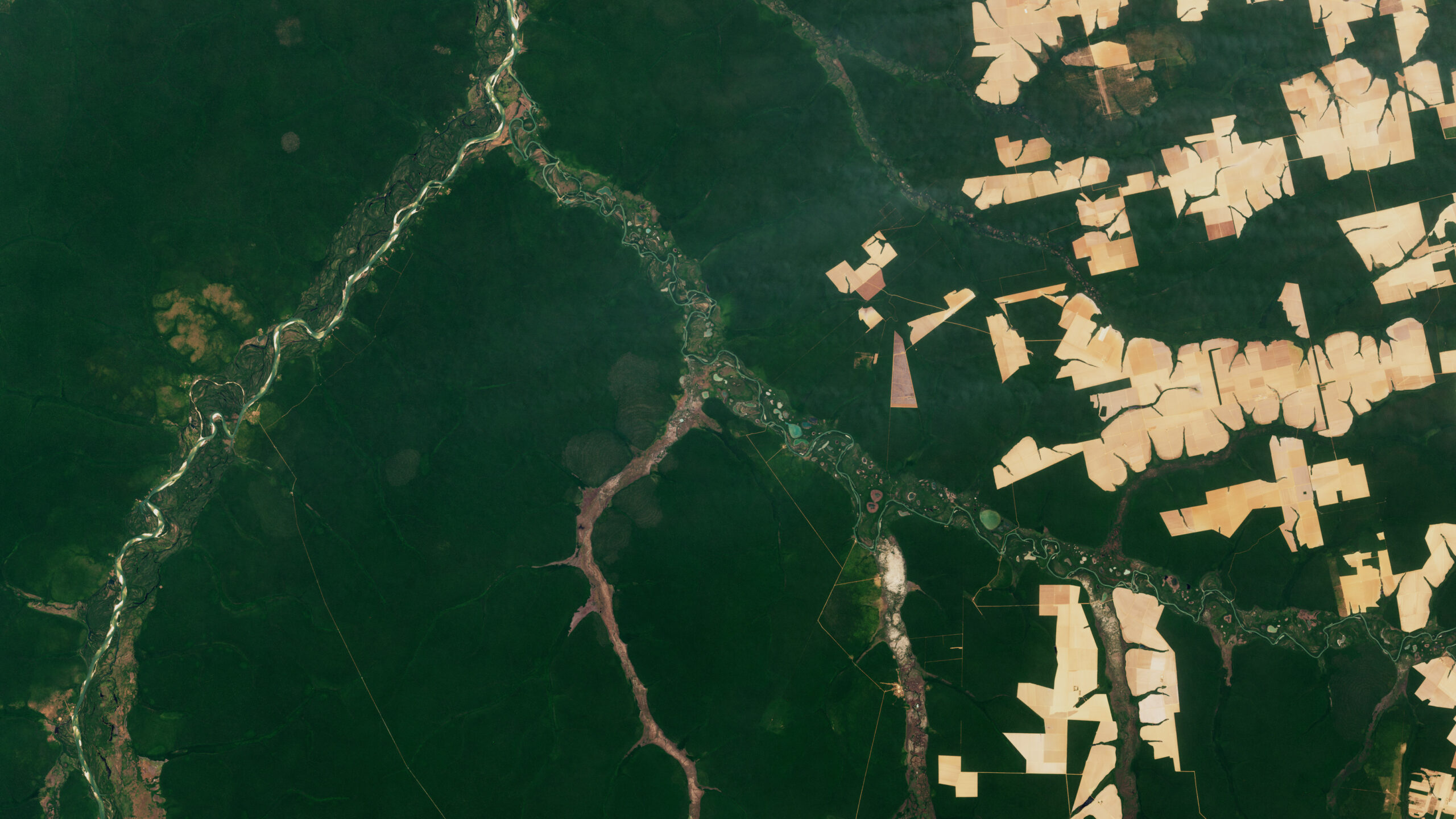
The Amazon is in trouble. Researchers found that, between 2000 and 2022, the Brazilian Amazon lost about 10% of its natural non-forest vegetation.| Landsat Science | A joint NASA/USGS Earth observation program.
In a study, researchers used GPS tracking data and satellite imagery to map elephant movement in northwestern Namibia, looking for corridors of connectivity.| Landsat Science | A joint NASA/USGS Earth observation program.
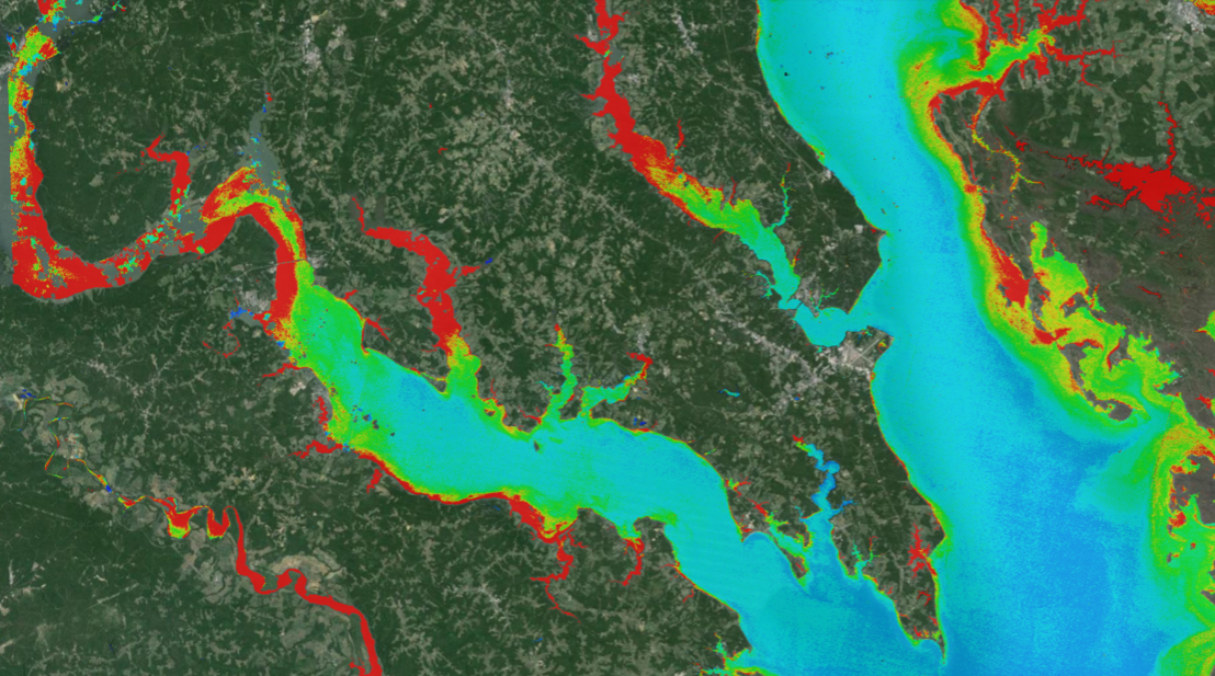
A combination of Landsat and Sentinel-2 imagery, NASA near real-time data, and machine learning provides near real-time access to high-resolution water quality maps.| Landsat Science | A joint NASA/USGS Earth observation program.
A new study using NASA satellite data reveals how drought affects the recovery of western ecosystems from fire, a result that could provide meaningful information for conservation efforts.| Landsat Science | A joint NASA/USGS Earth observation program.
NASA's Harmonized Landsat and Sentinel-2 (HLS) project is a groundbreaking initiative that combines data from Landsats 8 & 9 with the European Space Agency's Sentinel-2A & 2B satellites.| Landsat Science | A joint NASA/USGS Earth observation program.