שכבות GIS שלום עכשיו העלתה לאינטרנט כמה שכבות מידע גאוגרפי (GIS) ממפות שלום עכשיו להורדה. השכבות כוללות בין השאר את הקו הירוק, ההתנחלויות והמאחזים, אזור A ו-B, תחומי השיפוט ועוד. להורדת שכבות GIS של שלום עכשיו – לחצו כאן מפת התנחלויות ומזרח ירושלים להורדה להורדת מפת שלום עכשיו של...| שלום עכשיו
Getting different parties in the software industry to agree on a common standard is rare. Most of the time, a dominant player sets the rules. Occasionally, however, collaboration happens organicall…| Small Data And self service
Looking at the current landscape, it’s clear we’re in the midst of one of the most dynamic periods of consolidation our industry has ever seen. With over 50 significant M&A deals in the first half of 2025 alone, this surge is being fueled by a historic wave of federal infrastructure investment and a tech-driven boom in AI and data center construction. The post Mineralocity August Newsletter 2025 appeared first on Mineralocity .| Mineralocity
Mineralocity is more than just a platform; it's a reflection of our core mission: to solve the challenges of mining. We know how difficult this industry can be to navigate. Whether you are at the beginning of an idea or managing an established operation, you don’t have to do it alone.| Mineralocity Aggregates
Po wiosennej, bardzo udanej rekrutacji nasz zespół liczy już 18 osób. Dzięki temu jakość naszych usług stale wzrasta. W sierpniu dołączyła do nas Adrianna, urbanistka z doświadczeniem w pracy zarówno w miejskich, jak i prywatnych pracowniach urbanistycznych. Od października mamy na pokładzie Agatę, doktorantkę, która specjalizuje się w opracowaniach środowiskowych, a dołączyła do nas, uciekając w porę przed krakowskim smogiem;) Artykuł Ruszamy z nową rekrutacją! po...| Urban Consulting
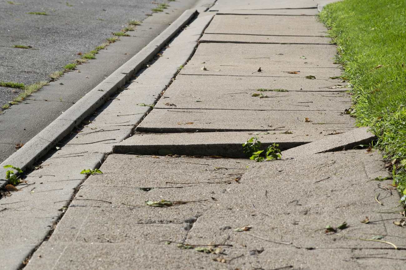
The two Midwest cities are using GIS, artificial intelligence and lidar to make fix accessibility issues with their curb ramps and sidewalks.| StateScoop
At Our Towns, we’ve been following the tools and applications of geospatial information systems (GIS), as they have progressed from promise to delivery. GIS helps in countless ways: for cities… The post How Story Maps Drive Progress appeared first on Our Towns.| Our Towns
The era of AI is upon us, and we’re using it. While we’re seeing incredible value in integrating AI into our everyday work, we also understand the importance of real people and real-life education and experiences.| Mineralocity Aggregates
Why has this blog been so quiet lately? There are plenty of excuses for that. It doesn’t really matter either way, but since we’re on the subject, one thing that has kept me occupied recently is being back in school. I’m working on a certificate in GIS, and I’m hoping to make some cool maps. […]| awkward botany
Our intro guide on community asset mapping has everything you need to know to get started with asset-based community development (ABCD).| Visible Network Labs
As we move forward into another successful quarter, we want to take a moment to reflect on the value we’re committed to providing. At Burgex, we see our relationship with you as more than just service—it's about sharing knowledge, insights, and resources that empower your success.| Mineralocity Aggregates
An article from last year’s Perl Advent Calendar gave me an idea. As is often the case, that idea spawned other ideas. One of those new ideas raised the question: “How do I get all tram lines and tram stops in Hannover, Germany from OpenStreetMap?”. Here’s my answer to that question, implemented–because reasons–in Python.| P.T.C.
Got the itch to do more speculative cartography, so for the last week or two I've been simulating the weather on the Moon, if it had an earth-like atmosphere...| Idraluna Archives
Explore how data analytics and market analysis enhance decision-making in construction aggregate exploration. Learn how integrating geospatial data, market trends, and production insights can optimize site selection and strategic planning.| Mineralocity Aggregates
A short post today about the QGIS YouTube channel I just launched: called Map Academy. I have my Udemy courses online, and these are aimed at people who want a fully-fledged end-to-end QGIS course at intro or intermediate level. The Udemy courses are going pretty well and I have more than 6,000 students in 148 countries so far - with the top countries being the US, India, the UK, Germany, Canada, Nigeria, Turkey, Indonesia, Egypt and Brazil. If you want to request a video on my new YouTube ch...| Stats, Maps n Pix
So, you've heard about the mysterious 🌏 geometry generator 🌍in QGIS and you want to know more? You're in the right place. No idea what I'm talking about but you do use QGIS? Well you're still probably in the right place because I'm going to explain things here, with examples you can try yourself. I've put this post together for anyone who really wants to know what a geometry generator in QGIS can do. So before going any further here's a map of US states where I have used a geometry ge...| Stats, Maps n Pix
Let's begin with a story, from some time around the early 1990s in the north of Scotland. I used to go to a church in Inverness with my Mum when I was growing up and although I've forgotten lots of things, one of the things I do remember is the minister asking this question at the start of a sermon:| Stats, Maps n Pix
We built a platform that aims to automatically address many data quality issues, what one might call a Master Data Management (MDM) system in enterprise data management circles but focusing on sensor data. For imagery, many use cases from creating mosaics to change detection and various other deep learning applications require these data corrections for best results.| Bora Beran
After 5 exhilarating years at Tableau on December 29th, I said my goodbyes and walked out of the Seattle offices for the last time. Tableau was a great learning experience for me. Watching the company grow nearly 7 fold, going through an IPO and becoming the gold standard for business intelligence… I worked with very […]| Bora Beran
W związku z dużą liczbą zapytań o możliwość odbycia u nas stażu w semestrze letnim 2025 zapraszamy Was do gry o staż:) Przygotowaliśmy dla Was kilka zadań z QGisa. Osoby, które poradzą sobie z tymi zadaniami najlepiej zaprosimy do nas na płatny staż. Gra przeznaczona dla studentów ostatniego roku studiów magisterskich. Minimalna liczba godzin stażu - 200. Wszystkich zainteresowanych prosimy o przesłanie CV na adres rekrutacja@urbanconsulting.pl do 10.12.2024r.| Urban Consulting
It all started with the following statement: "my renders are too slow". There were three issues as the root case: osm-carto had become more complex (nothing I can do there), my compute resources were| .:: Marcos Dione/StyXman's glob ::.
Overture’s Global Entity Reference System (GERS) could revolutionize geospatial data by standardizing ‘place’, making geospatial intelligence more accessible through simple data joins rather than complex mapping tools.| Drew Breunig
Zapraszamy do współpracy firmy lub osoby fizyczne z doświadczeniem w sporządzaniu opracowań ekofizjograficznych oraz prognoz oddziaływania na środowisko do aktów planowania przestrzennego. Posiadamy własny dział środowiskowy, niemniej z uwagi na dużą liczbę realizowanych projektów chętnie nawiążemy stałą współpracę z zewnętrznymi, doświadczonymi partnerami na terenie całego kraju. Dane kontaktowe znajdziecie Państwo na naszej stronie, w zakładce kontakt. W temacie ...| Urban Consulting
Continuing the series on the history of mapping, Map Happenings publishes the 6th ‘Map Happening’ that rocked our world and delves into the advent of Computer Based Mapping. Read the fa…| Map Happenings
A couple of years ago, two of us attended the project conference in Amsterdam for Philip Verhagen’s Limits of the Limes (a video of my presentation can be seen here, but not Tyler’s). T…| English Landscape and Identities
This post is the text and images from a book chapter that I have recently had published. The published version has had the images converted to black and white, so I thought I’d post the prope…| English Landscape and Identities
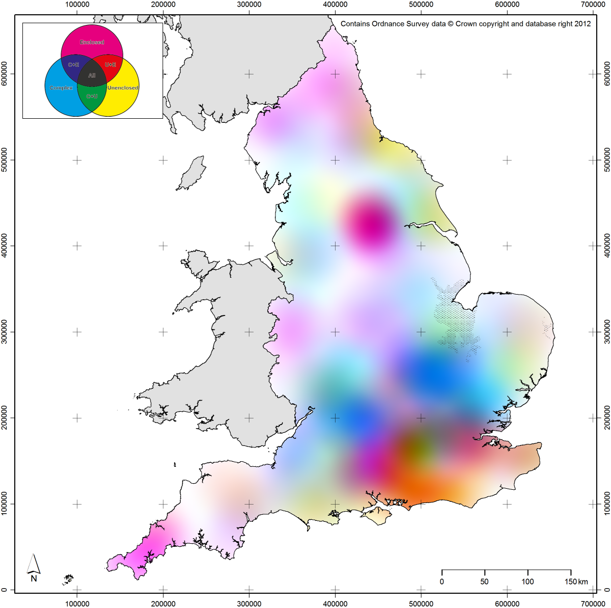
This post follows on in part from a post I wrote a couple of years ago on regionality. It will also begin with an apology: the maps presented here will be very difficult for colour blind readers to…| English Landscape and Identities