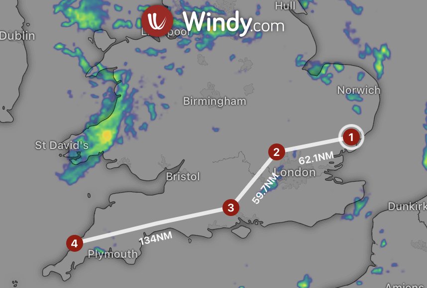
This guide outlines how helicopter pilots can enhance flight planning by integrating Helipaddy with Windy. It details the process of generating a GPX route in Helipaddy, saving it to cloud storage, and uploading it to Windy for comprehensive weather analysis. This combination improves situational awareness and safety during flights.| Helipaddy
Only ‘regulated’ locations in Great Britain can accept non-domestic flights A Quick Guide for Helipaddy Pilots and Site Owners In| Helipaddy
Map tool shows landing sites within range Helipaddy v5 onwards lets you overlay a range circle of 200nm (or anything| Helipaddy
CAA launches consultation on weather minima in the London area See https://consultations.caa.co.uk/safety-and-airspace-regulation-group/helilanes-svfr-minima-amendment/consultation/subpage.2024-01-09.4035038628/ Old: The existing weather minima for SVFR operations| Helipaddy
Helicopter pilots must safeguard Natura 2000, Europe's network of protected areas, by using updated maps, flying at considerate altitudes, planning routes to avoid sensitive sites, and observing noise reduction practices. Compliance with local regulations and awareness of breeding seasons are crucial for minimizing disturbances and preserving natural habitats.| Helipaddy