An OPSGROUP member on a recent westbound NAT flight from the Middle East received the following message via CPDLC: The crew contacted Shanwick via HF, who requested their RNP capability and operational status. The controller explained that due to their point of departure (OMAA/Abu Dhabi) they wa| International Ops 2025 - OPSGROUP
The 746 Test Squadron’s DI testing, with its end-to-end traceability, offers a rapid, cost-effective and low-risk alternative to traditional testing methods.| Inside GNSS - Global Navigation Satellite Systems Engineering, Policy, and De...
A look at the main concerns noted during the comment period.America’s Global Positioning System (GPS) is simultaneously amazing, indispensable and vul| Inside GNSS - Global Navigation Satellite Systems Engineering, Policy, and De...
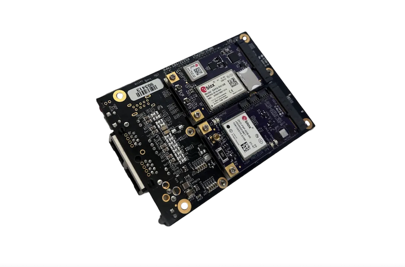
U-blox, a global provider of leading positioning and wireless communication technologies and services, has expanded its partnership with Nordian to deliver its PointPerfect Flex (PPP-RTK) centimeter-level correction services across Argentina and Paraguay, building on existing coverage in Brazil as p| Inside GNSS - Global Navigation Satellite Systems Engineering, Policy, and De...
Focal Point Positioning, a next-generation global navigation satellite system (GNSS) solution company, and STMicroelectronics have announced that they are to| Inside GNSS - Global Navigation Satellite Systems Engineering, Policy, and De...
The Australian Defence Force (ADF) has formally stood up a Joint Positioning, Navigation and Timing (PNT) Directorate, a 17-member unit that has reached initia| Inside GNSS - Global Navigation Satellite Systems Engineering, Policy, and De...
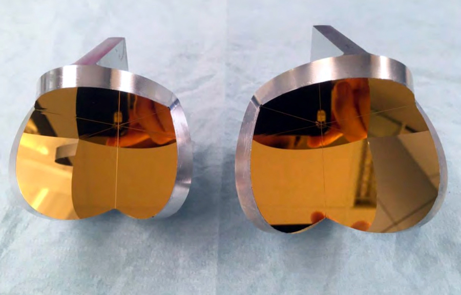
'Hollow Corner Cube for In-Orbit PNT' is an advanced optical reflector concept developed by the Istituto Nazionale di Fisica Nucleare (INFN) in Italy, with Medi| Inside GNSS - Global Navigation Satellite Systems Engineering, Policy, and De...
In a major move marking the latest wave of consolidation in the GNSS and positioning tech sector, Swiss-based u-blox Holding AG has agreed to a $1.3 billion acq| Inside GNSS - Global Navigation Satellite Systems Engineering, Policy, and De...
Thales Alenia Space, with funding from the European Space Agency (ESA) NAVISP program, has developed the 'Advanced MEOSAR Test Beacon Setup' (AMTBS). Thi| Inside GNSS - Global Navigation Satellite Systems Engineering, Policy, and De...
NEURONAV is an advanced AI-augmented positioning system developed for maritime navigation, designed to enhance the accuracy of Global Navigation Satellite Syste| Inside GNSS - Global Navigation Satellite Systems Engineering, Policy, and De...
The Department of the Air Force (DAF) achieved a major milestone last night with the successful launch of the Navigation Technology Satellite-3 (NTS-3) Vanguard| Inside GNSS - Global Navigation Satellite Systems Engineering, Policy, and De...
Signal structure and ephemeris and timing error correction. Finding alternative positioning, navigation and timing (PNT) technologies to GNSS is more pressing t| Inside GNSS - Global Navigation Satellite Systems Engineering, Policy, and De...
Galileo OSNMA (open service navigation message authentication) is a cryptographic system that is used to authenticate the navigation message (satellite ephemeris and clocks, etc.) in the Galileo GNSS. I have spoken before about OSNMA in this blog, since I implemented an OSNMA library in Rust a few years back. A good introduction to OSNMA for readers unfamiliar with how it works can be found in Bert Hubert‘s short series of OSNMA posts. The OSNMA system is currently in the public observation...| Daniel Estévez
BAE Systems unveiled a diverse line of M-Code Global Positioning System (GPS) receiver solutions at the Joint Navigation Conference in Cincinnati this week, ro| Inside GNSS - Global Navigation Satellite Systems Engineering, Policy, and De...
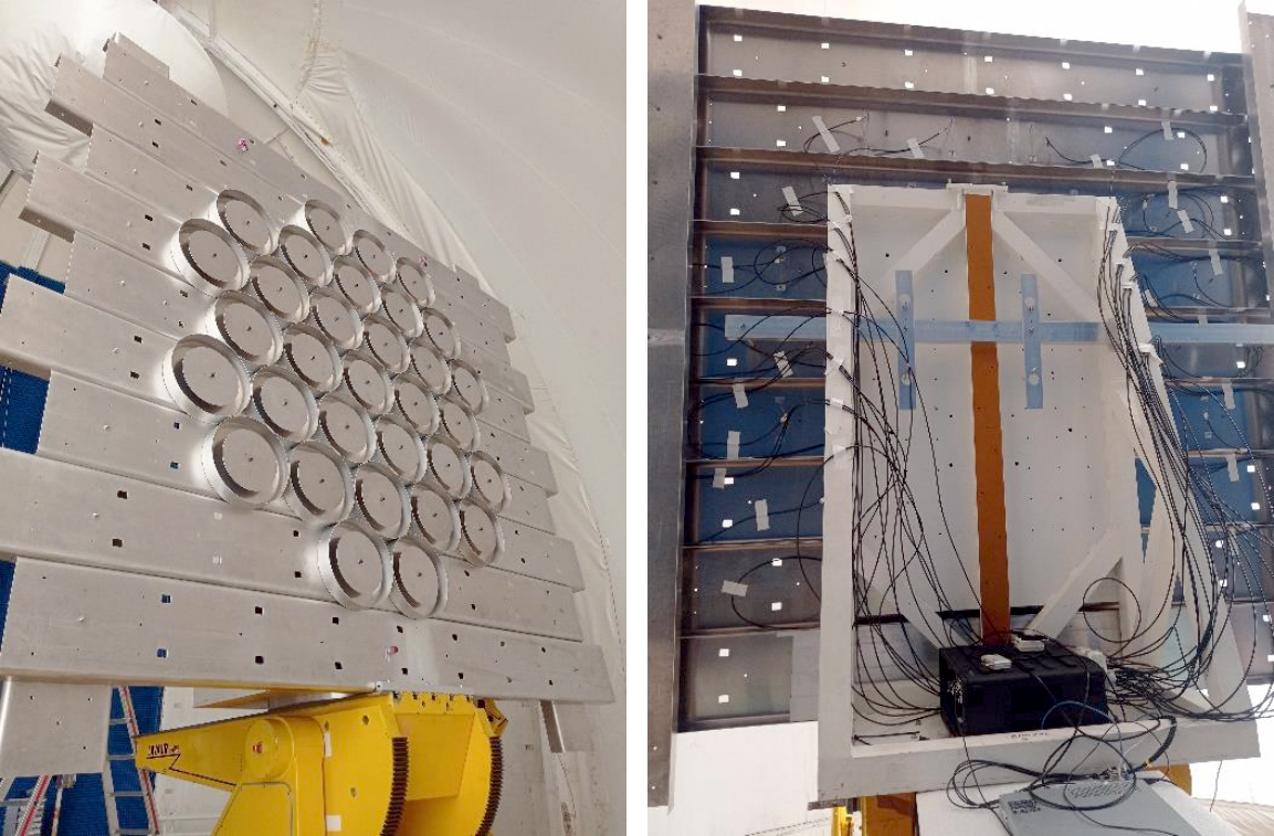
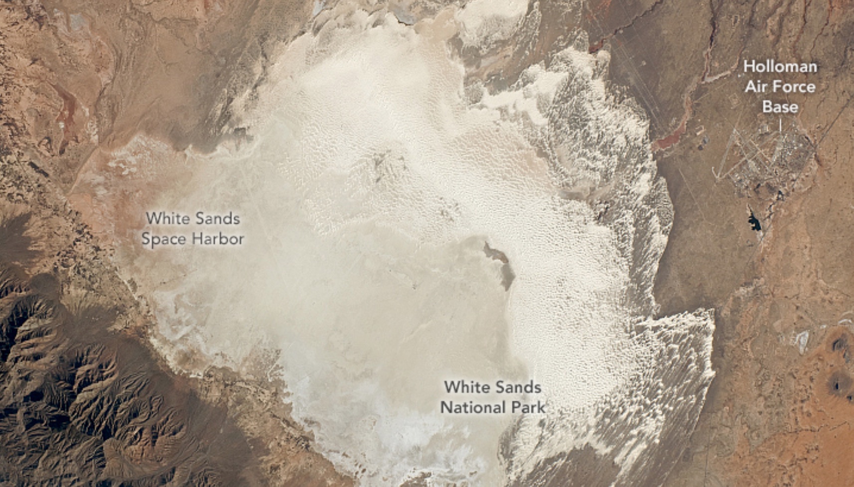
A simulation-based analysis of the 746th Test Squadron’s Locata non-GPS based positioning system for navigation testing at White Sands Missile Range (WSMR).| Inside GNSS - Global Navigation Satellite Systems Engineering, Policy, and De...
Zephr.xyz, a provider of augmented position, navigation, and timing (AugPNT) technologies, has been awarded a $1.74 million Small Business Innovation Research| Inside GNSS - Global Navigation Satellite Systems Engineering, Policy, and De...
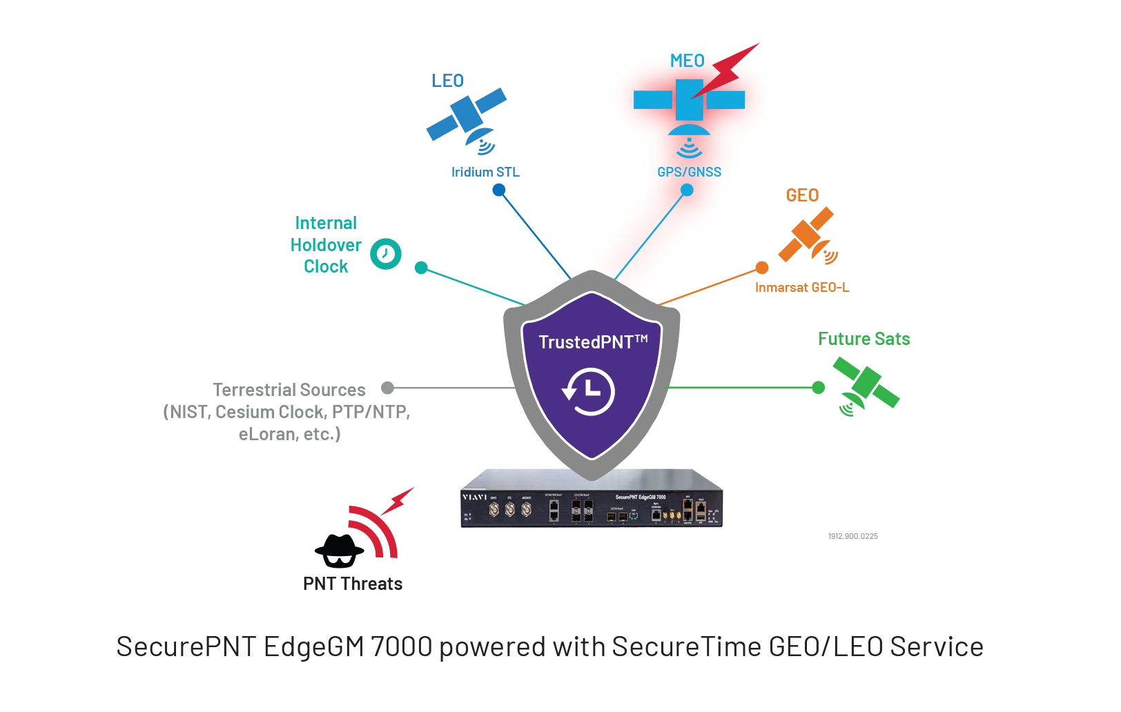
VIAVI Solutions Inc. has launched EdgeGM 7000, a highly resilient Edge Grandmaster Clock building on the SecurePNT portfolio. EdgeGM 7000 offers up to 25G Pr| Inside GNSS - Global Navigation Satellite Systems Engineering, Policy, and De...
Topcon Positioning Systems and Pix4D have announced a strategic agreement that combines their expertise in geopositioning and photogrammetry solutions. The c| Inside GNSS - Global Navigation Satellite Systems Engineering, Policy, and De...
By bert hubert bert@hubertnet.nl / @bert_hu_bert / https://galmon.eu/ Late July 2019, Galileo, “the European GPS” suffered from a week long outage. I’m a proud European, and I think we should have our own well-functioning navigation system, so I tried to figure out what was going on. Surely someone was monitoring this stuff in public? I come from the internet where we monitor all the things, if someone asked for it or not.| Bert Hubert's writings
A research and development project headed by Geospatial Ventures Limited (GVL) has unveiled new artificial intelligence (AI)-based positioning, navigation and| Inside GNSS - Global Navigation Satellite Systems Engineering, Policy, and De...
A conventional GPS (Global Positioning System) or GNSS (Global Navigation Satellite System) receiver has an accuracy that is at best 1 or 2 metres (3 or 6 feet), which is insufficient for some applications, most notably land surveys, and self-driving agricultural vehicles. There are a few techniques that can be used to improve that accuracy, … Continue reading "High-accuracy satellite positioning using GPS RTK"| Lean2
A Global Navigation Satellite System (GNSS) aims to provide Earth-based position and navigation. Spaceborne GNSS receivers have become universal sensors for spa| Inside GNSS - Global Navigation Satellite Systems Engineering, Policy, and De...
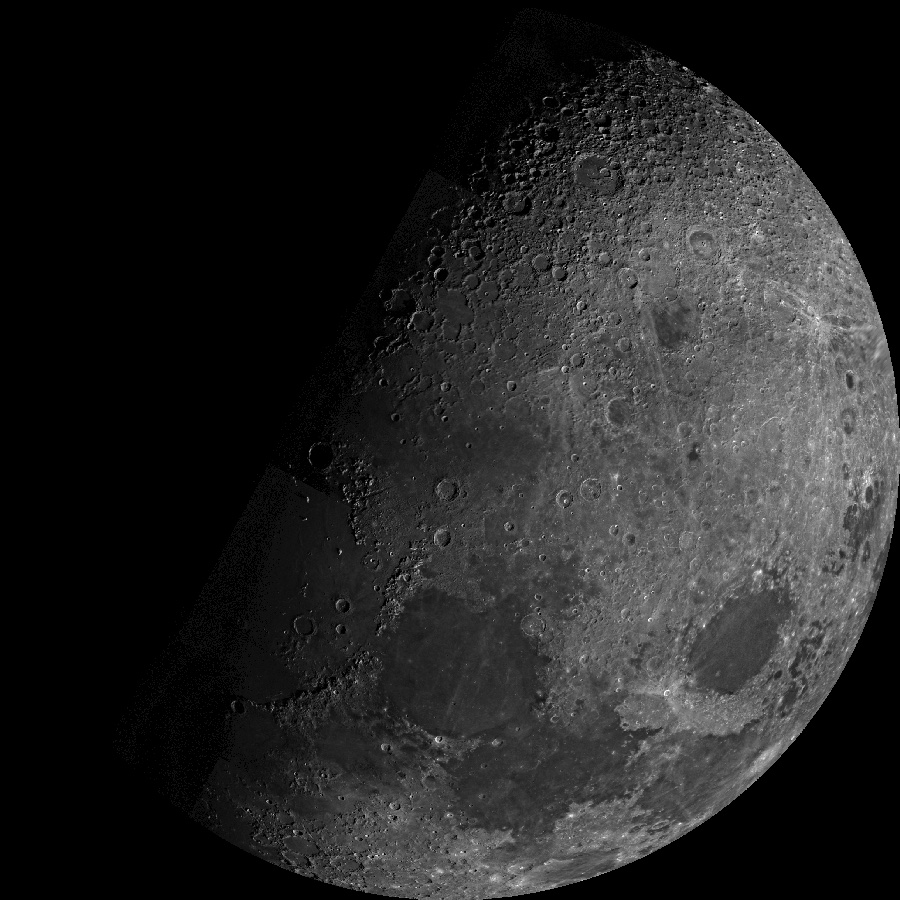
A look at lunar in-situ PNT GNSS-like frequencies and how we can open the “radio window” into the universe. JEAN-LUC ISSLER, JEAN PLA, ROMAIN DESP| Inside GNSS - Global Navigation Satellite Systems Engineering, Policy, and De...
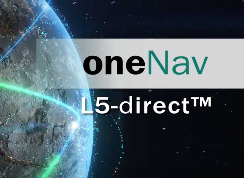
GPS technology developer oneNav has announced the successful results of a test of its technology's resilience to widespread GPS interference. The test| Inside GNSS - Global Navigation Satellite Systems Engineering, Policy, and De...
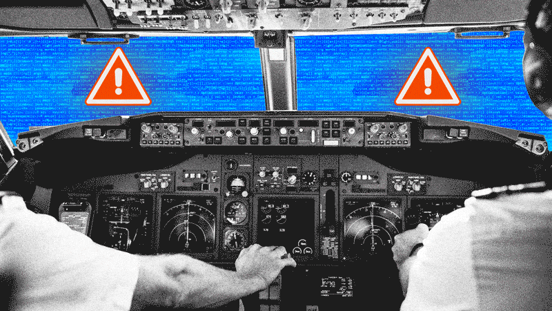
The European Union Aviation Safety Agency (EASA) has released a revised Safety Information Bulletin (SIB) addressing the growing issue of Global Navigation Sate| Inside GNSS - Global Navigation Satellite Systems Engineering, Policy, and De...
Learn about the differences between loose and tight coupling in GNSS, and why tight coupling provides greater precision to power more reliable solutions.| pointonenav.com
The Map Happenings series on the hugely impactful events that forever changed our world. This week: a deep dive in to how we all figure out where we are. It’s a fascinating story. Read on!| Map Happenings
Flying back from Miami last week I put my life in the hands of two strangers, just because they wore gold epaulets. These aviators, in turn, trusted their onboard computers to safely navigate the p…| CHRONICLING THE ROBOT INDUSTRY
Welcome to the Galmon project! Our goals are to monitor the major Global Navigation Satellite Systems, including GPS, GLONASS, Galileo and BeiDou, but also Space Base Augmentation Systems like WAAS, EGNOS and GAGAN. Galmon is an open source & open data project with a community of over 30 station operators running more than 50 receivers. Some history of the project may be found in the second part of this blog post, and on this page on the big Galileo 2019 outage.| Bert Hubert's writings
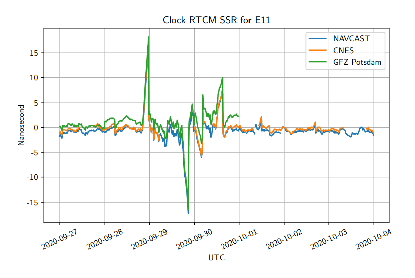
The European Global Navigation Satellite System Galileo has recently been suffering from frequent "almost disruptions", most likely partially due to Corona, and possibly also due to Brexit, but in any case due to some historical stinginess. Before I explain what is going on, I should hasten to say that most days of the week, Galileo is working well for most users. But for example, Monday the 28th of September, one satellite was off by a stunning 5 meters.| Bert Hubert's writings