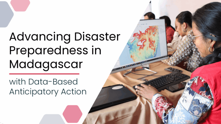
Anticipatory Action (AA) is becoming an increasingly vital approach in humanitarian and disaster risk management. By leveraging forecasts and risk data, AA enables timely interventions before extreme events occur. Geoinformation technologies play a key role in operationalizing this approach. In Madagascar, where cyclones regularly cause widespread damage, HeiGIT has been working with Croix-Rouge Malagasy (CRM, the Malagasy Red Cross) and the German Red Cross (GRC) and with the financial suppo...| HeiGIT
We’re excited to share the release of the ohsome-planet – a new software library on GitHub, marking a significant step toward the development of ohsome 2.0. This tool is designed to facilitate the transformation of raw OpenStreetMap (OSM) history data into the GeoParquet format, making it more accessible and efficient for spatial data analysis.| GIScience Blog
A short post today about the QGIS YouTube channel I just launched: called Map Academy. I have my Udemy courses online, and these are aimed at people who want a fully-fledged end-to-end QGIS course at intro or intermediate level. The Udemy courses are going pretty well and I have more than 6,000 students in 148 countries so far - with the top countries being the US, India, the UK, Germany, Canada, Nigeria, Turkey, Indonesia, Egypt and Brazil. If you want to request a video on my new YouTube ch...| Stats, Maps n Pix