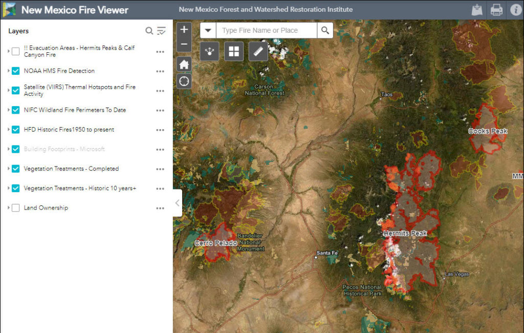
NMFWRI’s GIS Team has developed the New Mexico Fire Viewer, an interactive web map that provides access to real-time and historical wildfire data. The web map integrates satellite imagery and GIS layers, allowing users to search for active wildfires by name and view perimeter boundaries and hot spots. These updates, sourced from satellite infrared images, […]