Top 5 Benefits of Owning Your Mobile Mapping Data - Mosaic51
Owning your data is crucial to project efficiency, security, and customization in the mobile mapping and geospatial industries.| Mosaic51.com
Owning your data is crucial to project efficiency, security, and customization in the mobile mapping and geospatial industries.| Mosaic51.com
Discover the real-life stories and solutions that our 360 mobile mapping camera systems are solving with Mosaic case studies from customers.| Mosaic51.com
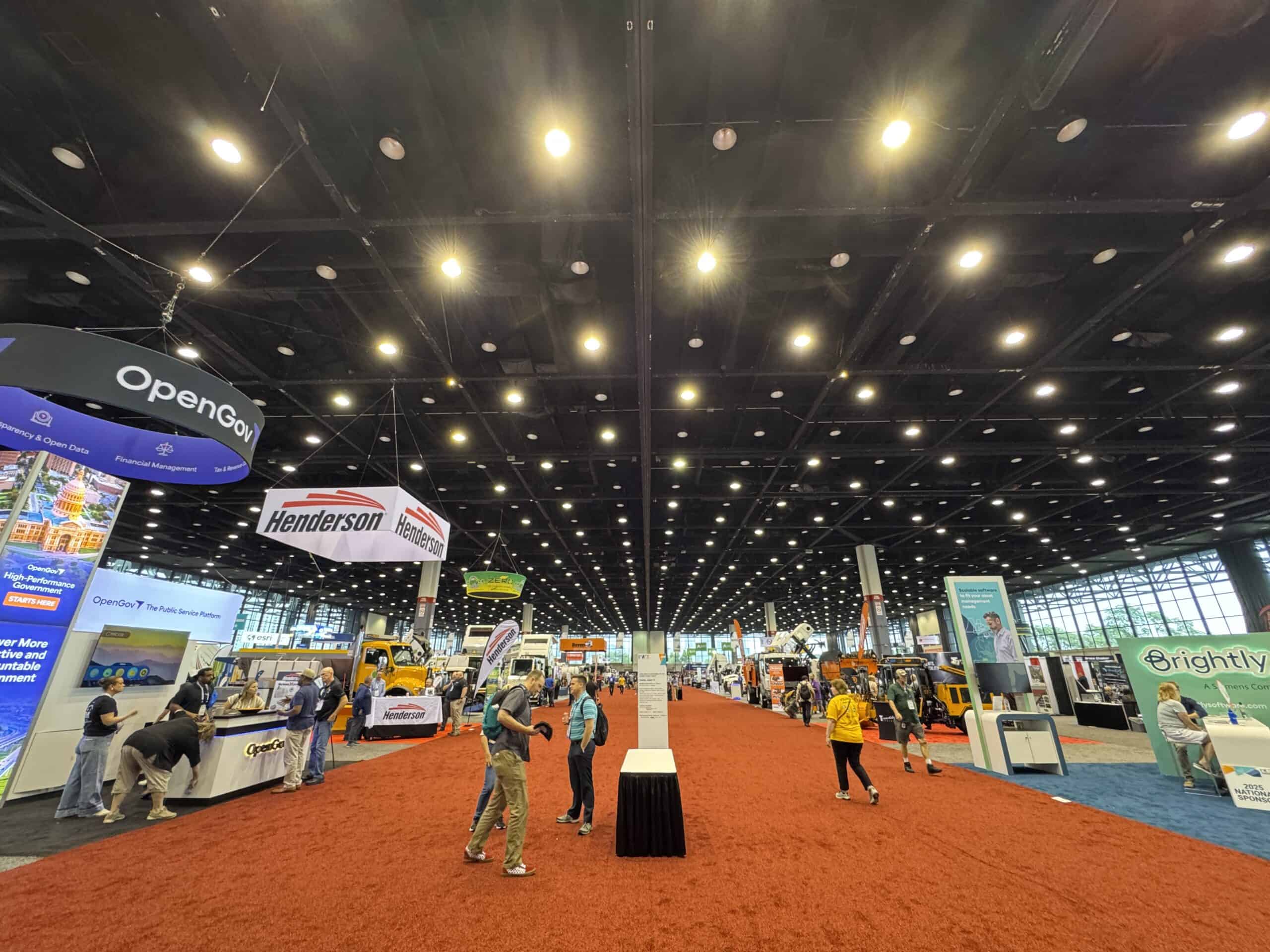
The 2025 Public Works Expo (PWX) just finished, and our team was there to report on industry trends and reconnect with satisfied customers.| Mosaic51.com
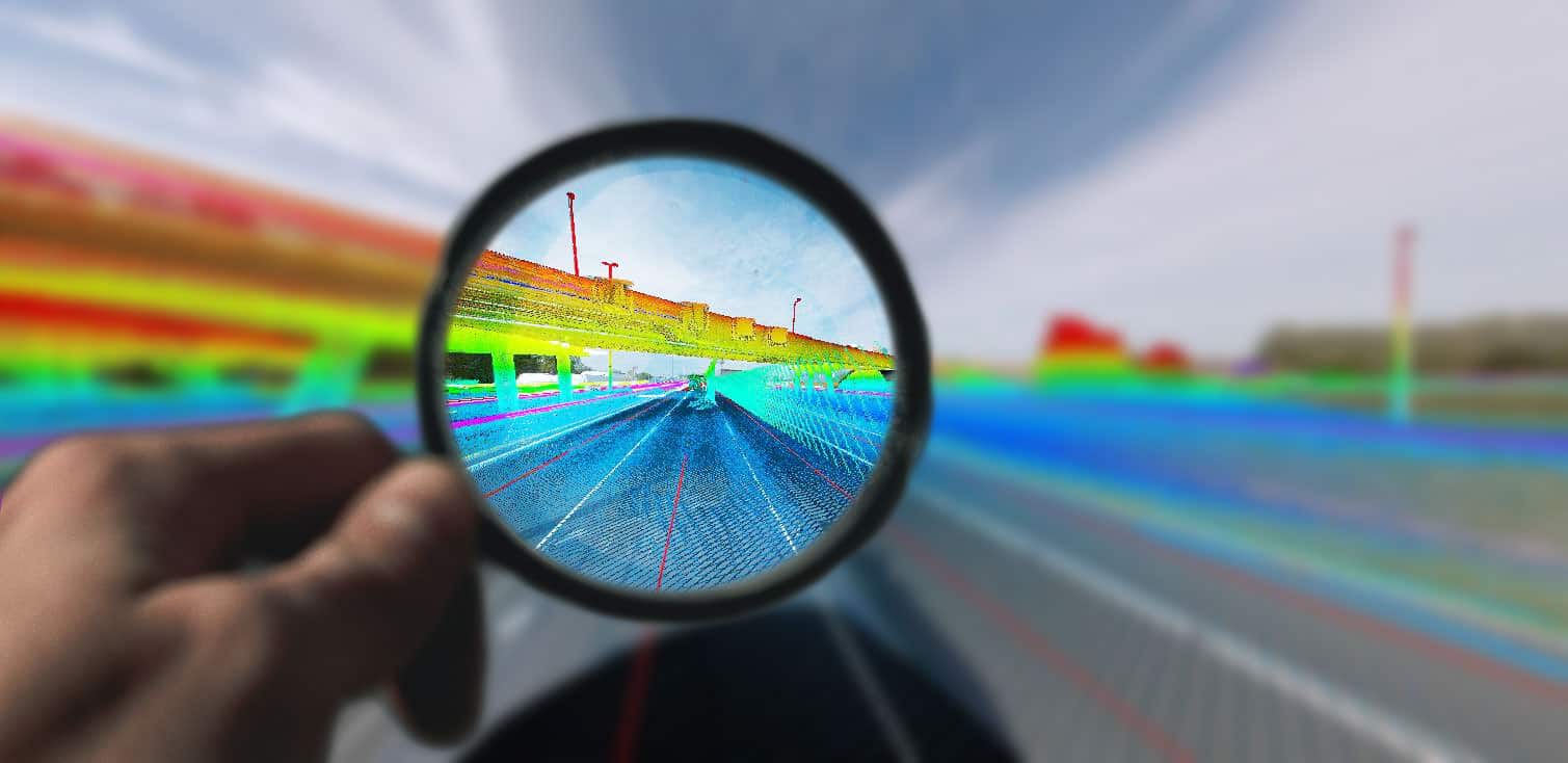
Capture and analyze challenging-to-reach environments like industrial facilities, factories, pedestrian zones with the ease of highest-resolution laser and photogrammetric scanning| Mosaic51.com
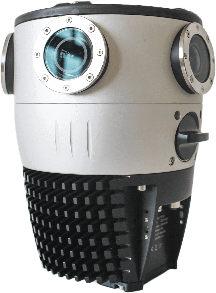
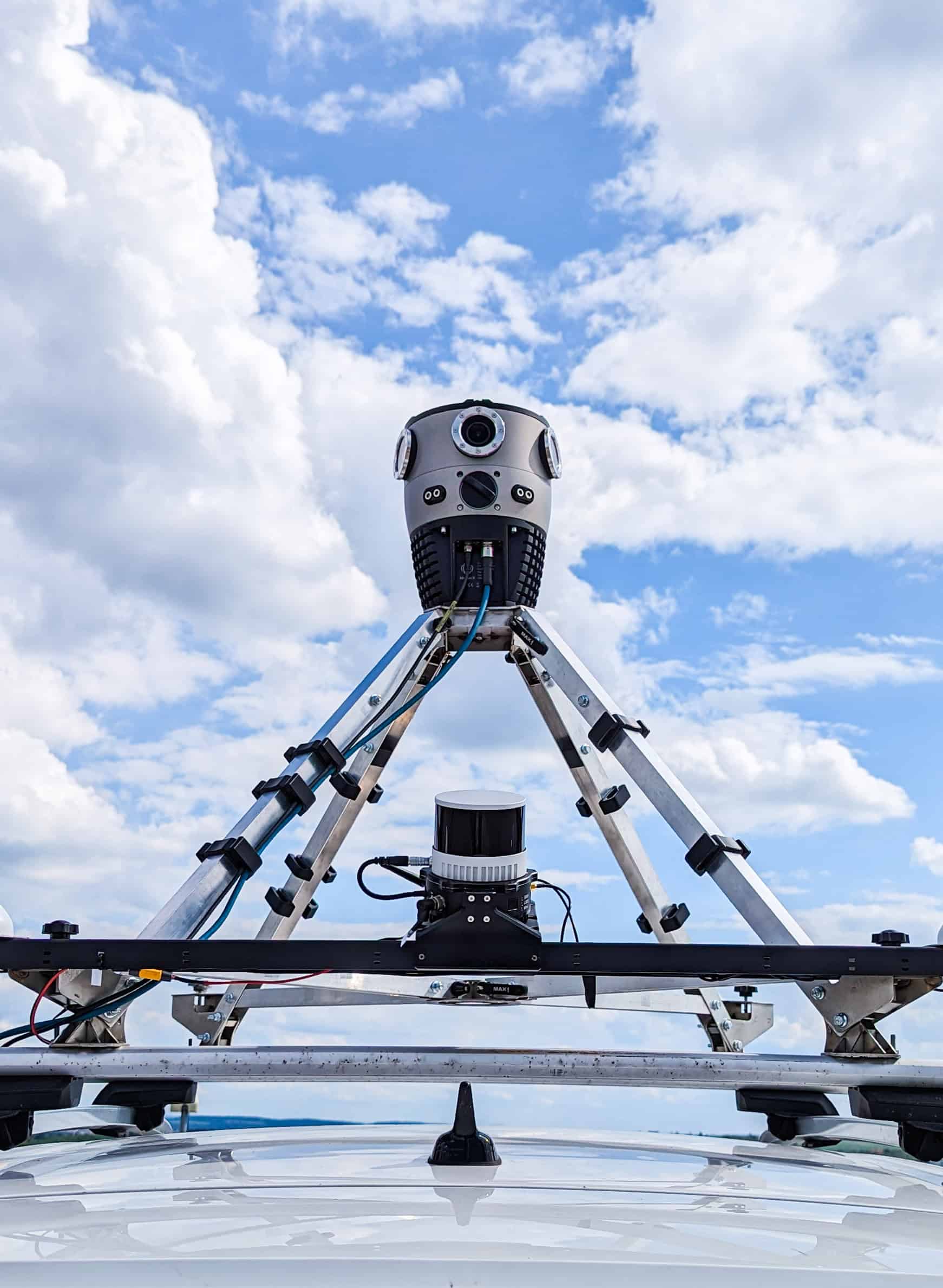
Meet the Mosaic X, the 360º mobile mapping camera with Global Shutter, built for photogrammetry, 3D modeling and Digital Twins at scale.| Mosaic51.com
The Mosaic Viking camera offers 22K resolution, 6x31MP APS-C sensors, making it the highest resolution 360 camera in the world. Available now| Mosaic51.com
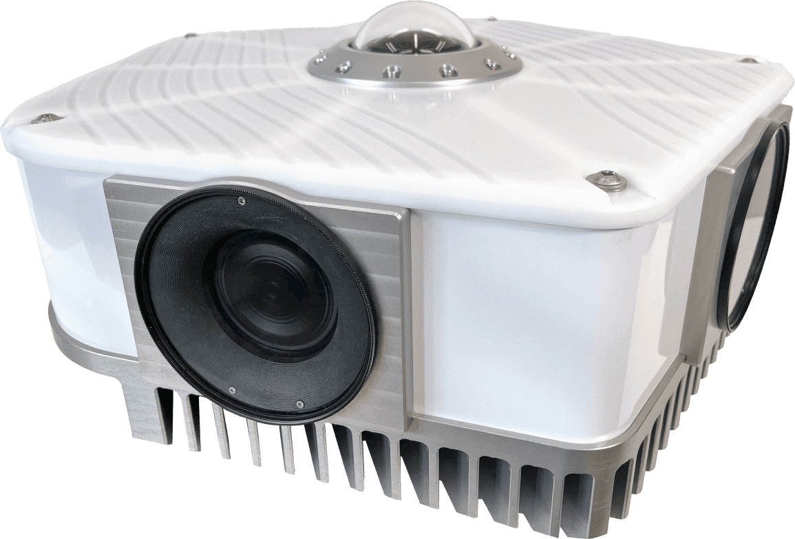
High-Quality 360° & LiDAR Mapping at an accessible price. A versatile mobile mapping solution for surveying, mapping, and GIS.| Mosaic51.com
Journey into the community of 360 cameras and mobile mapping with experts in the field. Be inspired to innovate with interviews, expert opinions, and tutorials.| Mosaic51.com
Advanced HD 360º cameras and services for mobile mapping, AR, 3D modeling, GIS, infrastructure inspection, and more, built by Mosaic.| Mosaic51.com
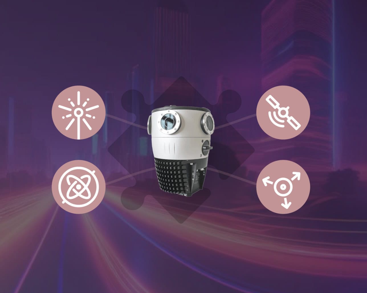
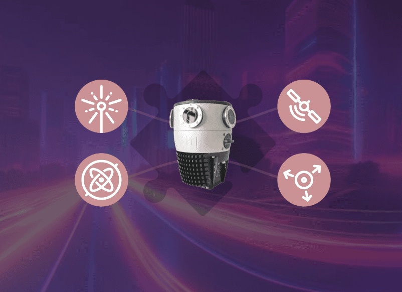
Optimize your surveying with Mosaic integrations. Connect external sensors, like GNSS, LiDAR, and IMU to Mosaic 360 cameras for enhanced geospatial accuracy and efficiency.| Mosaic51.com
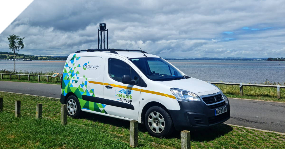
Discover how a mobile mapping camera helped one company scale quickly, reduce costs by more than 20%, and capture better data for telcos.| Mosaic51.com
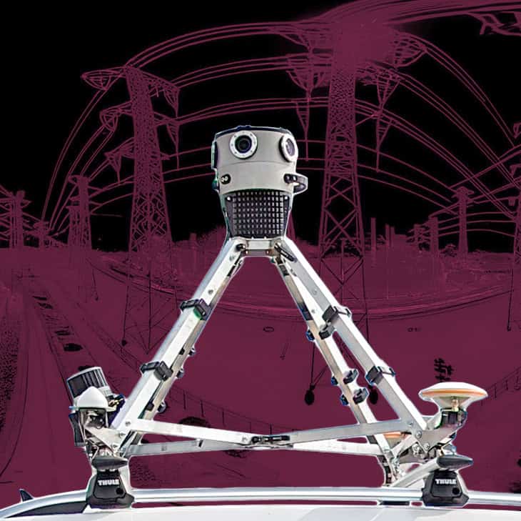
Check out an electrical grid inspection case study. The Mosaic 51 360º mobile mapping camera combined with LiDAR| Mosaic51.com
The newest and fastest way to collect high quality street-level images, process and share. Mosaic 51 and Site Tour 360 collaboration.| Mosaic51.com
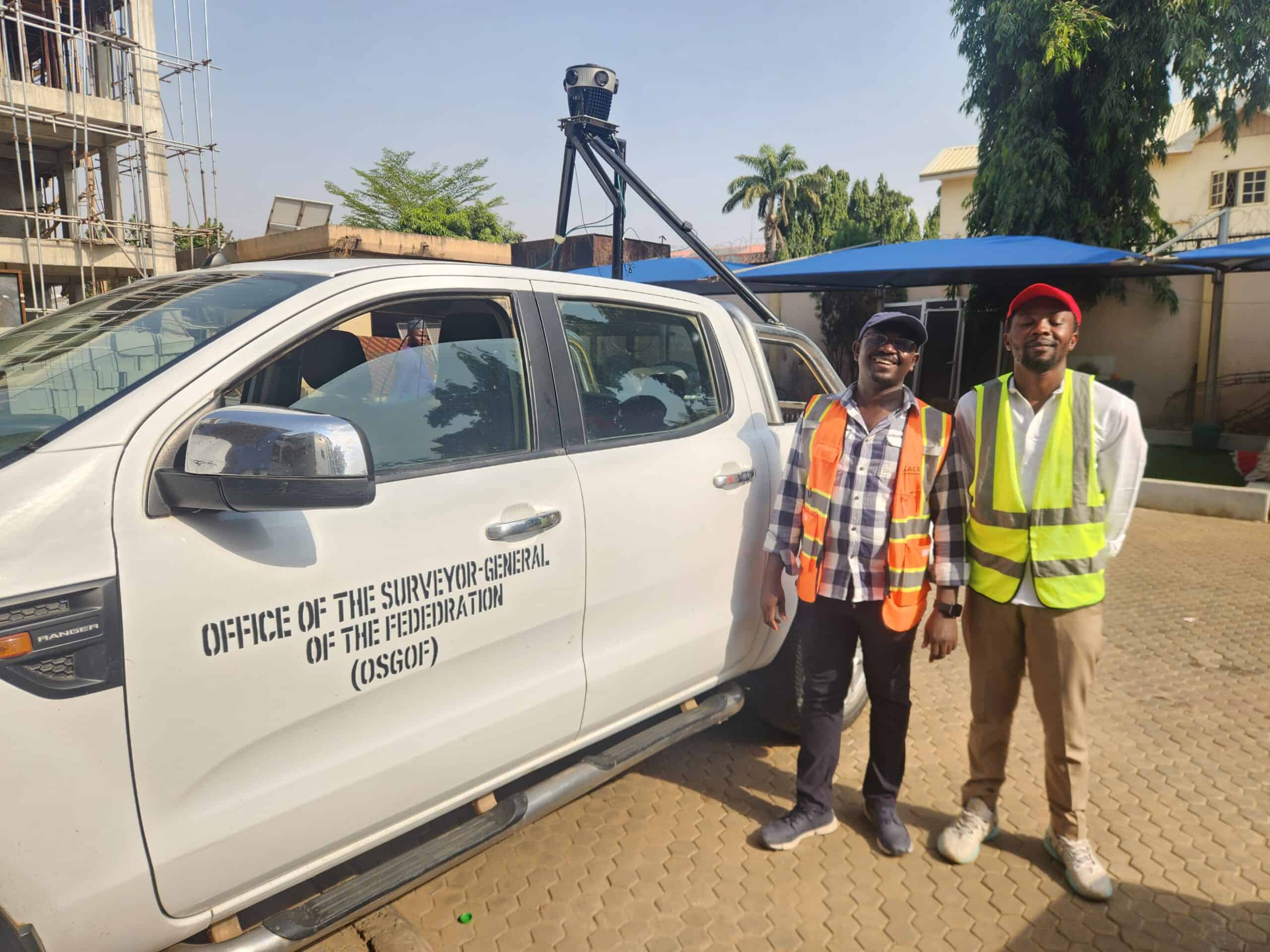
Building smart cities starts with a smart digital model. Follow Nigeria's largest cities as they use mobile mapping to improve infrastructure.| Mosaic51.com
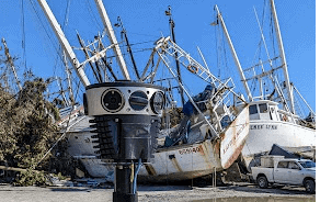
McKenzie Intelligence Services uses Mosaic-gathered data to assess disaster damage and return fast results to their clients.| Mosaic51.com
Mosaic's cameras are specifically designed to capture high-resolution 360° images and integrate with external sensors,| Mosaic51.com
A Mosaic integration is seamless and cost-effective when paired with industry leaders like Reigl, Trimble, and Emlid.| Mosaic51.com
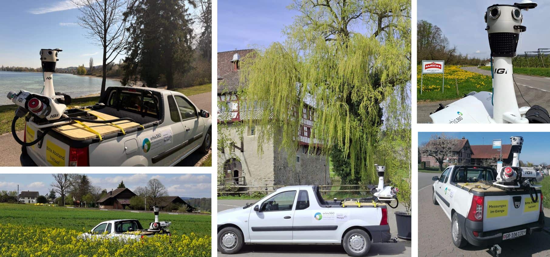
IGI successfully integrated the Mosaic X camera onto the existing StreetMapper-V platform.| Mosaic51.com

Don't interrupt your workflow or stress about learning new software! Mosaic's non-vendor-locked data has 20+ compatible software programs.| Mosaic51.com
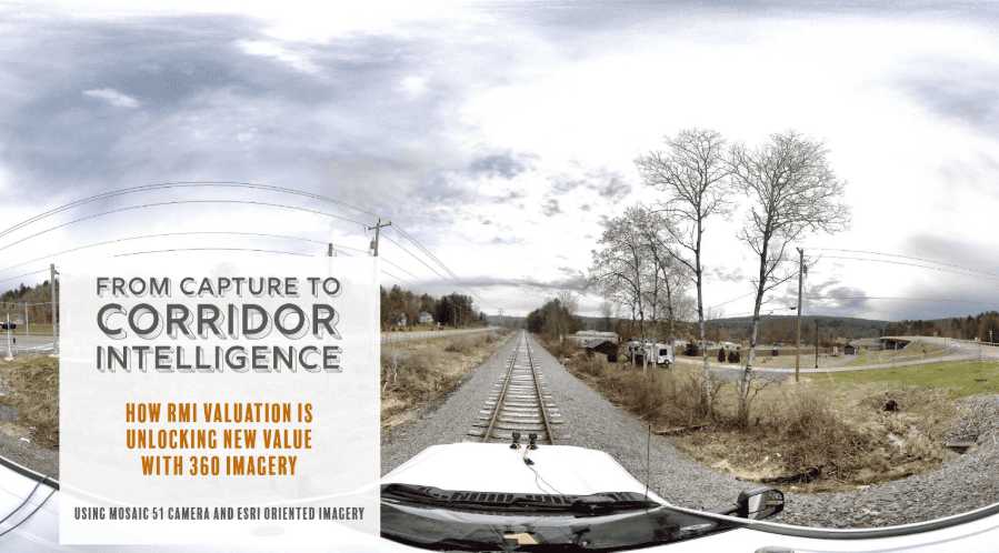
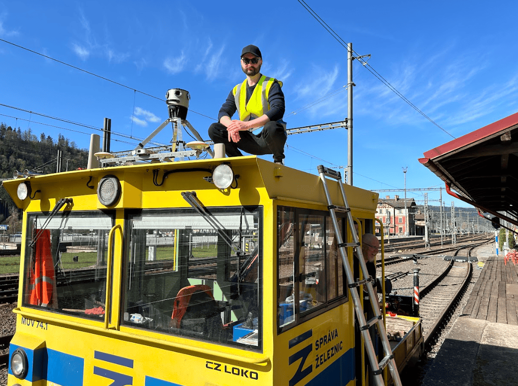
RMI Valuation has developed an end-to-end 360° imagery workflow for rail corridors with the Mosaic 51 camera, GNSS, and ArcGIS.| Mosaic51.com
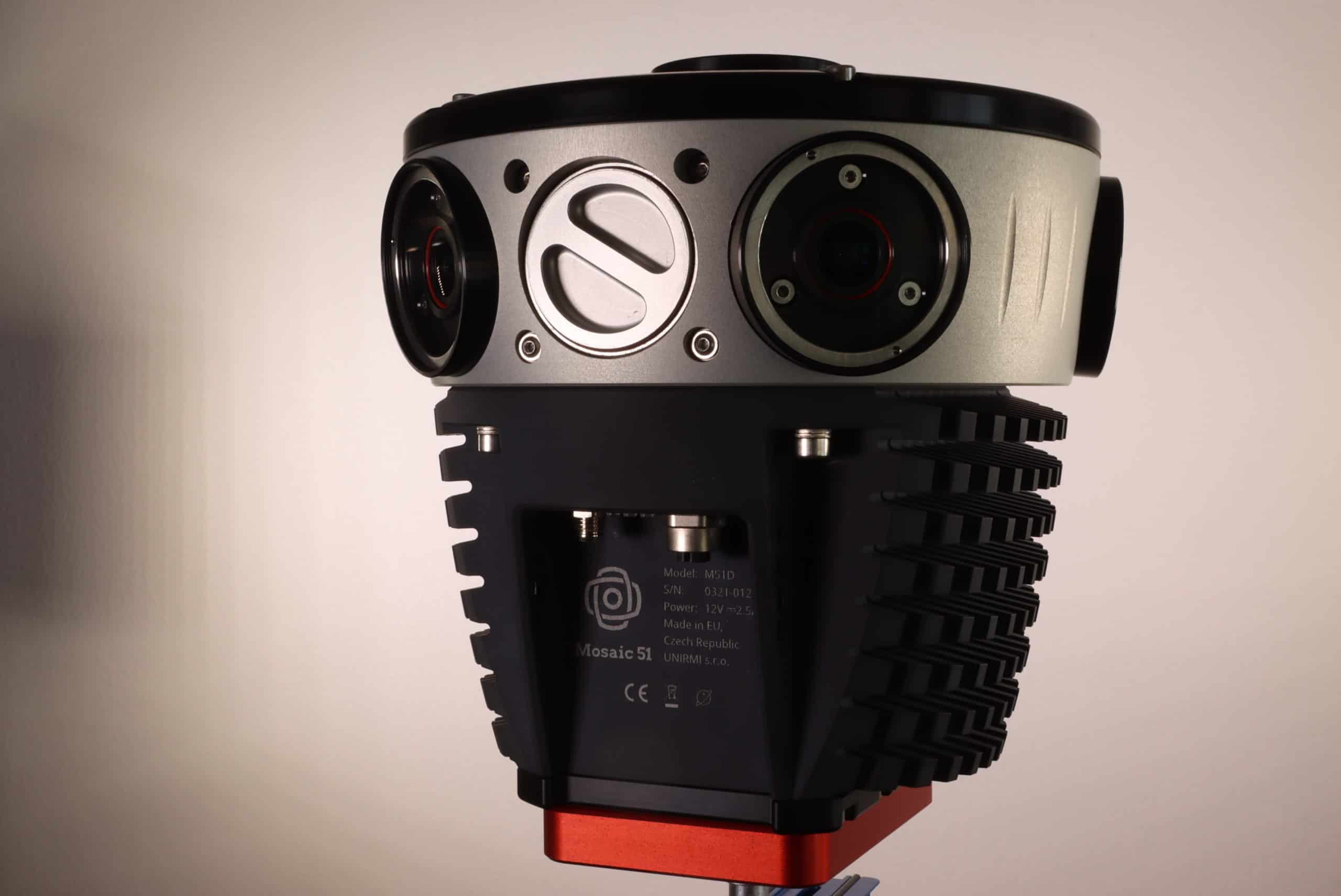
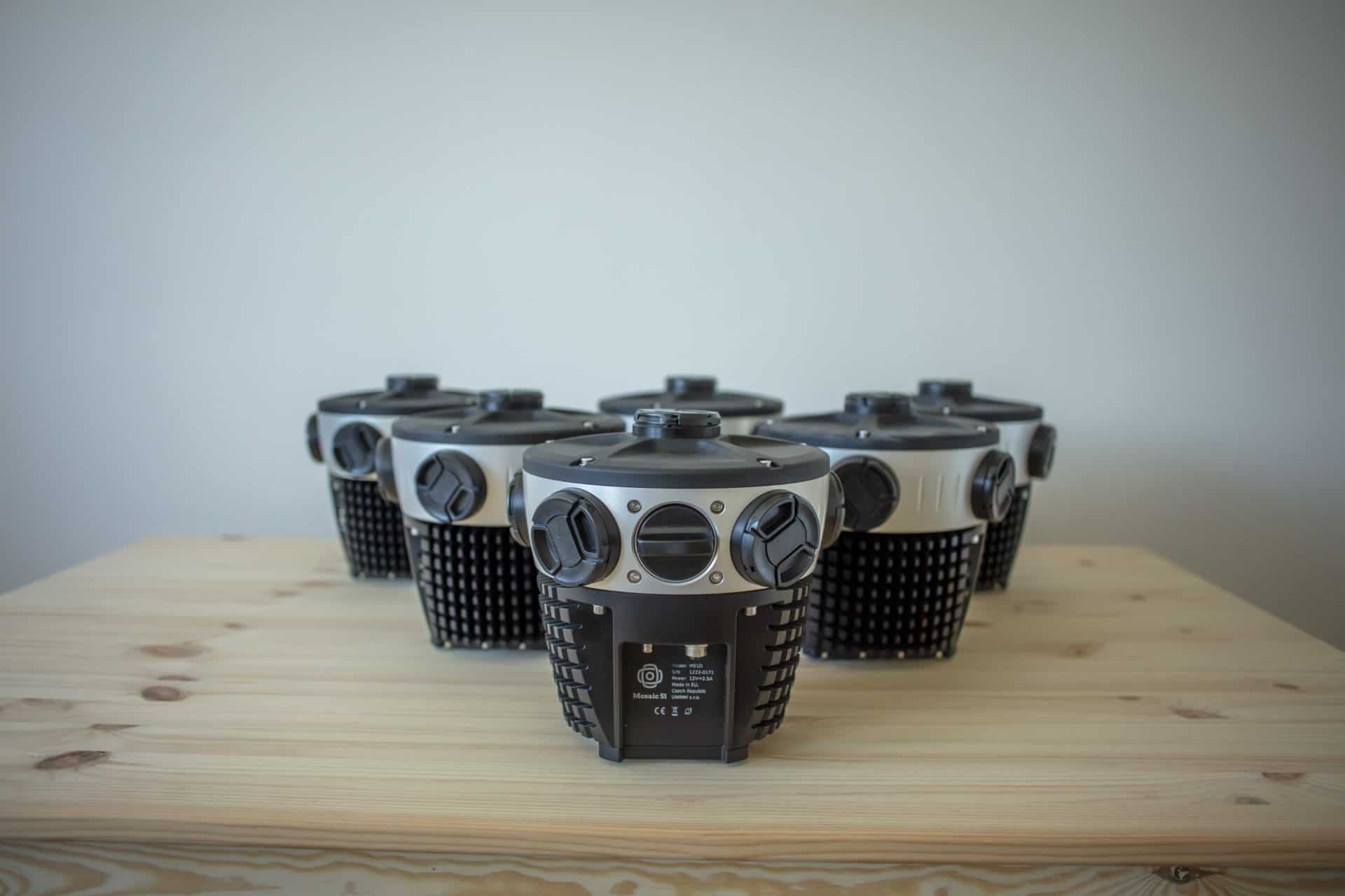
The Mosaic 51 camera, a panoramic mobile mapping camera, for the highest quality images in a single device. Onboard CPU/GPU, storage, & GNSS.| Mosaic51.com
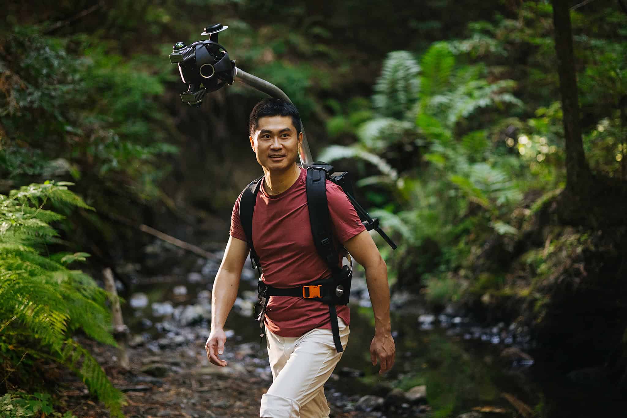
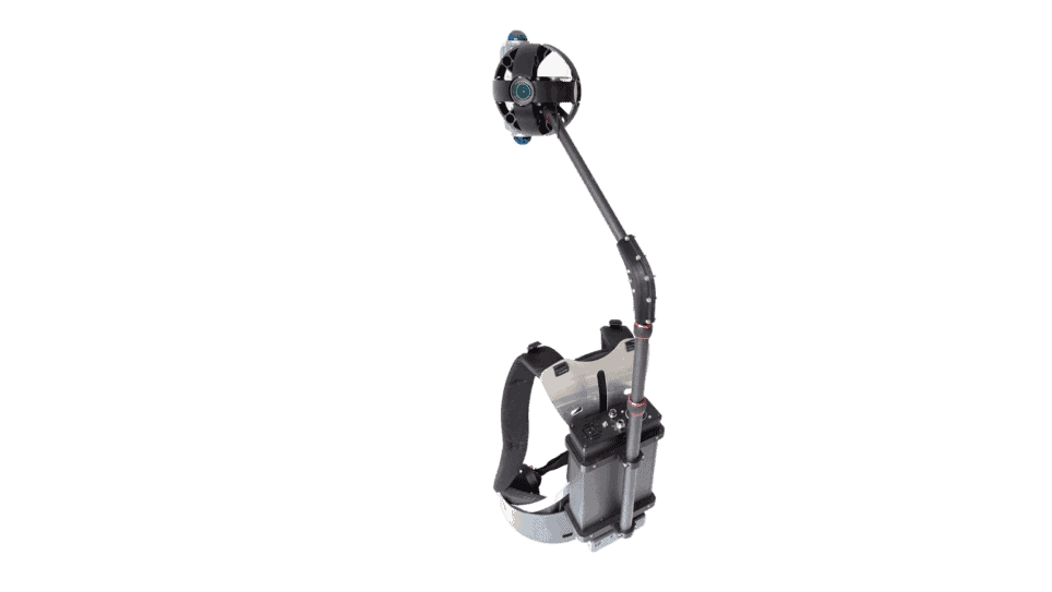
Learn how a backpack with a 360° camera and LiDAR overcomes traditional reality capture limitations, delivering high-res data in the toughest environments.| Mosaic51.com
Mosaic's 360 camera solutions cross multiple industries such as AR, 3D, governments, telecoms, self-driving cars, and insurance companies.| Mosaic51.com
In the world of 3D modeling, NeRF vs photogrammetry is a hot topic. Check out our learnings from our own experience using both technologies.| Mosaic51.com

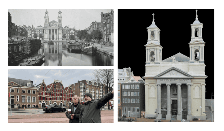
How Mosaic and their 360º mobile mapping cameras and unique approach to building 3D models is revolutionizing the VFX world.| Mosaic51.com
You've been asking so here it is - what it takes to create our incredible 3d models with Mosaic camera imagery and 100% pure photogrammetry.| Mosaic51.com

Learn more about a comprehensive solution for the VFX, movie and gaming industries, which reduces time and costs in the pre-production phase.| Mosaic51.com
This case study highlights Mapersive's journey of enhancing their GIS and urban planning operations through the adoption of the advanced Mosaic 51 camera.| Mosaic51.com
Discover how a team of 2 with Mosaic's 360° camera plus LiDAR transformed the production of "The Ice Cream Man," enabling high-fidelity 3D imagery for VFX.| Mosaic51.com
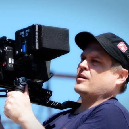
An Emmy-winning VFX supervisor reviews the Xplor, a portable 360° scanning backpack, highlighting its innovative design and impact on the VFX industry.| Mosaic51.com
Mosaic's line of rugged 360º mapping cameras are the highest resolution available, perfect for 3D modeling and AR. Made for mobile mapping.| Mosaic51.com
