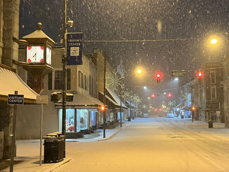
Limited rainfall brought drought back last month, while our temperatures were mostly typical for the first month of fall. Last month had a quiet start but a busy end in the tropics, as we discuss in our hurricane season update. Note: Due to the federal government shutdown, statewide statistics and rankings from the National Centers| North Carolina State Climate Office
Cooler weather made for an unseasonable August, while we started wet and finished the month on a dry note. In this post, we also wrap...| North Carolina State Climate Office
This week, we at the State Climate Office say farewell to our director, Dr. Kathie Dello, and wish her all the best as she begins...| North Carolina State Climate Office
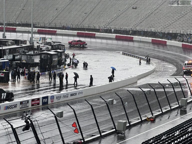
The first hurricane – and the first major hurricane – of the 2025 Atlantic hurricane season passed off our coastline this week, and despite not...| North Carolina State Climate Office
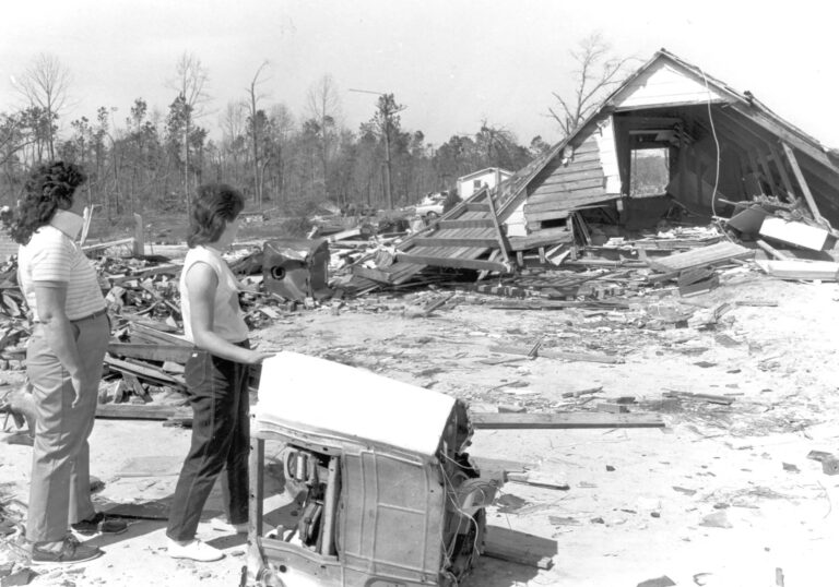
Five years ago, an overactive Atlantic brought an early-season hurricane to North Carolina’s doorstep. Just after 11 pm on August 3, 2020, Hurricane Isaias made...| North Carolina State Climate Office
July saw a wet start including Tropical Storm Chantal and month-long warmth, especially overnight. To help communities prepare for hot weather like that, an Extreme...| North Carolina State Climate Office
Thirty minutes into the most recent Olympic women’s soccer gold medal match between the United States and Brazil, officials recognized it was time for a...| North Carolina State Climate Office
The first tropical system of the season to affect North Carolina produced locally heavy rainfall and flooding in parts of the Piedmont and Sandhills. Tropical...| North Carolina State Climate Office
It was an environmental domino effect that was hard to fathom considering huge swaths of western North Carolina had been under water just two months earlier following Hurricane Helene.| North Carolina State Climate Office
It began in the wake of extreme flooding from Hurricane Helene and ended amid the onset of sunny summer weather. After spanning parts of all four seasons and all corners of the state at its peak, our latest drought in North Carolina is finally over. This week’s US Drought Monitor shows that the final sliver| North Carolina State Climate Office
April featured unseasonable warmth and an uncharacteristic lack of rain showers and severe weather. That has extended our drought with new impacts emerging last month.| North Carolina State Climate Office
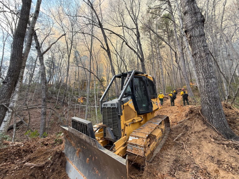
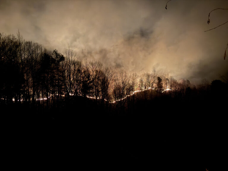
On the fast track into spring, March remained mostly warm in North Carolina, with dry weather especially in the west. Low humidity, gusty winds, and ongoing drought combined to fuel more wildfires across the state.| North Carolina State Climate Office
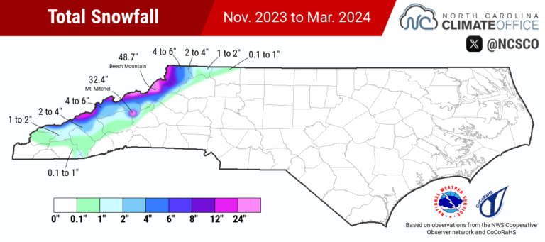
Our weather this winter included evidence of the expected, including overall dry conditions, along with some surprises sprinkled in with the return of snow across the state for the first time in almost three years.| North Carolina State Climate Office
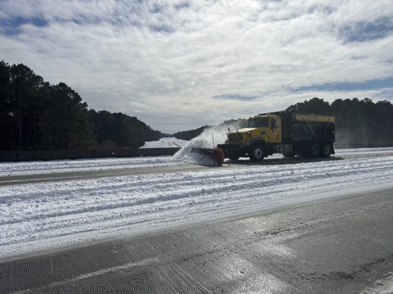
The third significant winter storm of the season across the state brought a mixed bag of precipitation and bumped up the seasonal snow totals for some sites.| North Carolina State Climate Office
January brought a rare run of cold weather that supported several rounds of snow. But with little other precipitation, drought continued expanding across the state last month.| North Carolina State Climate Office
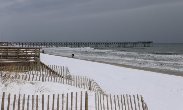
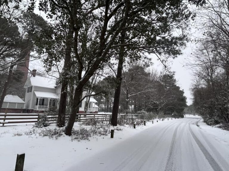
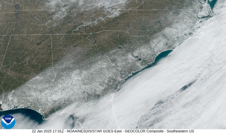
The second winter storm in a week and a half affected North Carolina on Tuesday night, and this time, it was eastern areas seeing the greatest accumulations and ending multi-year snow droughts. This event was part of a region-wide cold air outbreak courtesy of a deep trough in the jet stream that allowed an Arctic| North Carolina State Climate Office
This post is a summary of our recent Year in Review webinar. The recording from that event will be posted soon, and the presentation slides are now available.| North Carolina State Climate Office
After almost three years of waiting, measurable snow fell again across parts of North Carolina late last week, ending long-running and, in some cases, record-setting snow-free streaks.| North Carolina State Climate Office
December started with snow and finished with heavy rain in the Mountains, sandwiching unseasonably warm spells that added to a near-record warm year. We also check on recent and possible upcoming snow events.| North Carolina State Climate Office
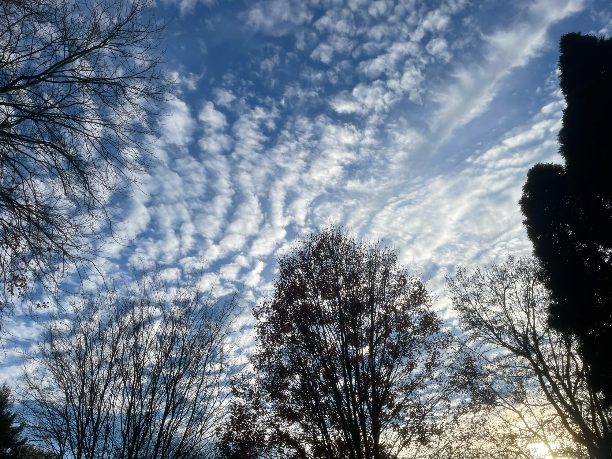
A steady stream of early-fall-like days made for a warm November, and despite returning rainfall, it was a dry month too. November wrapped up a fall defined by big rain events and background warmth.| North Carolina State Climate Office
It’s setting up to be a consequential winter for North Carolina, with the fate of a newly emerging drought, along with a potentially record-breaking “snow drought,” hanging in the balance.| North Carolina State Climate Office
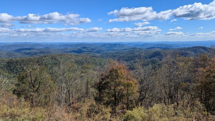
Coming off a soaking September, October offered a decidedly drier pattern, along with mostly warm temperatures. That has made for an unconventional start to fall across the state.| North Carolina State Climate Office
Due to Hurricane Helene, the National Centers for Environmental Information’s data center in Asheville is currently shut down. Our colleagues at NCEI have confirmed that all of their staff are safe and accounted for in the wake of the storm. Since the preliminary statistics and statewide rankings are unavailable, our monthly climate summary for September will have a different format than usual. | North Carolina State Climate Office
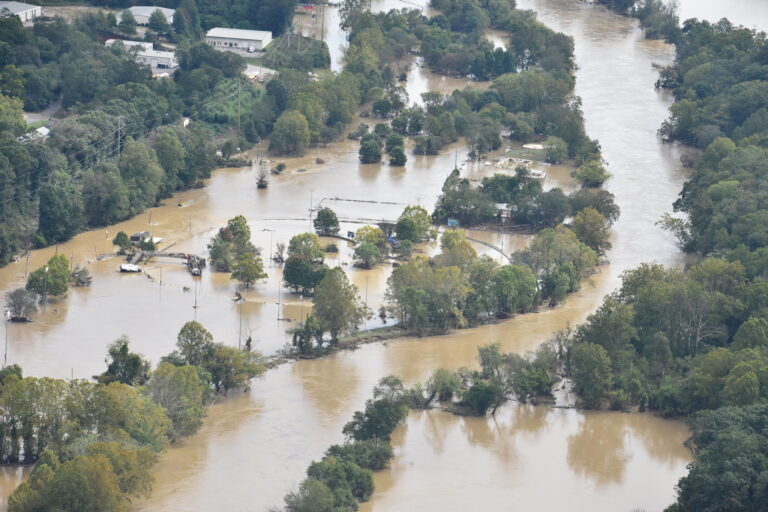
Torrential rainfall from the remnants of Hurricane Helene capped off three days of extreme, unrelenting precipitation, which left catastrophic flooding and unimaginable damage in our Mountains and southern Foothills. It was close to a worst-case scenario for western North Carolina as seemingly limitless tropical moisture, enhanced by interactions with the high terrain, yielded some of| North Carolina State Climate Office
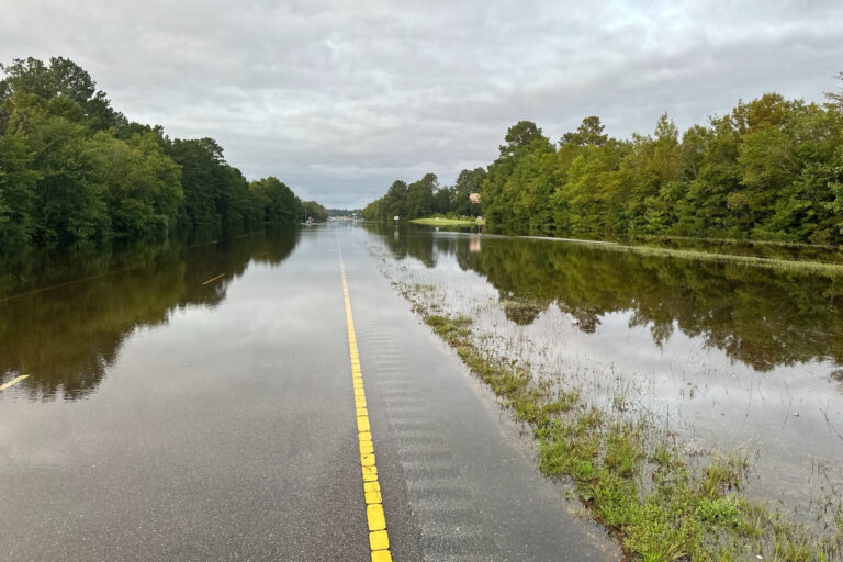
For the second time in just six weeks, parts of southeastern North Carolina have seen more than a foot of rainfall from a slow-moving storm system.| North Carolina State Climate Office
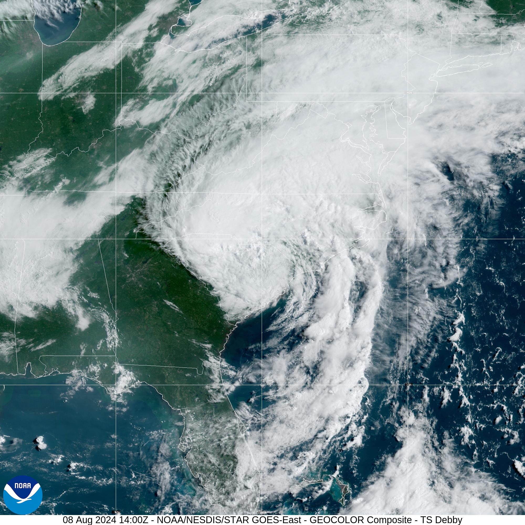
August was wet for most of North Carolina thanks to Debby’s rainfall, while temperatures peaked in the final week of the month. That ended a roller coaster summer with extremes of all sorts. Doused by Debby, but Dry in the West Our August precipitation was dominated by Tropical Storm Debby’s contribution, which single-handedly made for| North Carolina State Climate Office
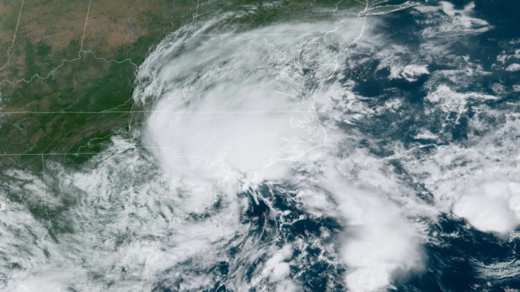
An expected active hurricane season took its first swipe at North Carolina last week, with four days of rainfall from the slow-moving Tropical Storm Debby soaking much of the state. That heavy rain fell on already saturated soils and streams following a record wet July for parts of eastern North Carolina, which created flooding issues| North Carolina State Climate Office
Last month started with more extreme heat, but a wetter pattern followed that brought improvements to our summer drought. Heat Continues in Early July Hot weather especially early in the month made for an overall warmer-than-normal July in North Carolina. The National Centers for Environmental Information (NCEI) reports a preliminary statewide average temperature of 79.3°F,| North Carolina State Climate Office
Extreme heat hit home in June, with little rainfall throughout the month. That combination brought the rapid onset of drought conditions in North Carolina. Summer Sizzle Shows Up A boost from a late-month heat wave helped put our June temperatures well above normal. The National Centers for Environmental Information (NCEI) reports a preliminary statewide average| North Carolina State Climate Office
Springtime showers and storms made for a wet May, while summer-like temperatures settled in during the month. That wrapped up an overall warm, wet, and stormy spring.| North Carolina State Climate Office
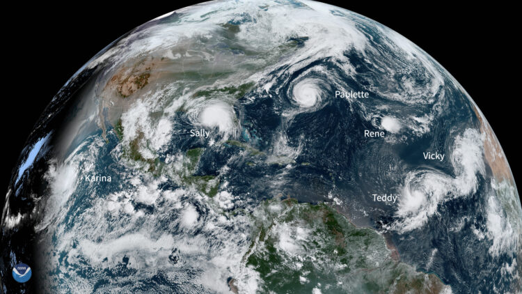
Few hurricane seasons in recent memory have arrived with as much anticipation as this year's, and for good reason: few seasons have ever been favored for the sort of ample activity that current outlooks call for over the next seven months. On a recent webinar together with the National Weather Service in Raleigh, we broke| North Carolina State Climate Office
Ascending temperatures arrived in April, while the rain that moistened our March was mostly absent. However, our few thunderstorms did bring an icy, potentially record-matching surprise.| North Carolina State Climate Office
It was a record wet March in parts of North Carolina, while the entire state experienced warm temperatures and the corresponding arrival of pollen season last month. Frequent Rains Roll Through Heavy rain especially at the coast fueled a wet March for the state. NCEI reports a preliminary statewide average precipitation of 5.45 inches, which| North Carolina State Climate Office
The long-awaited arrival of El Niño late last year helped our winter start with a splash, with multiple rain events across the state in December and January. But prevailing warm weather meant no snow for most areas, with the last flakes now a distant memory from more than two years ago.| North Carolina State Climate Office
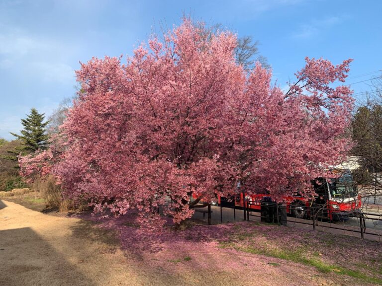
Warm weather dominated last month, and so did dry conditions across much of the state. In light of those unseasonable stretches, we look at how early spring has settled in this year.| North Carolina State Climate Office
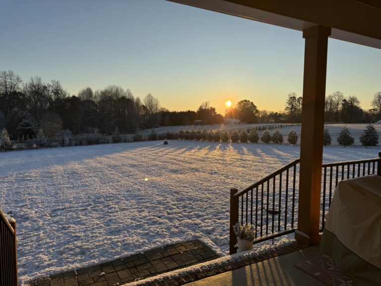
Warm temperatures dominated January, as did wet weather in western North Carolina, which brought our ongoing drought to an end.| North Carolina State Climate Office