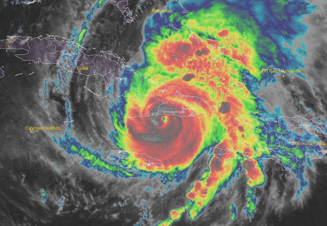
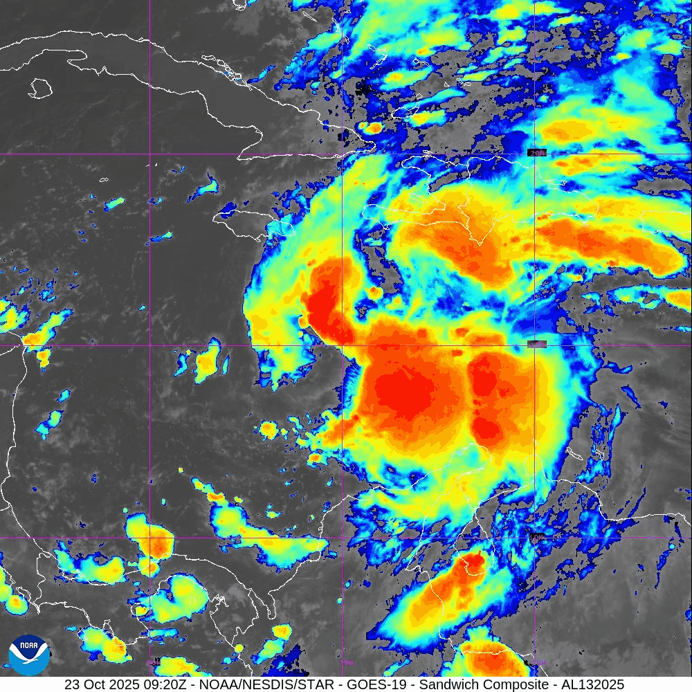
Melissa Strikes Eastern Cuba after Ravaging Jamaica
Melissa is the strongest hurricane to hit eastern Cuba in 9 years| Eye on the Tropics
Melissa is the strongest hurricane to hit eastern Cuba in 9 years| Eye on the Tropics

Melissa ties Dorian in 2019 and the 1935 Labor Day hurricane as the strongest landfalling Atlantic basin hurricane on record| Eye on the Tropics
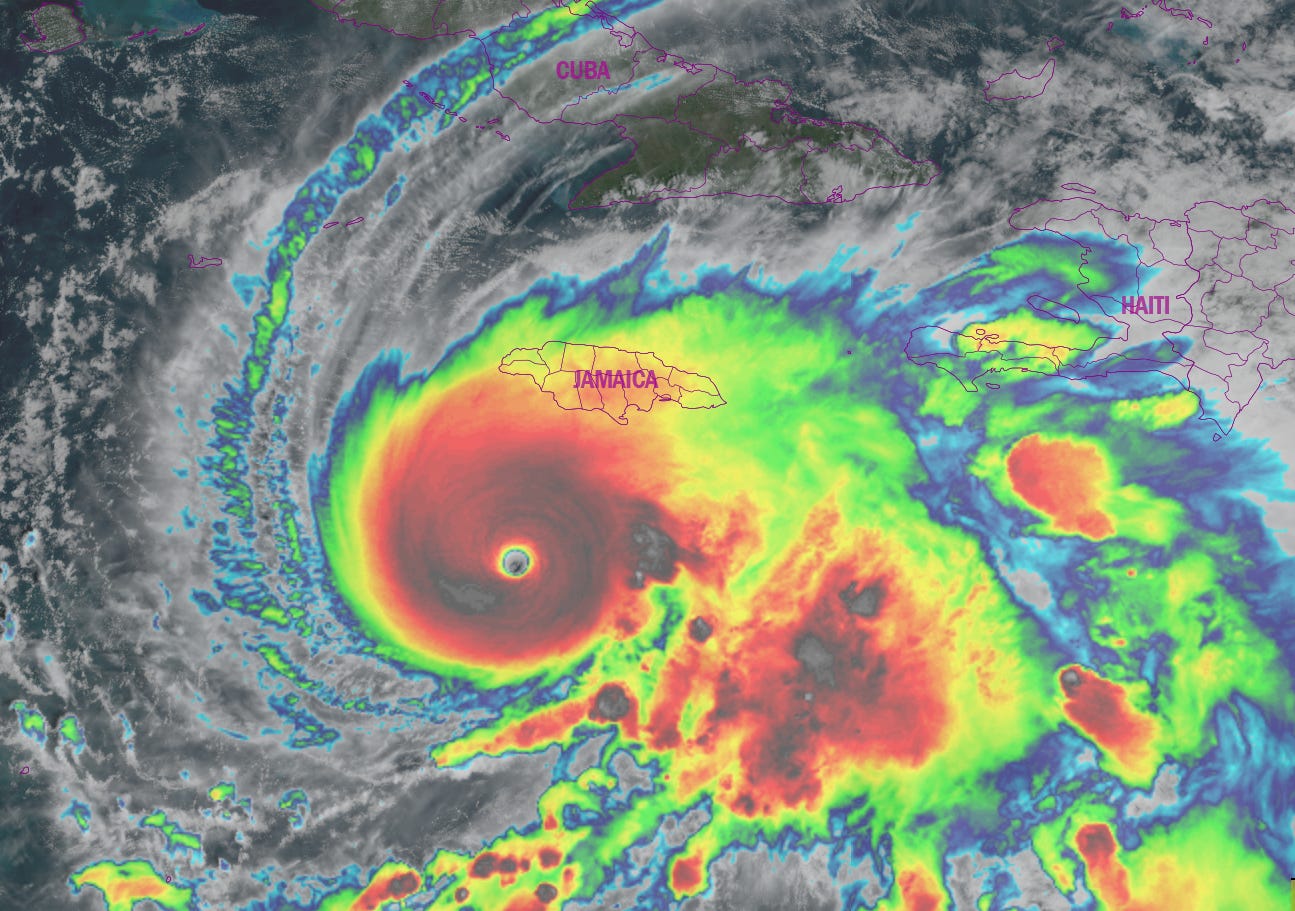
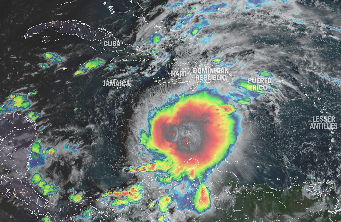
Melissa becomes the third Category 5 hurricane of the 2025 hurricane season, expected to strike Jamaica Tuesday morning near peak strength| Eye on the Tropics
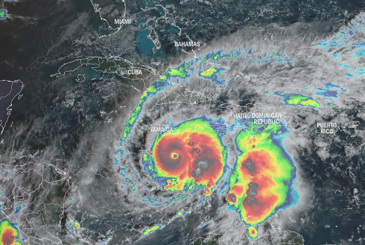
Melissa rocketed from a tropical storm Saturday to a Category 4 hurricane before first light Sunday, with additional strengthening expected today| Eye on the Tropics
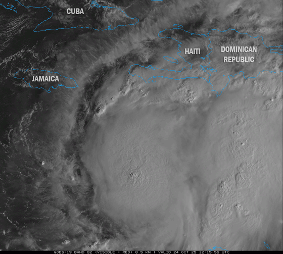
Days of potentially catastrophic flash flooding and landslides threaten southern Haiti, the Dominican Republic, and eastern Jamaica| Eye on the Tropics
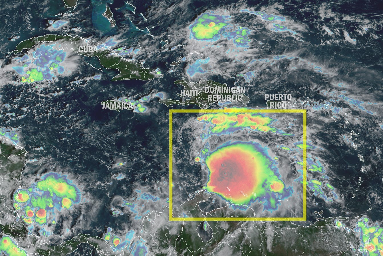
Melissa threatens to be a two-pronged disaster for the central Caribbean, first as a prolific rainmaker, then as a blockbuster hurricane| Eye on the Tropics
Melissa’s uncertain course could deliver torrential rains to parts of Haiti, the Dominican Republic, and Jamaica this week| Eye on the Tropics
Melissa expected to loiter under light steering this week, raising the risk for prolonged heavy rains and flooding| Eye on the Tropics
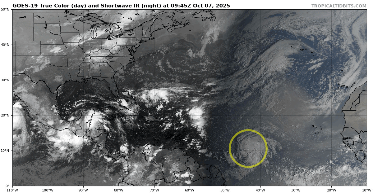
Melissa likely to form in the next day or two and could strengthen into a hurricane before the end of the week| Eye on the Tropics
Does the hurricane season have more in the tank or does next week pass with little fanfare?| Eye on the Tropics
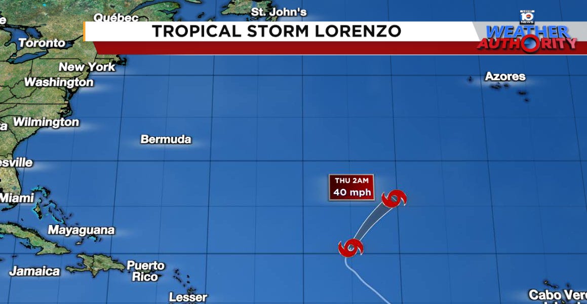
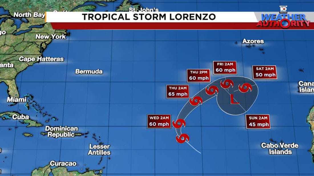
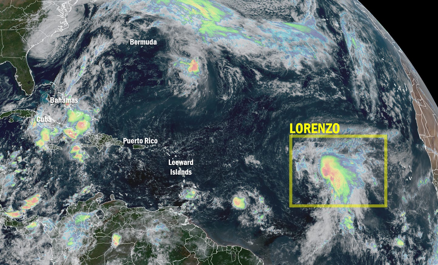
Lorenzo unravels, capping a busy stretch of hurricane season activity| Eye on the Tropics
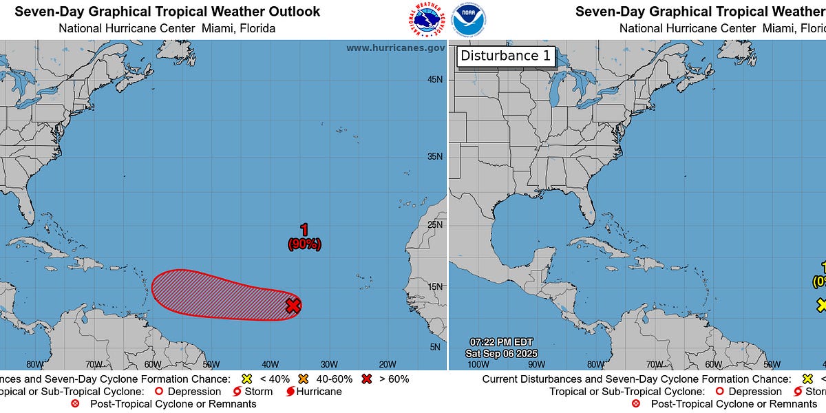
Models still hinting at a development opportunity late next week in the western Caribbean but nothing yet to sink our teeth into| michaelrlowry.substack.com
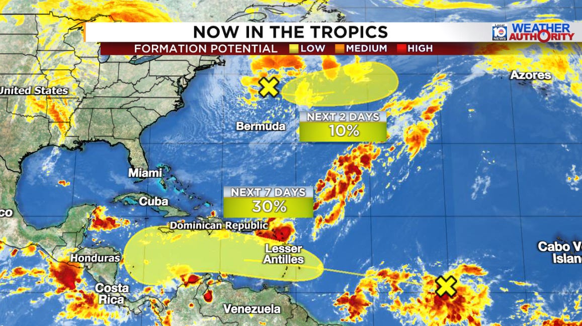
Quiet week expected otherwise across the Atlantic| Eye on the Tropics
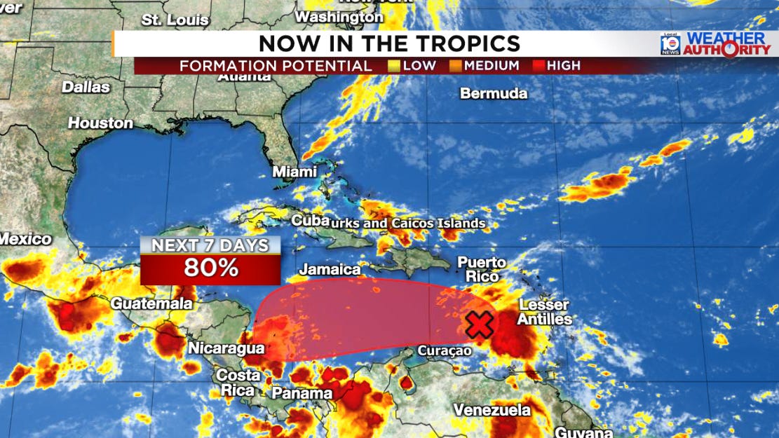
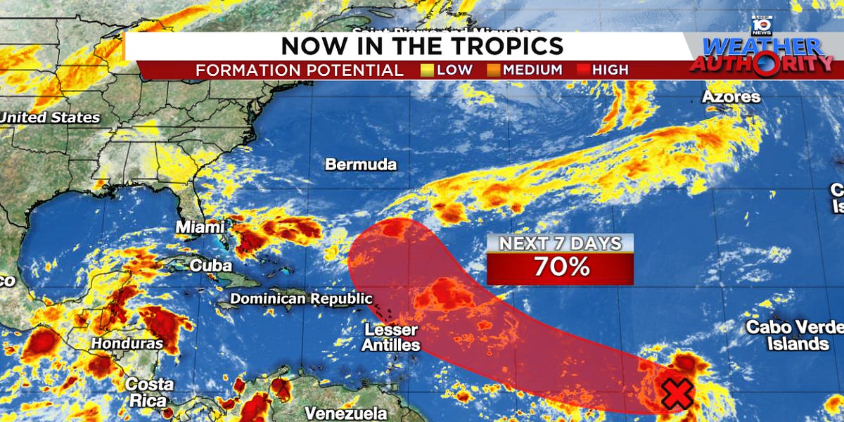
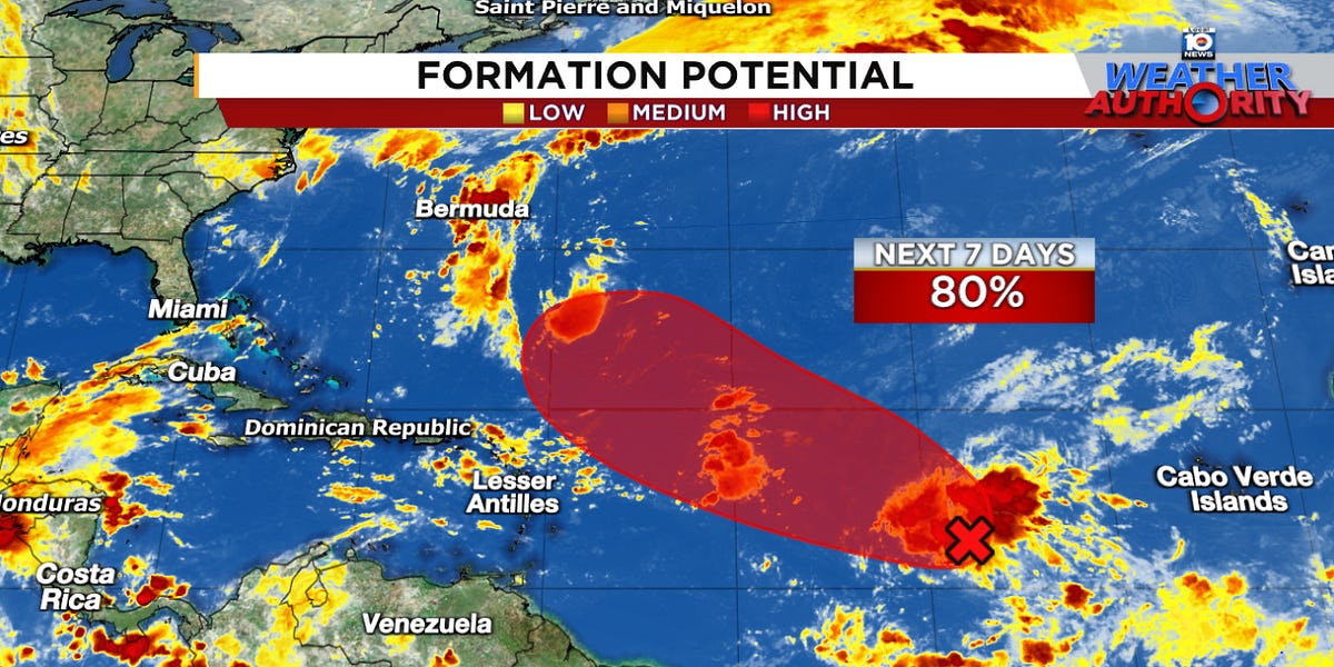
Monitoring a growing signal for Caribbean development next week| Eye on the Tropics
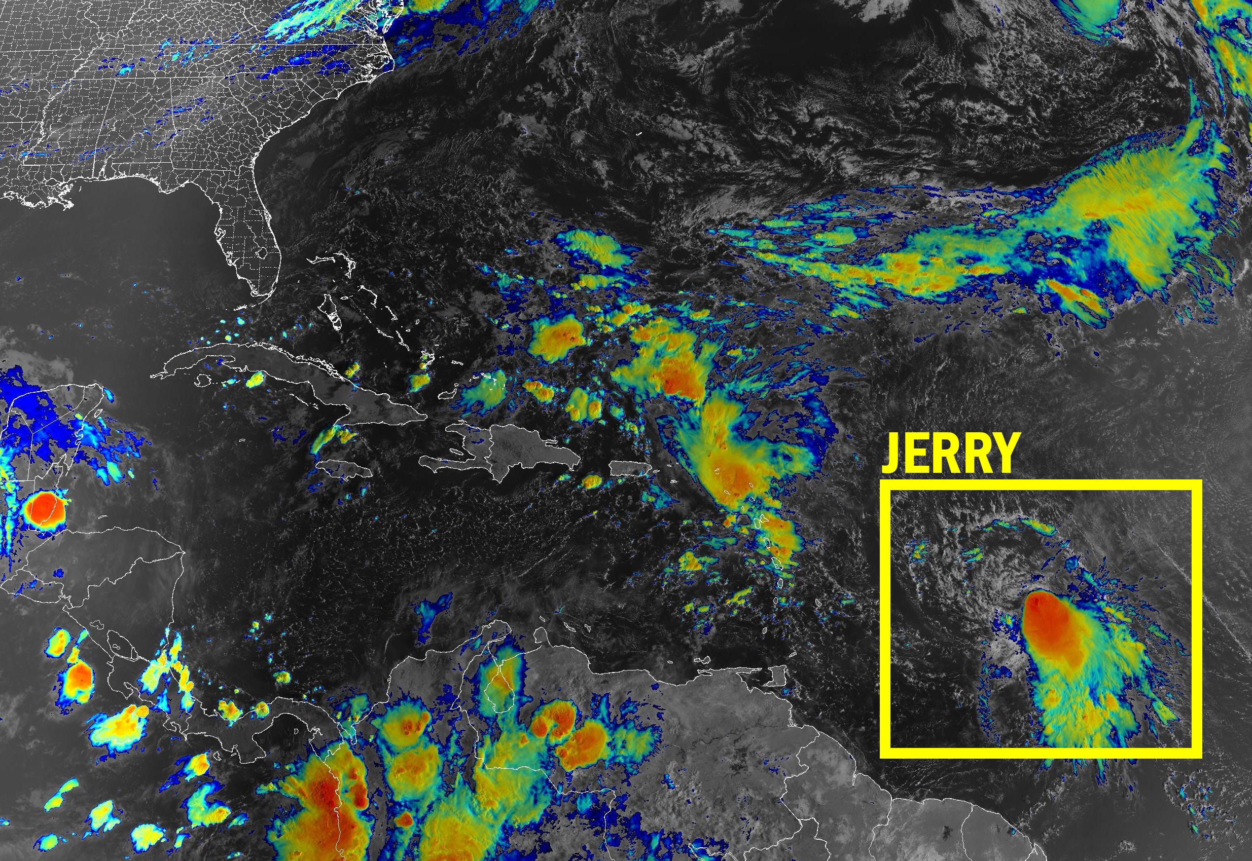
Jerry passing to the north of the Leeward Islands, Virgin Islands, and Puerto Rico but heavy rains and a flash flood threat continues into early Saturday| Eye on the Tropics
Jerry’s strongest winds should pass north of the islands today, but a squally tail will bring the threat of blustery rains through tomorrow| Eye on the Tropics
Jerry forecast to pass near the northern Leeward Islands as a hurricane tomorrow and Friday but turn well east of the U.S.| Eye on the Tropics
Soon-to-be Jerry could move precariously close to the easternmost Caribbean islands as a hurricane by Thursday and Friday| Eye on the Tropics
Invest 95L could become Jerry before the week is out, passing near or north of the Lesser Antilles| michaelrlowry.substack.com
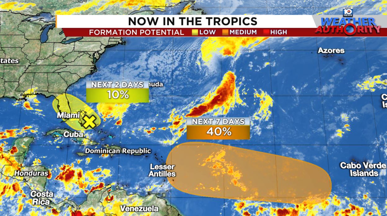
Area near Florida unlikely to develop but could enhance weekend rains while development odds are growing for the central Atlantic next week| Eye on the Tropics
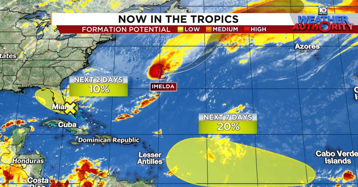
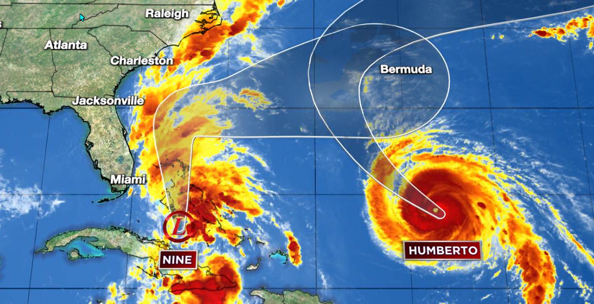
About half of Bermuda was without power early Thursday after Imelda struck during the overnight hours| michaelrlowry.substack.com
Bermuda now in the path of Imelda, which could bring hurricane conditions later this week| michaelrlowry.substack.com
Heavy rains still forecast along the immediate Carolina coastal plain ahead of Imelda but landfall scenarios quickly fading| michaelrlowry.substack.com
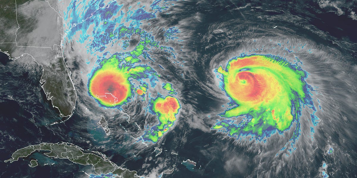
Humberto forecast to become a major hurricane while Imelda could form and threaten the southeast U.S. early next week| michaelrlowry.substack.com
How much each develops may hinge on the other; interests from the Bahamas and southeastern U.S. to Bermuda should monitor| michaelrlowry.substack.com
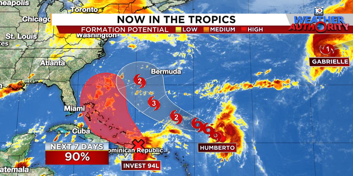
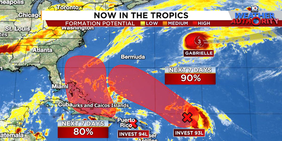
Gabrielle passing east of Bermuda today as a major hurricane with two other areas in queue behind it| michaelrlowry.substack.com
Confidence increasing that Gabrielle’s center will pass east of Bermuda early next week| michaelrlowry.substack.com
September’s underperformance continues courtesy of bouts of wind shear and dry air| michaelrlowry.substack.com

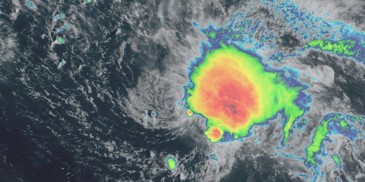
New system breaks a nearly 3-week dry spell in the Atlantic at the peak of the hurricane season| michaelrlowry.substack.com

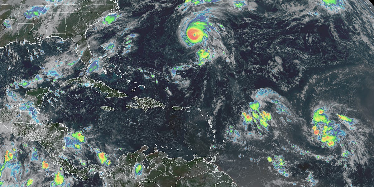
For the second year in a row, no active Atlantic systems to start September| michaelrlowry.substack.com
Atlantic unusually quiet this week headed into the traditional hurricane season peak| michaelrlowry.substack.com

Tropical storm conditions and coastal flooding will begin affecting North Carolina’s Outer Banks by this evening| michaelrlowry.substack.com
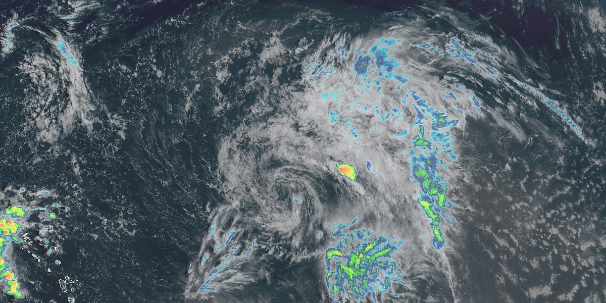
The Atlantic is 18 days removed from its last active tropical system. Could the dry spell end this week?| michaelrlowry.substack.com
