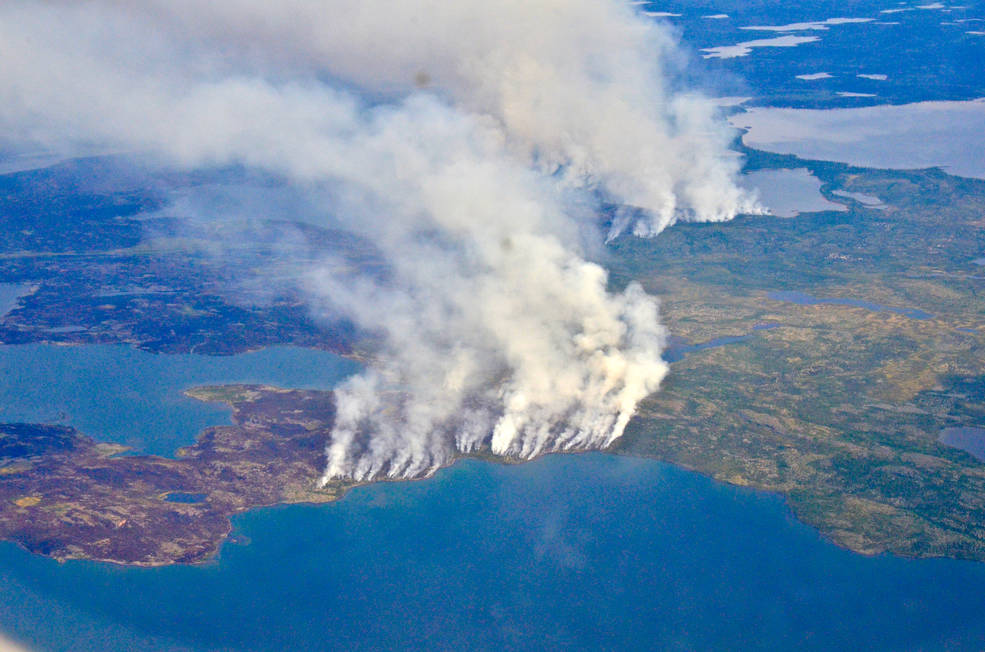
The 2014 megafires in Canada's Northwest Territories burned 7 million acres of forest, making it one of the most severe fire events in Canadian history.| Landsat Science | A joint NASA/USGS Earth observation program.
Data interoperability expert Dana Ostrenga explains how government and commercial Earth observation satellites provide broader support to the scientific community when used together.| Landsat Science | A joint NASA/USGS Earth observation program.
Why do we calibrate Landsat data? We spoke with Brian Markham, a key figure of Landsat calibration science for four decades. He said that it all comes down to this: "If we're using a system to quantify changes on the Earth, we must make sure the system we're using is not changing."| Landsat Science | A joint NASA/USGS Earth observation program.
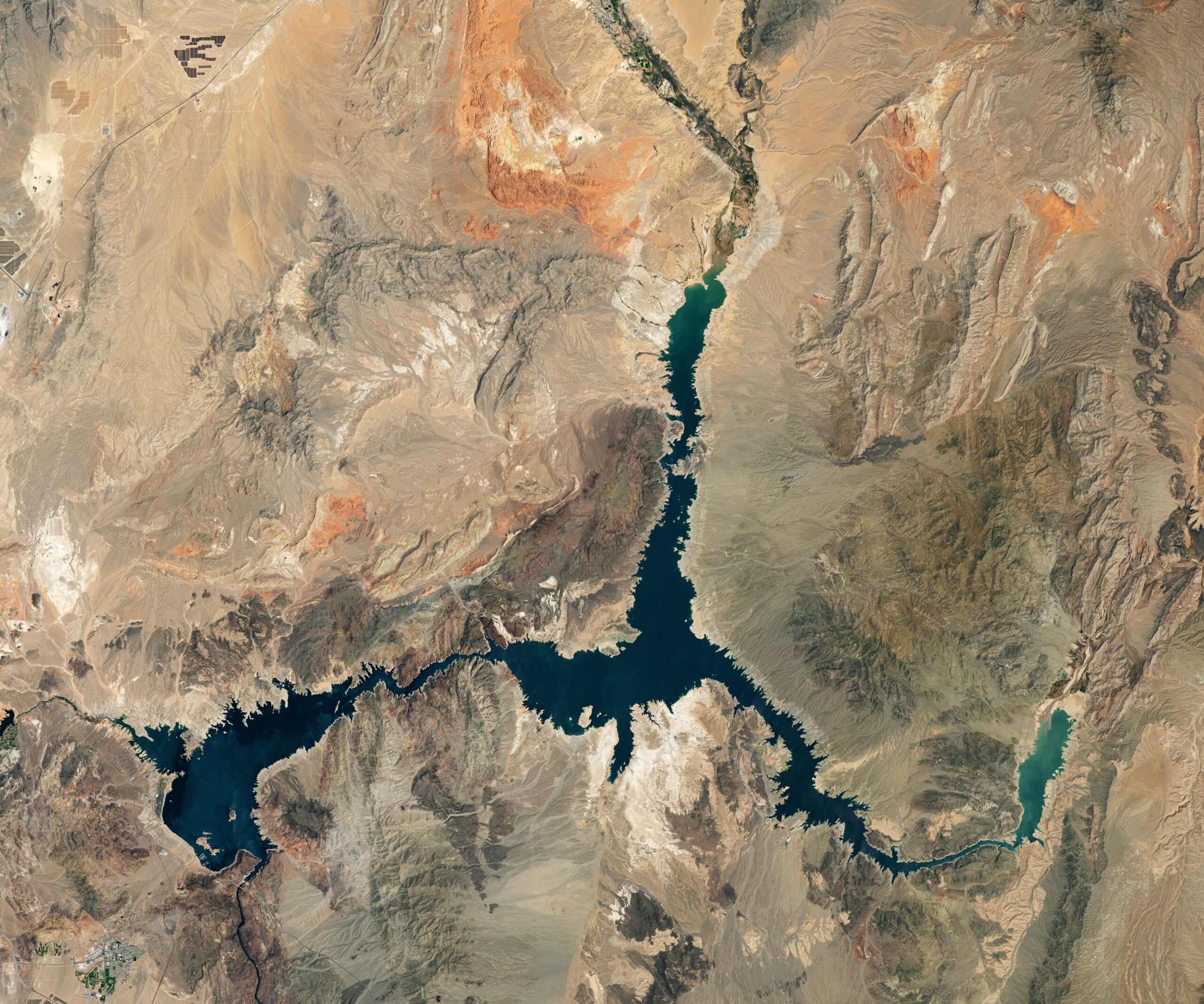
More water is taken from the Colorado River than it has to give. Better water use accounting made possible by Landsat provides needed guidance for difficult water use decisions.| Landsat Science | A joint NASA/USGS Earth observation program.
The Landsat Next project is currently assessing alternate mission architectures to support more affordable ways to maintain the continuity of Landsat imagery per the language in the FY26 President’s Budget Request (PBR). Updates will be forthcoming.| Landsat Science | A joint NASA/USGS Earth observation program.
Landsat-based National Land Cover Database (NLCD) helps predict hurricane wind risk to homes and other structures.| Landsat Science | A joint NASA/USGS Earth observation program.
Using data from Harmonized Landsat and Sentinel-2 (HLS), researchers developed a new algorithm to better monitor reservoir water levels in the contiguous U.S.| Landsat Science | A joint NASA/USGS Earth observation program.
The Landsat satellite program, with its unparalleled 53-year historic record, can reveal changes through the Annual National Land Cover Database (NLCD).| Landsat Science | A joint NASA/USGS Earth observation program.
As an avid Landsat user and an expert in commercial satellite data, Dr. Francois Smith spoke to how the private and public remote sensing sectors work together.| Landsat Science | A joint NASA/USGS Earth observation program.
When the first Landsat satellite launched in 1972, it posed the following question: could we manage our natural resources using remotely–sensed data? The answer, 53 years on, is a resounding “yes.”| Landsat Science | A joint NASA/USGS Earth observation program.
The USGS Earth Resources Observation and Science Center archive has more than one million Landsat 9 Level-1 products (that’s over 1 billion megabytes of data)!| Landsat Science | A joint NASA/USGS Earth observation program.
Celebrating the 25-year mission of Landsat 7, a NASA/USGS satellite that revolutionized Earth observation with high-resolution imagery used in agriculture, disaster response, climate research, and more.| Landsat Science | A joint NASA/USGS Earth observation program.
Using Landsat’s thermal imagery, researchers at Gallo Winery have been able to better understand vineyard water needs and optimize irrigation.| Landsat Science | A joint NASA/USGS Earth observation program.
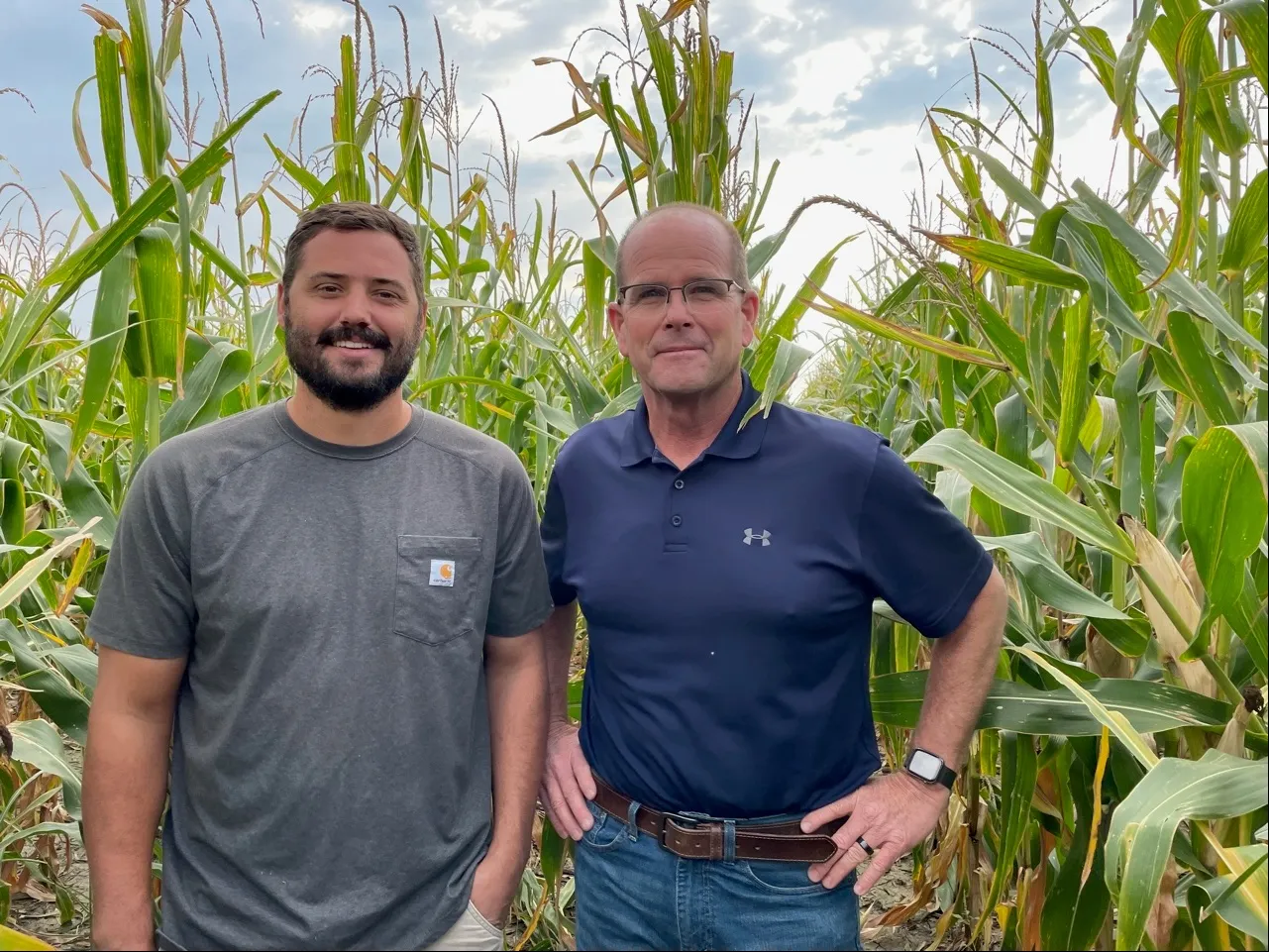
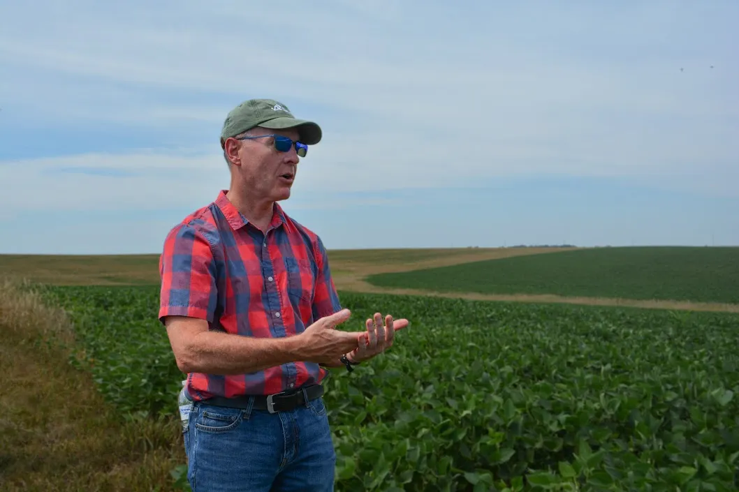
A NASA and U.S. Geological Survey (USGS)-supported research and development team, OpenET, is making it easier for farmers and ranchers to manage their water resources with the FARMS tool.| Landsat Science | A joint NASA/USGS Earth observation program.
From his South Dakota roots to leading NASA's agricultural program, Brad Doorn's mission has remained the same: help farmers feed the world.| Landsat Science | A joint NASA/USGS Earth observation program.
The USGS, in partnership with NASA, is calling for applications to staff the next Landsat Science Team to serve a 5-year term from 2025 to 2030.| Landsat Science | A joint NASA/USGS Earth observation program.
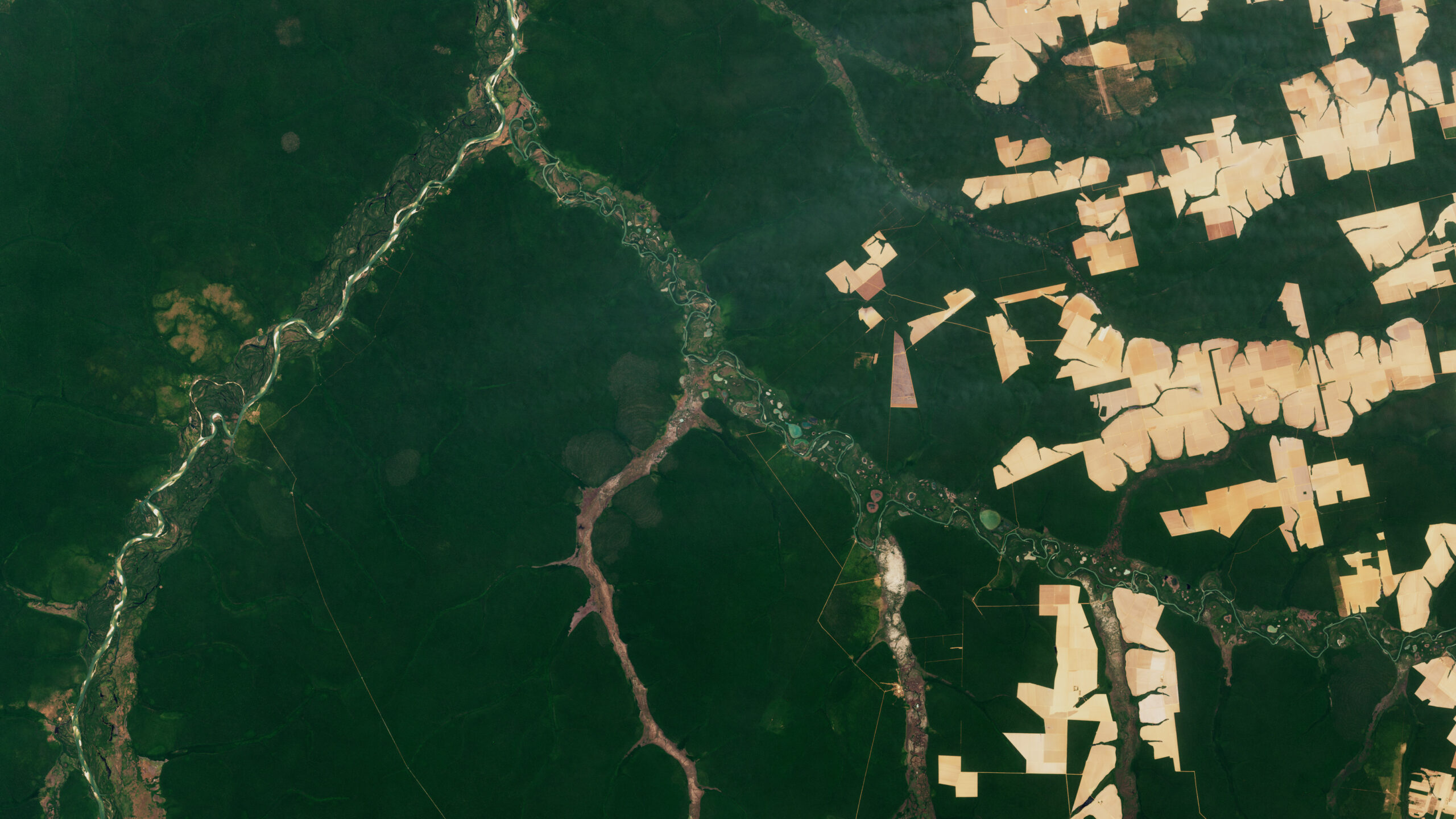
The Amazon is in trouble. Researchers found that, between 2000 and 2022, the Brazilian Amazon lost about 10% of its natural non-forest vegetation.| Landsat Science | A joint NASA/USGS Earth observation program.
In a study, researchers used GPS tracking data and satellite imagery to map elephant movement in northwestern Namibia, looking for corridors of connectivity.| Landsat Science | A joint NASA/USGS Earth observation program.
In Taiwan, earthquakes are linked to shallow stores of magma. New research explores this connection by linking land surface temperature with earthquakes.| Landsat Science | A joint NASA/USGS Earth observation program.
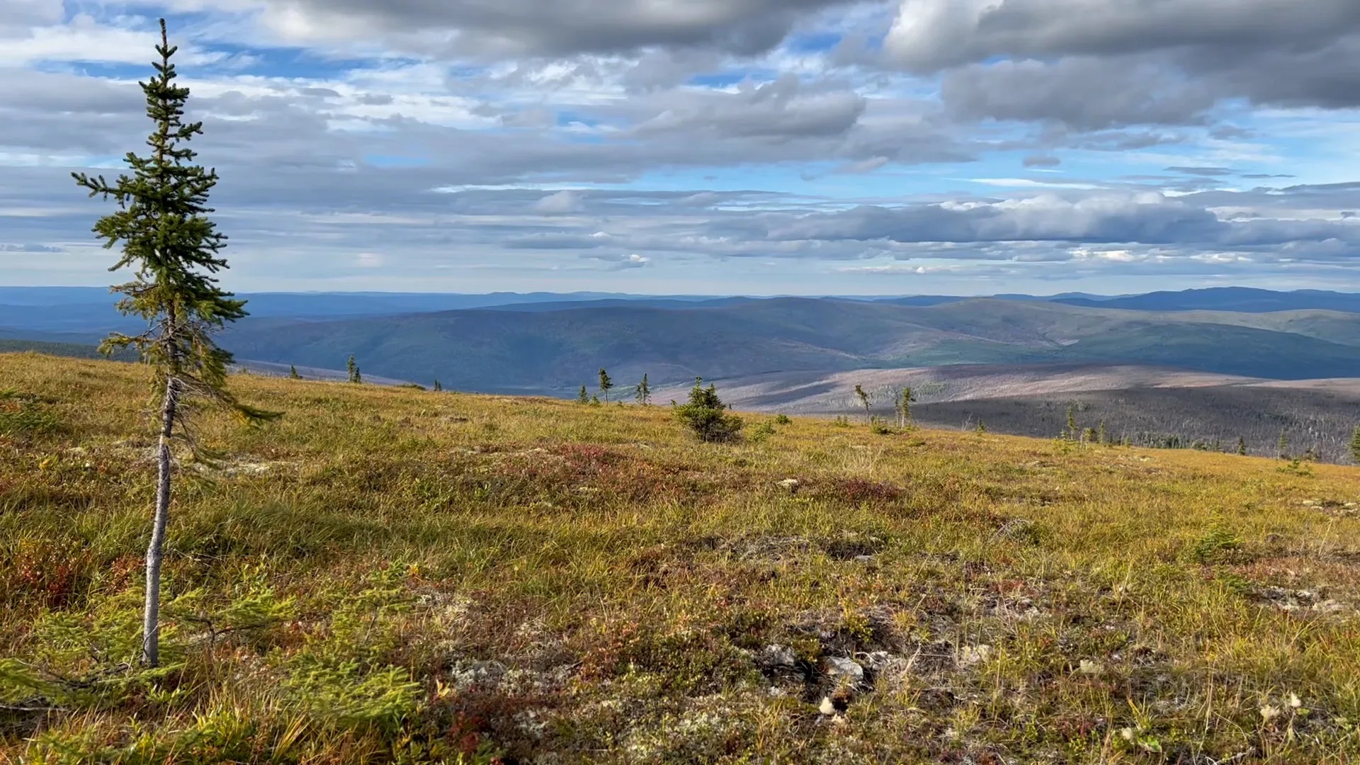
Warming global climate is changing the vegetation structure of forests in the far north. It’s a trend that will continue at least through the end of this century, according to NASA researchers.| Landsat Science | A joint NASA/USGS Earth observation program.
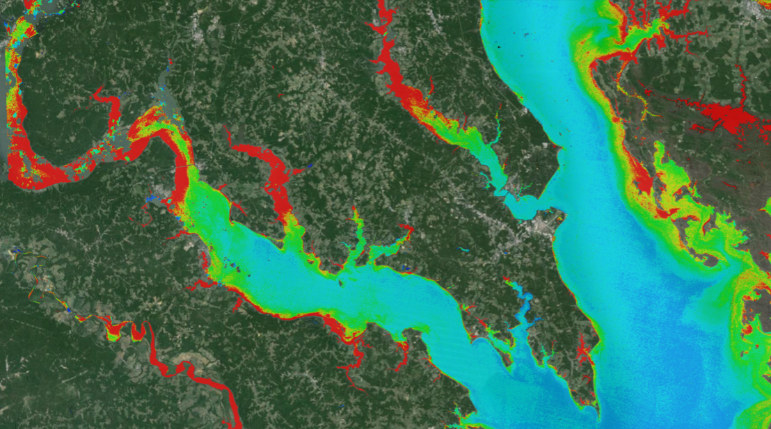
A combination of Landsat and Sentinel-2 imagery, NASA near real-time data, and machine learning provides near real-time access to high-resolution water quality maps.| Landsat Science | A joint NASA/USGS Earth observation program.
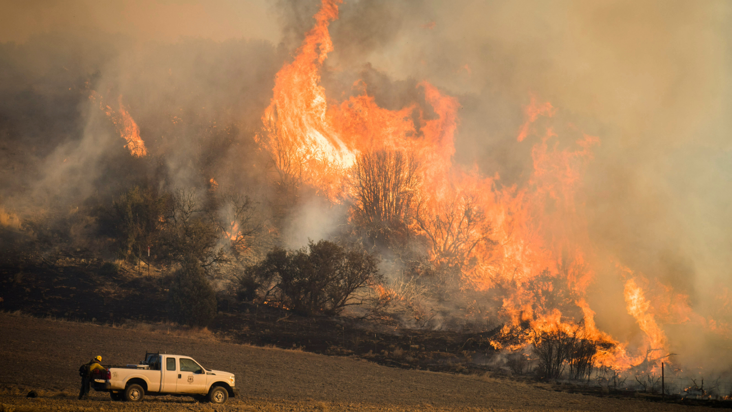
A new study using NASA satellite data reveals how drought affects the recovery of western ecosystems from fire, a result that could provide meaningful information for conservation efforts.| Landsat Science | A joint NASA/USGS Earth observation program.
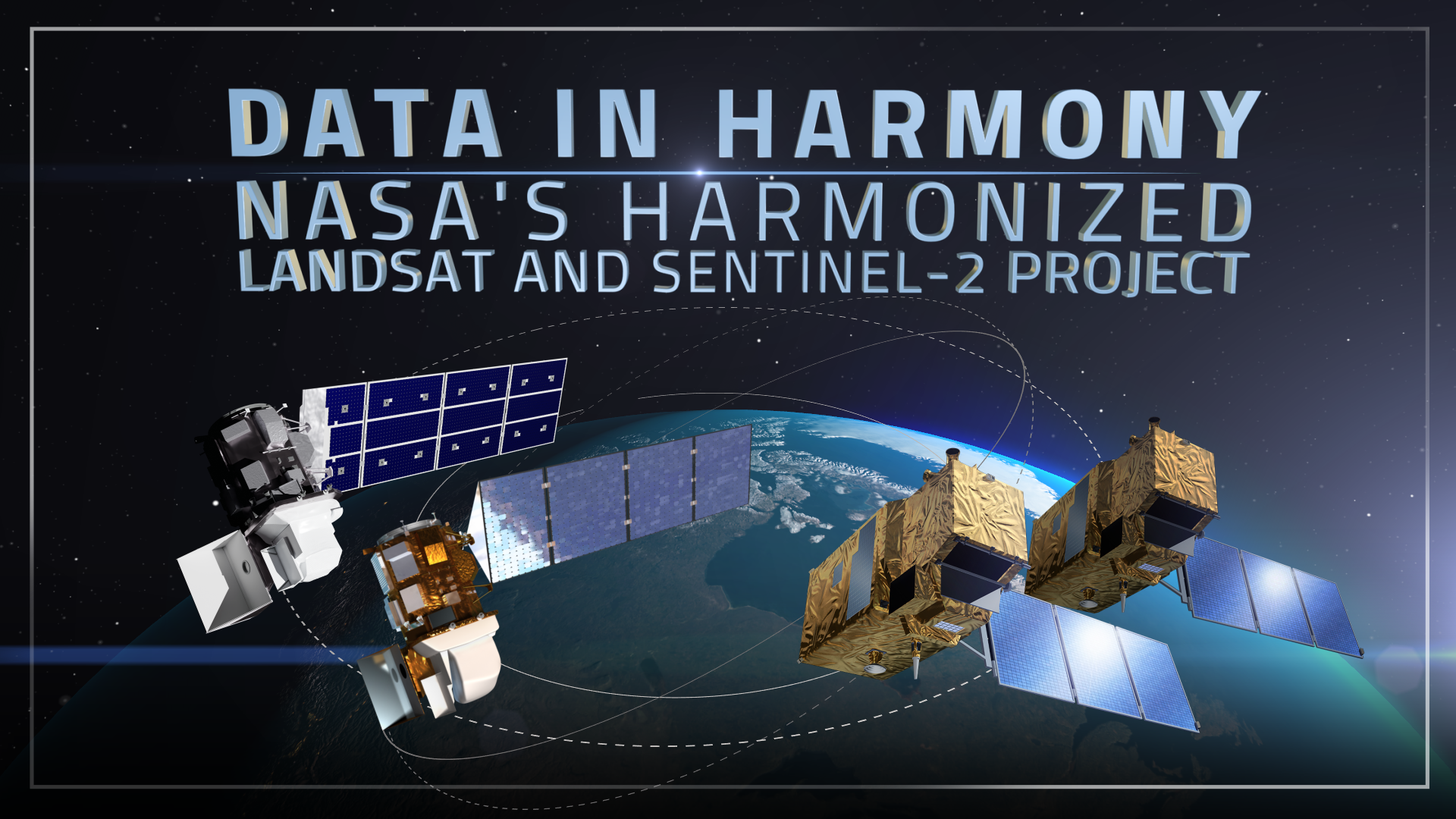
NASA's Harmonized Landsat and Sentinel-2 (HLS) project is a groundbreaking initiative that combines data from Landsats 8 & 9 with the European Space Agency's Sentinel-2A & 2B satellites.| Landsat Science | A joint NASA/USGS Earth observation program.
Landsat satellites have begun regularly acquiring images of ice at the poles during the winter, with enlightening results.| Landsat Science | A joint NASA/USGS Earth observation program.
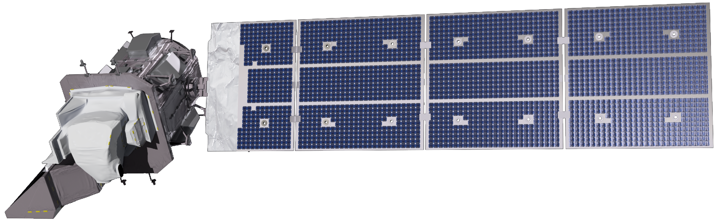
Landsat Next is on the horizon—the new mission will not only ensure continuity of the longest space-based record of Earth’s land surface, it will fundamentally transform the breadth and depth of actionable information freely available to end users. Take a look at the new capabilities that will define the next Landsat mission.| Landsat Science | A joint NASA/USGS Earth observation program.