Located in the high desert canyon country of western Colorado and eastern Utah, McInnis Canyons National Conservation Area consists of approximately 123,739 acres of BLM-administered land near Grand Junction, Colorado. Originally known as Colorado Canyons National Conservation Area, the NCA was established by Public Law 106–353 on October 24, 2000, and was renamed in honor of Representative Scott McInnis by Public Law 108–400 on January 1, 2005. Among its unique natural resources are...| Bureau of Land Management
ContactsDo you have questions about the Wild Horse and Burro Program, or would you like to request program data? We recommend first checking our data page, which provides decades of population, adoption, removal and other historical data, as well as our Frequently Asked Questions page. For additional questions or data requests, please contact the National Information Center prior to submitting a request under the Freedom of Information Act. We strive to provide substantive responses as quick...| Bureau of Land Management
Update February 2025: Currently there is no water available at the campgrounds. Please refer back to this page or contact the Taos Field Office for further updates. The Wild Rivers Recreation Area is located within the Rio Grande del Norte National Monument and along the Rio Grande Wild and Scenic River and Red River Wild and Scenic River. Here visitors may experience the beauty of an 800-foot deep canyon sliced into volcanic flows by the Rio Grande (Spanish for Big River) and Red River where...| Bureau of Land Management
The Orilla Verde Recreation Area is located within the Río Grande Del Norte National Monument and along the Río Grande Wild and Scenic River. Nestled along the banks of the Río Grande and within the steep-walled Río Grande Gorge, the campgrounds in this area offer nearby access to the river. The elevation along the river is 6,100 feet and the steep canyon rises more than 600 feet from the river to the Gorge rim. Gentle waters with occasional small rapids flow through Orilla Verde, provi...| Bureau of Land Management
The Adoption Incentive Program has been discontinued as of March 3, 2025. In accordance with a court order, the BLM will not make any adoption incentive payments for animals titled after March 3, 2025.| Bureau of Land Management
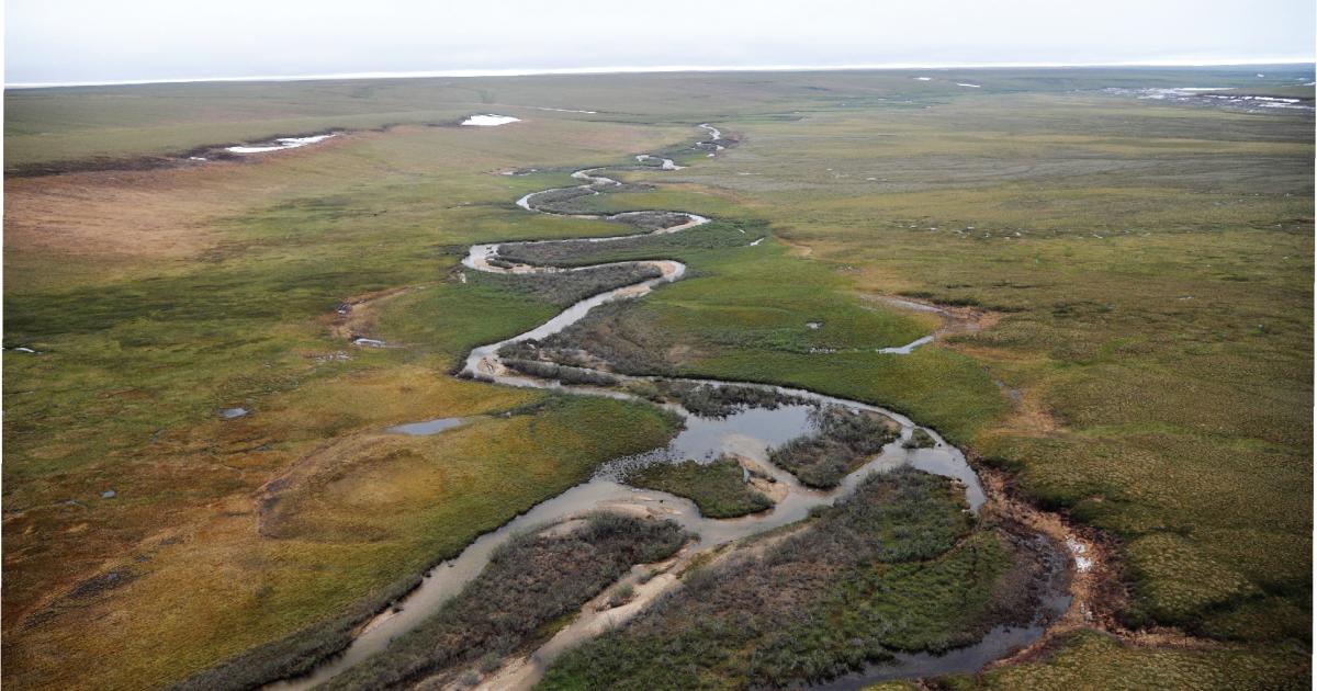
Today the Bureau of Land Management (BLM) issued a Record of Decision (ROD) for the Coastal Plain Oil and Gas Leasing Program Supplemental Environmental Impact Statement (SEIS).| Bureau of Land Management
Program DataThe Bureau of Land Management manages, protects, and controls wild horses and burros under the authority of the 1971 Wild Free-Roaming Horses and Burros Act (as amended by Congress in 1976, 1978, 1996, and 2004). This law authorizes the BLM to remove excess wild horses and burros from the range to sustain the health and productivity of the public lands. The BLM also manages the nation’s public lands for multiple uses, in accordance with the 1976 Federal Land Policy and Managemen...| Bureau of Land Management
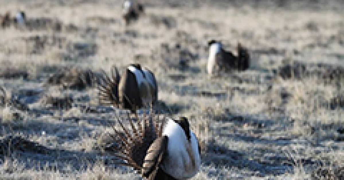
WASHINGTON – The Bureau of Land Management (BLM) is announcing a draft plan to strengthen greater sage-grouse conservation and management on public lands, informed by the best-available science and input from local, state, federal, and Tribal partners. The draft plan is built on decades of partnership, research, and on-the-ground knowledge and experience in maintaining, protecting and restoring healthy sagebrush habitats. Greater sage-grouse rely on sagebrush lands for all aspects of thei...| Bureau of Land Management
January 27, 2024 update: The Bureau of Land Management and Cochiti Pueblo today announced the Kasha-Katuwe Tent Rocks National Monument will reopen on Saturday, Feb. 1, 2025. The Monument was temporarily closed for a seasonal closure from Dec. 15, 2024, through Jan. 31, 2025. Starting January 30, visitors are welcome to begin making reservations through Recreation.gov for their future visits. For more detailed information please go to the Kasha-Katuwe Tent Rocks National Monument page. The Ka...| Bureau of Land Management
The remote 280,000-acre Vermilion Cliffs National Monument is a geologic treasure with some of the most spectacular trails and views in the world.| Bureau of Land Management
The Corona Arch Trail was designated as a National Recreation Trail on May 30, 2018. The trail is a moderately strenuous 3 mile round trip hike to the spectacular Corona Arch. There are a few sections of the trail with mild exposure to heights however, these sections include cables and ladders to assist you. From the parking lot on the north side of the highway follow the trail up to the visitor register box near the railroad; please register. Cross the railroad track and follow an old roadbe...| Bureau of Land Management
BLM-managed lands offer numerous opportunities for camping under the stars ranging from staying in an RV at a highly developed campground to simply throwing a sleeping bag on the ground in the backcountry. No matter what type of experience you are looking for, you can find it on BLM-managed public lands.| www.blm.gov
The Bureau of Land Management's mission is to sustain the health, diversity, and productivity of public lands for the use and enjoyment of present and future generations.| Bureau of Land Management