Oriented Imagery, Integrated into ArcGIS
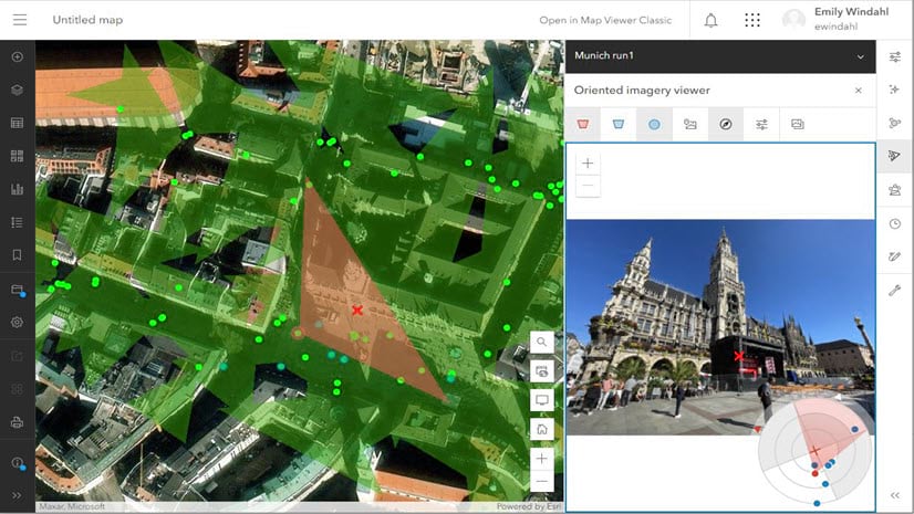
Oriented imagery, used to manage and visualize all kinds of imagery as part of your GIS, is being integrated into ArcGIS.| ArcGIS Blog
Oriented imagery, used to manage and visualize all kinds of imagery as part of your GIS, is being integrated into ArcGIS.| ArcGIS Blog
ArcGIS Pro is a powerful desktop GIS software with innovative tools for managing spatial data, performing advanced mapping analytics, and creating stunning visualizations.| www.esri.com

ArcGIS is a comprehensive geospatial platform. Explore the applications and capabilities of the world’s leading geographic information system (GIS) software technology for business and government.| www.esri.com

By Charlie Frye, Esri Chief Cartographer Text and imagery have had an uneasy relationship since the day they met. Satellite imagery an...| ArcGIS Blog
Find the definition of GIS. Learn how this mapping and analysis technology is crucial for making sense of data. Learn from examples and find out why GIS is more important than ever.| www.esri.com

Esri’s GIS software is the most powerful mapping & spatial analytics technology available. Learn about Esri’s geospatial mapping software for business and government.| www.esri.com
