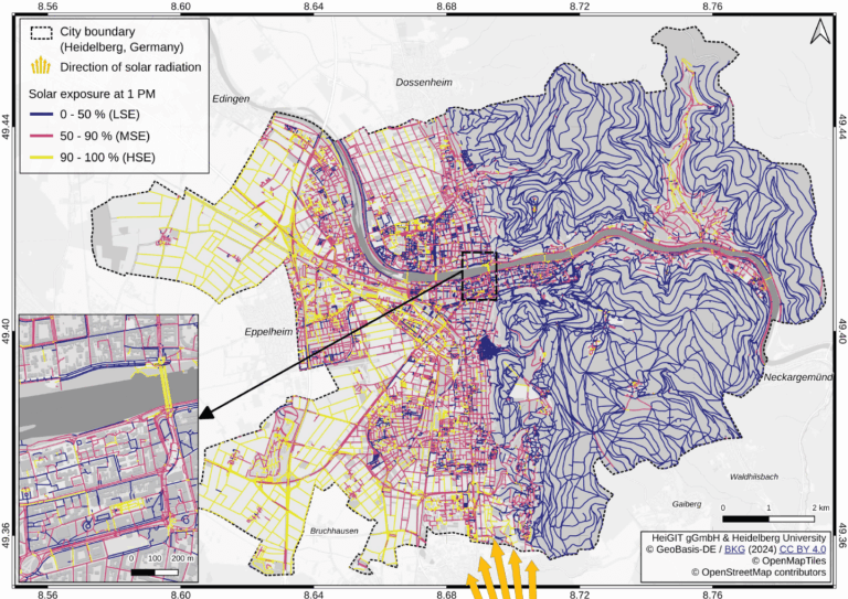
Using Heidelberg as a case study, researchers modeled time-dependent solar exposure for the entire pedestrian network by combining high-resolution DEM/DSM building and vegetation data with OpenStreetMap road data.| HeiGIT
As summer temperatures soar, being outdoors poses rising health risks, especially in urban areas and for vulnerable groups like the elderly, children, and citizen with pre-existing conditions. The HEAL project launched a routing app to help citizens avoid heat stress, supporting climate adaptation and public health during hot weather periods. Initially developed for Heidelberg, the […]| HeiGIT
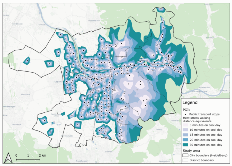
This study introduces the isocalor approach to assess how solar exposure and heat stress impact pedestrian access to essential services in Heidelberg, using OpenStreetMap data and a customized openrouteservice routing engine.| HeiGIT
Before coming to Heidelberg he led the Chair of Cartography at Bonn University and earlier was Professor for Applied Computer Science and Geoinformatics at the University of Applied Sciences in Mainz, Germany. He has a background in Mathematics and Geography from Heidelberg University and finished his PHD at the European Media Laboratory EML in Heidelberg where he was the first PhD student. There he also conducted further research as a PostDoc for 3 years.| HeiGIT
Students of the Institute of Geography at Heidelberg University explored local perceptions of urban heat in Heidelberg’s old town as part of a 2024 seminar on GIS for Disaster Risk Reduction and Humanitarian Aid. The project, supported by Heidelberg Institute for Geoinformation Technology (HeiGIT), tested participatory mapping using the Sketch Map Tool combined with KoboToolbox.| HeiGIT