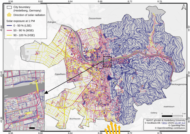
Using Heidelberg as a case study, researchers modeled time-dependent solar exposure for the entire pedestrian network by combining high-resolution DEM/DSM building and vegetation data with OpenStreetMap road data.| HeiGIT
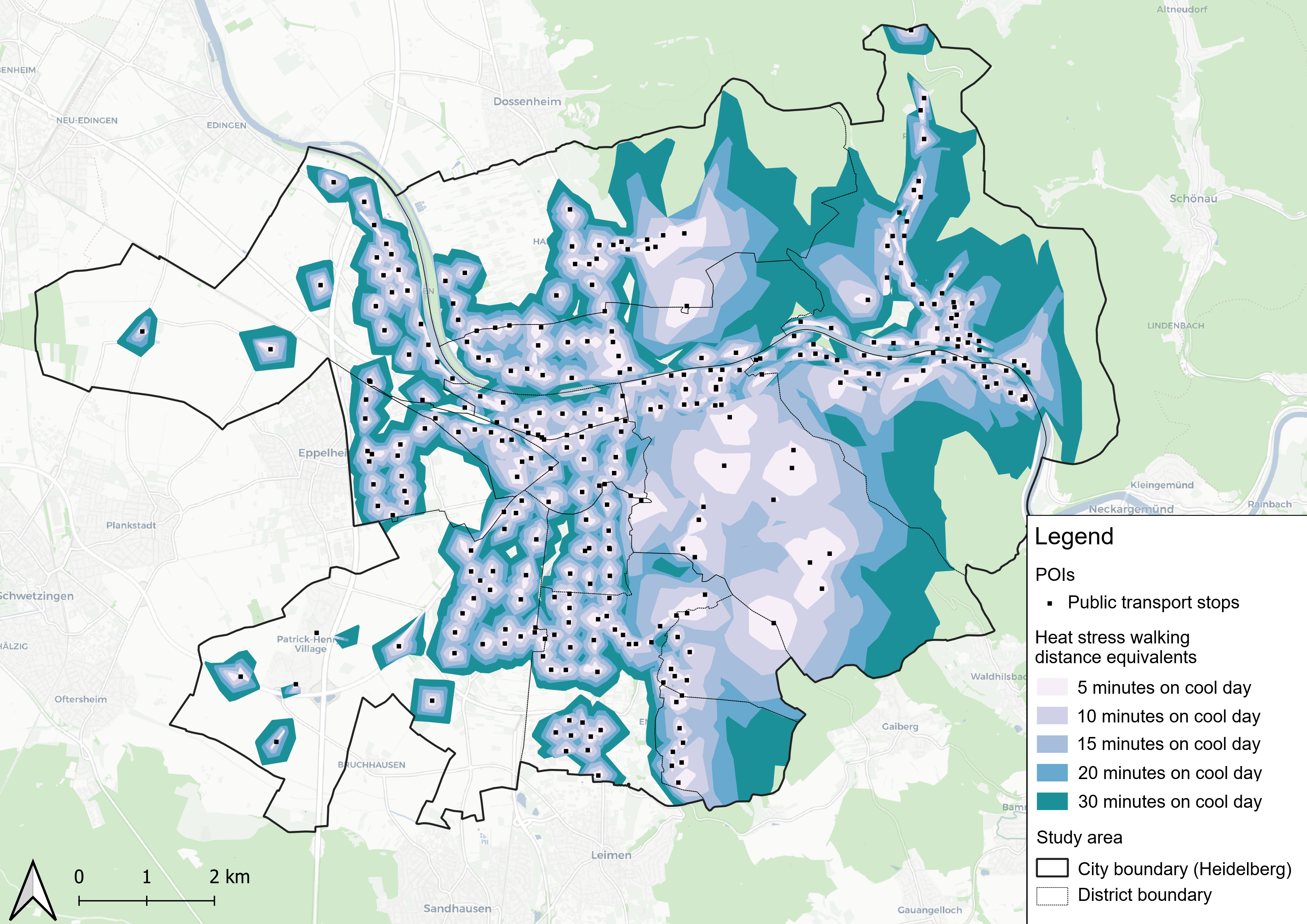
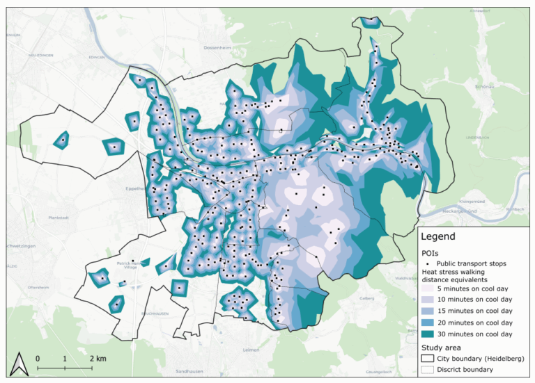
This study introduces the isocalor approach to assess how solar exposure and heat stress impact pedestrian access to essential services in Heidelberg, using OpenStreetMap data and a customized openrouteservice routing engine.| GIScience Blog
Students of the Institute of Geography at Heidelberg University explored local perceptions of urban heat in Heidelberg’s old town as part of a 2024 seminar on GIS for Disaster Risk Reduction and Humanitarian Aid. The project, supported by Heidelberg Institute for Geoinformation Technology (HeiGIT), tested participatory mapping using the Sketch Map Tool combined with KoboToolbox. | GIScience Blog
This study introduces the isocalor approach to assess how solar exposure and heat stress impact pedestrian access to essential services in Heidelberg, using OpenStreetMap data and a customized openrouteservice routing engine.| HeiGIT
Students of the Institute of Geography at Heidelberg University explored local perceptions of urban heat in Heidelberg’s old town as part of a 2024 seminar on GIS for Disaster Risk Reduction and Humanitarian Aid. The project, supported by Heidelberg Institute for Geoinformation Technology (HeiGIT), tested participatory mapping using the Sketch Map Tool combined with KoboToolbox.| HeiGIT