The Sketch Map Tool was used in Cartagena, Chile, to collect geographic information for effective disaster risk reduction. It is an easy-to-use tool for participatory sketch mapping through offline collection, digitization and georeferencing of local spatial knowledge. The group mapping activity allows to identify issues associated with the risks that most concern and interests the […]| HeiGIT
Volunteered Geographic Information (VGI) is a valuable resource for an effective disaster management. This article presents five free tools to enhance humanitarian work using VGI. What is VGI and why it matters for disaster management Volunteered Geographic Information (VGI) refers to user-generated geographic content contributed voluntarily by the public. It represents a form of crowdsourcing […]| HeiGIT
In June 2024, researchers from the Urban Big Data Centre (UBDC) and HeiGIT (Heidelberg Institute for Geoinformation Technology) carried out a joint field trip to Colombia to strengthen participatory mapping collaborations. The visit included workshops, partner meetings, and field activities with communities, universities, and government institutions, with a focus on the use and development of […]| HeiGIT
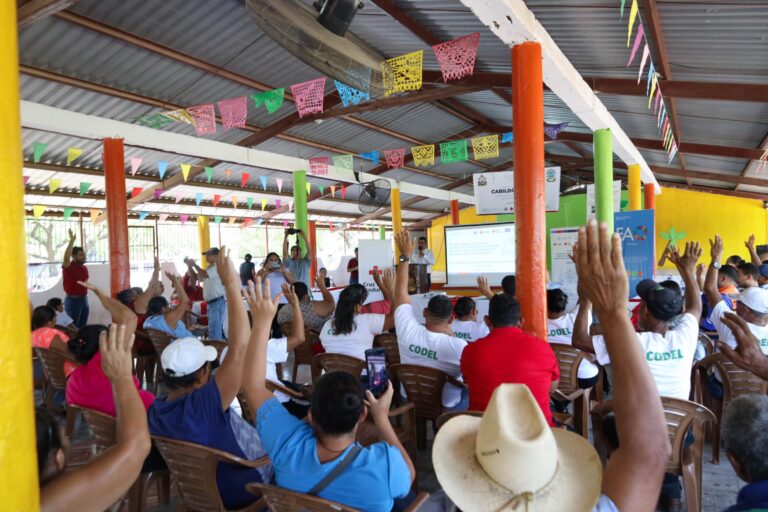
The Sketch Map Tool was used in a joint effort between the Honduran Red Cross and the municipal government to update the municipal response plan and develop an annex focused on anticipatory actions. Participants were asked to map local knowledge about areas affected by flooding and critical infrastructure.| GIScience Blog
Students of the Institute of Geography at Heidelberg University explored local perceptions of urban heat in Heidelberg’s old town as part of a 2024 seminar on GIS for Disaster Risk Reduction and Humanitarian Aid. The project, supported by Heidelberg Institute for Geoinformation Technology (HeiGIT), tested participatory mapping using the Sketch Map Tool combined with KoboToolbox. | GIScience Blog
Students of the Institute of Geography at Heidelberg University explored local perceptions of urban heat in Heidelberg’s old town as part of a 2024 seminar on GIS for Disaster Risk Reduction and Humanitarian Aid. The project, supported by Heidelberg Institute for Geoinformation Technology (HeiGIT), tested participatory mapping using the Sketch Map Tool combined with KoboToolbox.| HeiGIT
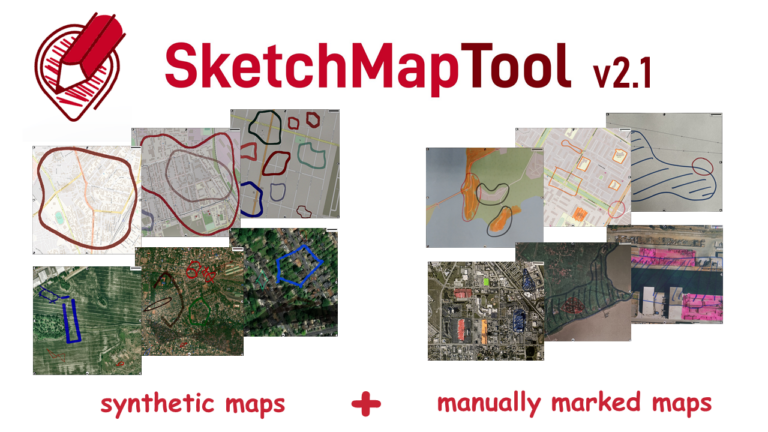
The newly released Sketch Map Tool v2.1 features a higher accuracy in digitizing hand-sketched markings on Sketch Maps, thanks to a larger training dataset and an updated machine learning model for sketch detection. New user metrics show that thousands of Sketch Maps are created every month all over the world.| GIScience Blog