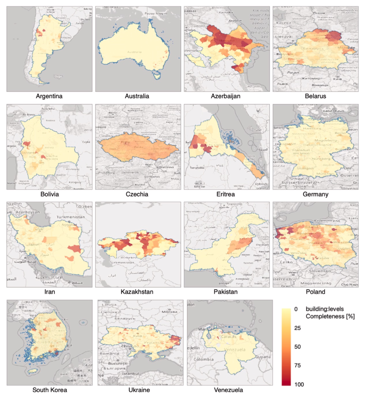
Geospatial data of the building stock is essential in many domains pertaining to the built environment. These datasets are often provided by governments, but crowdsourcing them has surged in the last decade. Nowadays, OpenStreetMap (OSM) — the most popular Volunteered Geographic Information (VGI) platform — contains geospatial and descriptive data on more than 500 million buildings worldwide collected by millions of contributors, and it is increasingly used in studies ranging from energy ...