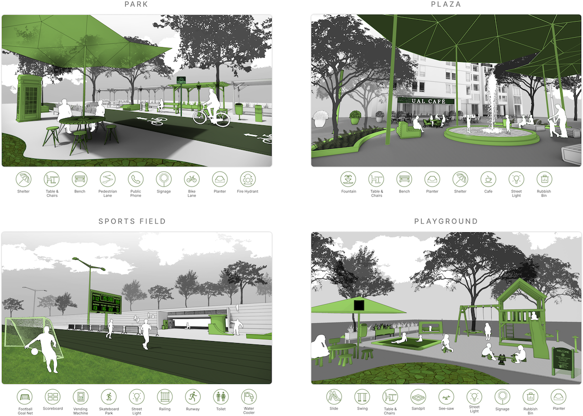
Public open space (POS) is essential to urban areas. Assessing them usually requires tedious approaches such as fieldwork and manual processes. Street View Imagery (SVI) and Computer Vision (CV) have been adopted in some urban environment research, bringing fine granularity and human perspective. However, limited aspects have been subject in these studies, and SVI and CV have not been used for holistic POS assessment. This research introduces a novel approach of employing them in conjunction ...