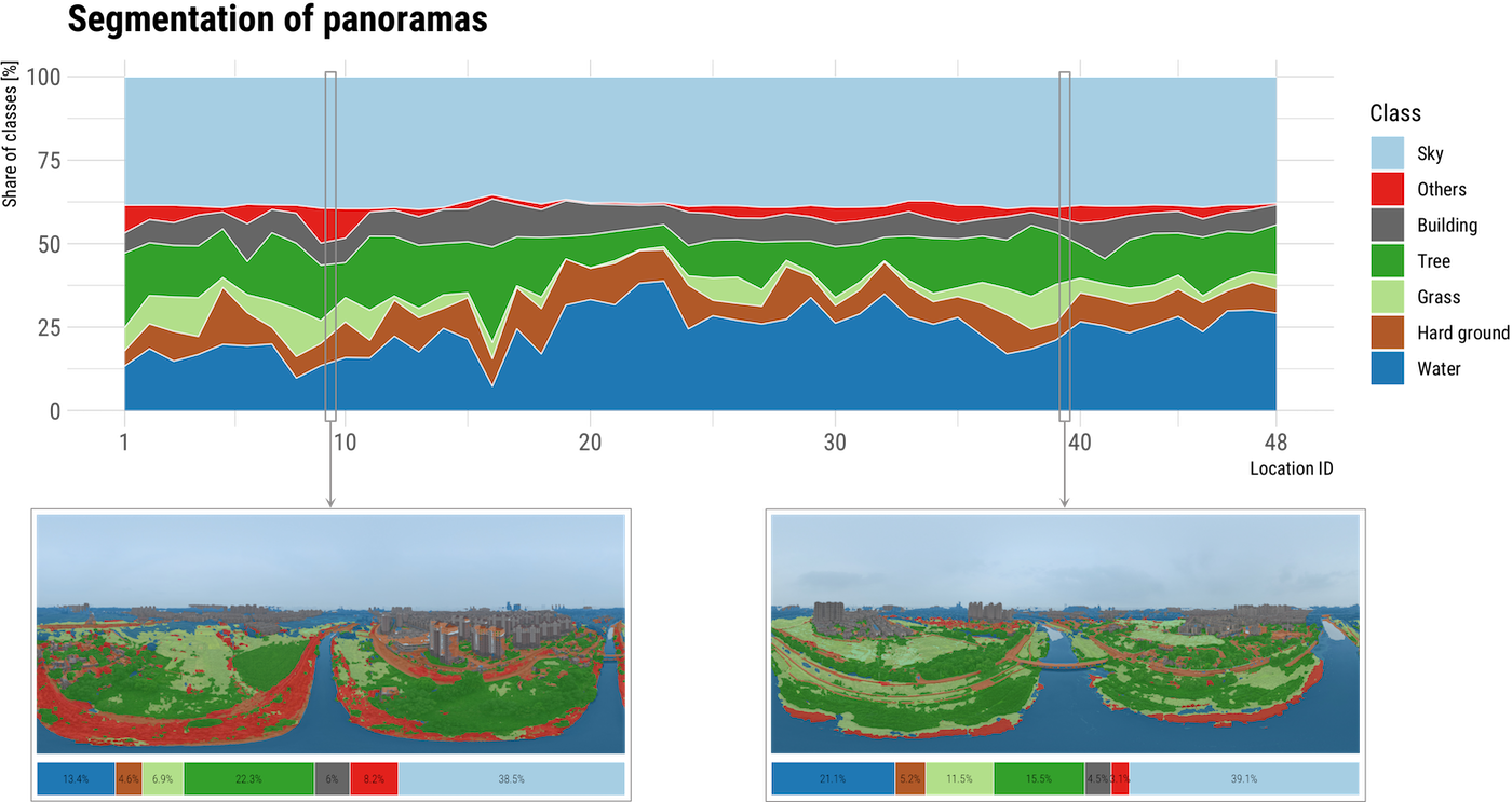
Traditional approaches for visual perception and evaluation of river landscapes adopt on-site surveys or assessments through photographs. The former is expensive, hindering large-scale analyses, and it is conducted only on street-level or top-down imagery. The latter only reflects the subjective perception and also entails a laborious process. Addressing these challenges, this study proposes an alternative: a novel workflow for visual analysis of urban river landscapes by combining unmanned a...