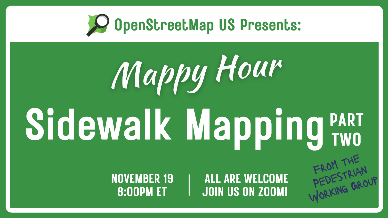
Back by popular demand, the OSM US Pedestrian Working Group will be leading another sidewalk-focused Mappy Hour on November 19th, 2025 at 8:00pm EST! Join us for a continuation of the discussions and mapping...| openstreetmap.us
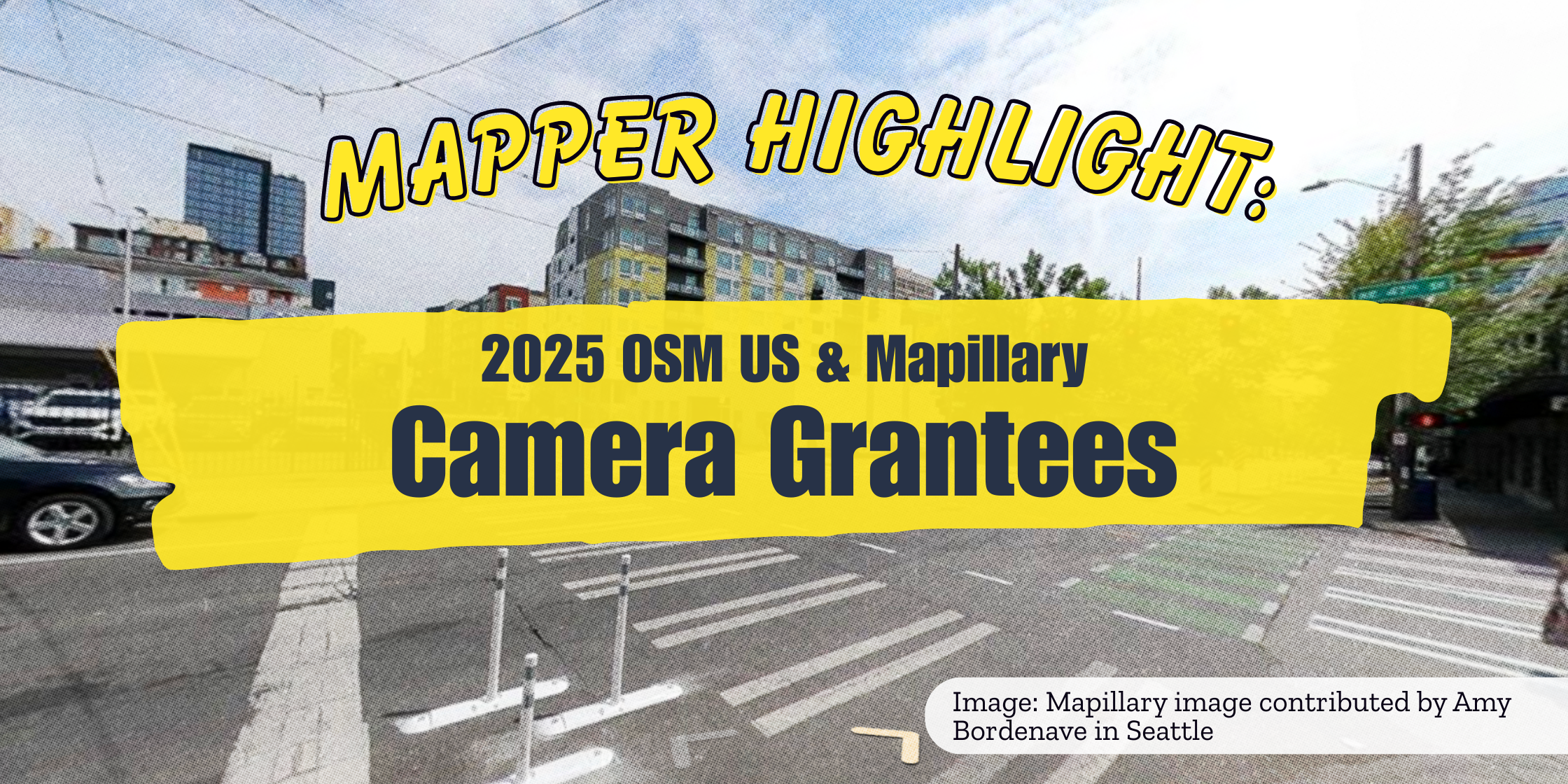
Since the launch of the OSM US & Mapillary Camera Grant Program in April of this year, 21 grantees have uploaded over 3 million images to Mapillary, and grant packages have been shipped to New Jersey, Oh...| openstreetmap.us
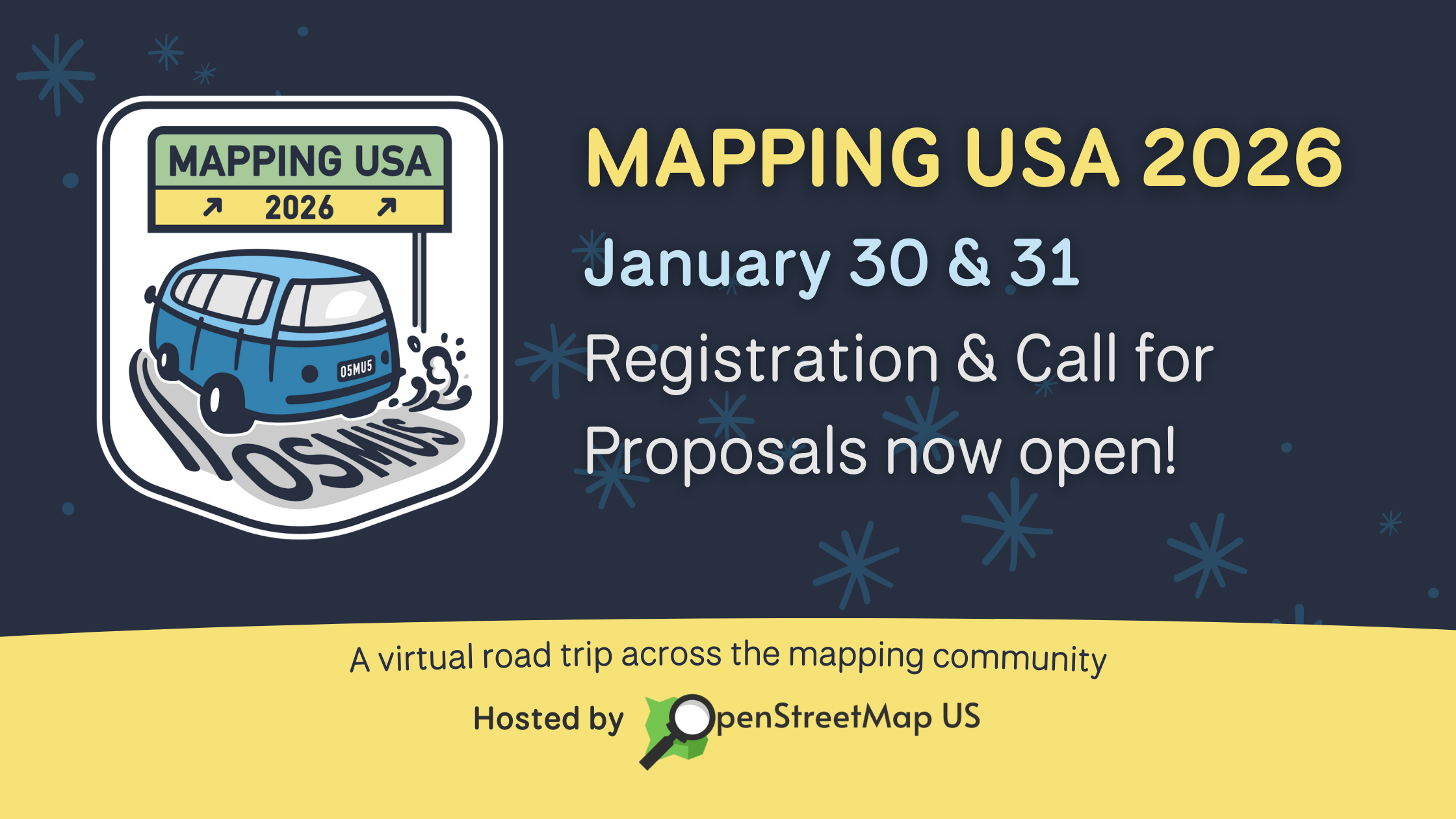
January 30th & 31st, 2026Hop in the virtual Mapmobile, it’s time for Mapping USA 2026! Every year, Mapping USA gathers hundreds of OpenStreetMap contributors, data users, and enthusiasts online for two d...| openstreetmap.us
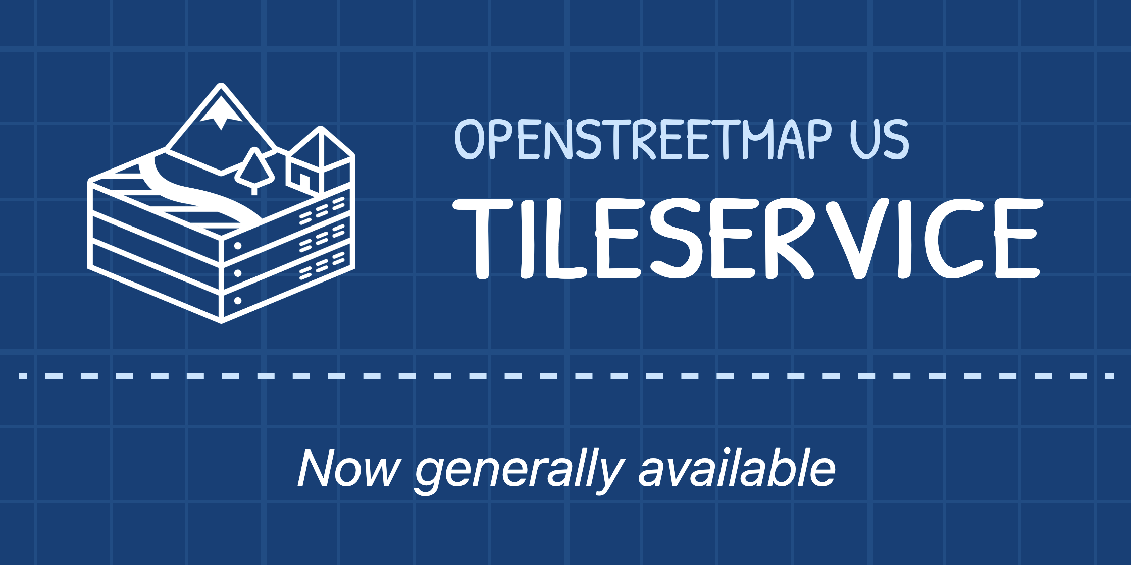
OpenStreetMap US is excited to announce the general availability of the OpenStreetMap US Tileservice: a free web service which provides vector map tiles and related resources to help people create maps that ...| openstreetmap.us
Join the Pedestrian Working Group for a Mappy Hour on Wednesday, July 30th from 8 - 9 pm ET. Contribute to a sidewalk mapping project in OpenStreetMap with guidance from Working Group members, and learn all about the schema for pedestrian infrastructure mapping that the group has been developing for over a year. Mappers of all experience levels are welcome, whether you know the difference between kerb=flush and kerb=lowered or you’ve never mapped a sidewalk before.| OpenStreetMap US All Posts
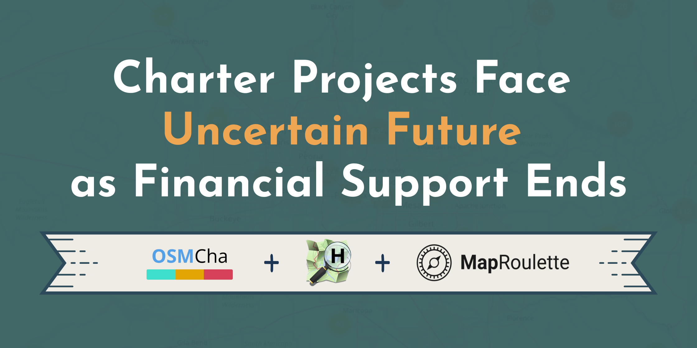
Many of the best OpenStreetMap tools emerge organically as personal projects built by members of the global community. Informal structures can be great for getting a project off the ground, but at some point...| openstreetmap.us
Join OpenStreetMap US for a Mappy Hour on Wednesday, September 17th with special guest: Jason Boone! Boone creates map animation tools and tutorials on his YouTube channel, BooneLovesVideo. He has worked as a freelance motion designer for clients such as The Wall Street Journal, Veritasium, and Johnny Harris. In this Mappy Hour Boone will walk you through his process of creating map animations using OpenStreetMap data with Adobe After Effects and Geolayers, with time for audience questions af...| OpenStreetMap US All Posts
OpenStreetMap US is excited to partner with Mapillary to launch a US version of their popular global challenge: CompleteTheMap. This initiative rewards new and returning Mapillary contributors for their efforts collecting street-level imagery with exciting prizes. More crowdsourced street-level imagery means more accurate, detailed, and up-to-date reference photos for OpenStreetMap contributors! How it works Interested participants can join CompleteTheMap by filling out this application form....| OpenStreetMap US All Posts
The OpenStreetMap US team welcomes our latest organizational member, the American Geographical Society (AGS). “AGS convenes a diverse global community of innovators, thinkers, and practitioners to create and curate geographical knowledge, and advance geographic science and technologies to address society’s challenges and opportunities… Most notably AGS’s commitment to our fall symposium Geography 2050 and our TeenMaptivists Initiative are great examples of our work.” “AGS utilizes...| OpenStreetMap US All Posts
At State of the Map US 2025 this past June, the OSM US team had the chance to hear from maintainers of popular and emerging tools in the OSM ecosystem who expressed interest in additional opportunities to co...| openstreetmap.us
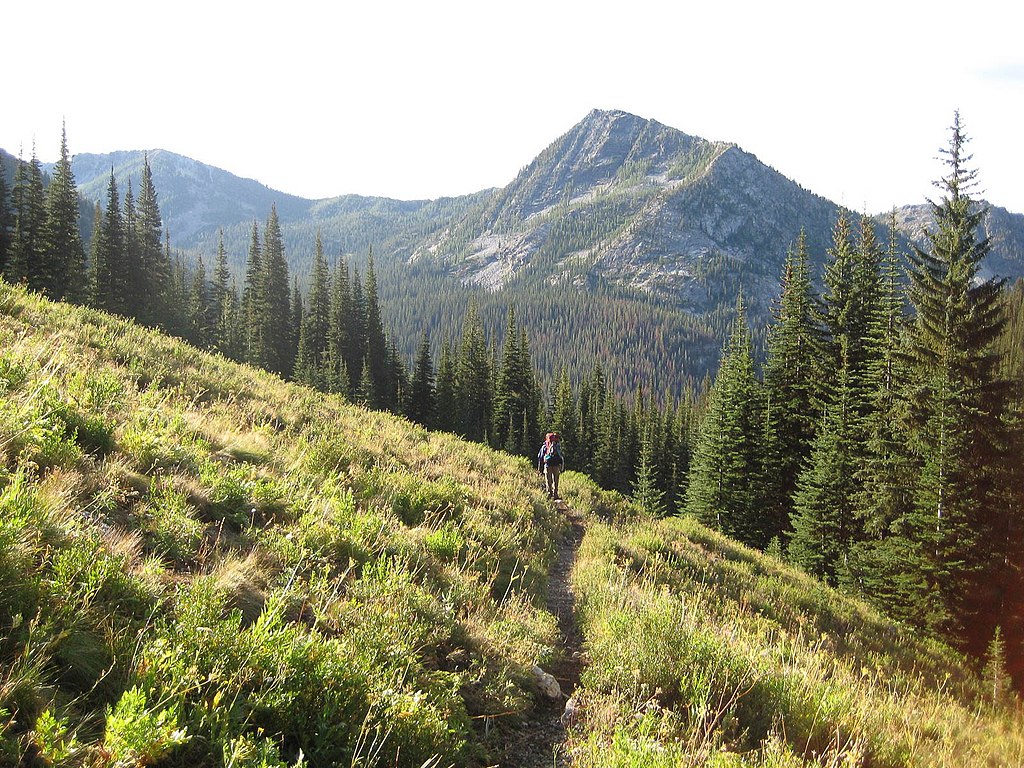
Jake is a software developer and mapmaker based in Seattle, Washington. He currently works at OpenStreetMap US, supporting MapRoulette, OSMCha, and other community tools. In his spare time he enjoys hiking a...| openstreetmap.us
The OpenStreetMap US team is thrilled to announce our latest organizational member, TomTom. In 2019, TomTom attended and sponsored its first State of the Map US in Minneapolis, and has been a growing part of the OSM US community and a SOTMUS sponsor ever since. Organizational membership demonstrates TomTom’s commitment to the OSM ecosystem and supports projects that companies like TomTom rely on, including OSMCha, MapRoulette and the OSM US Tasking Manager. Shaundrea Kenyon, Director of Com...| OpenStreetMap US All Posts
The OpenStreetMap US team proudly announces the OSM US Advisory Council, designed to complement the Board of Directors and help shape the organization’s long-term strategy and sustainability. The Advisory Council convenes to offer advice, support fundraising efforts, and supplement the organization’s core knowledge on important issues related to finance, law, politics, geospatial technology, and engagement. This group differs from the Board in that the Council has no official decision-mak...| OpenStreetMap US All Posts
For 10 years, Kaart has captured street level imagery in more than 65 countries around the world and contributed them to the OSM community. Join us as we take a stroll through memory lane and share some of the more interesting locations and events that have been observed.| OpenStreetMap US All Posts
In this lightning talk we will give a quick overview of updates across a few projects we are involved with: OpenHistoricalMap, OSMCha, OSM for Cities, Gradient, and OSM Teams. We will talk about contributions and new features we’ve made during the year and our roadmap for the future.| OpenStreetMap US All Posts
Just about every colonial New England town had one of these stone wall enclosures for containing livestock which had strayed from their owner’s land and were causing problems on other people’s property. The sheep, cattle, or other animals would be held in the pound until the owner could collect them and pay a fee. Many are still standing today, in varying states of repair, as historic reminders of these towns’ agricultural past. Hear about my efforts to find and “armchair map” these...| OpenStreetMap US All Posts
This session explores the effort to map all 398 bus stops on the 16 FXBGO! local routes in Fredericksburg, Stafford, and Spotsylvania, Virginia. By surveying each stop, capturing images for Wikimedia Commons, and updating OpenStreetMap, this project aims to improve public transit accessibility for locals and tourists in a historically significant area. Learn how community-driven mapping can enhance transportation equity and navigation!| OpenStreetMap US All Posts
How do you determine the best route from point A to point B? In this talk, we will explore the core components of Lyft’s routing algorithm, highlighting how it integrates with OpenStreetMap (OSM) to provide high-quality routes for the ride-share use-case. We will discuss some of the machine learning components we’ve built to leverage OSM data as well as the continuous feedback loop we’ve created to enhance OSM data accuracy based on driver behavior and improve our routing algorithm.| OpenStreetMap US All Posts
UDef-ARP is an open-source Python tool designed to facilitate the Verra VT0007 Unplanned Deforestation Allocation. It is also implemented in TerrSet, QGIS, and ArcGIS.| OpenStreetMap US All Posts
VirtuGhan is a Virtual Computation Cube designed for efficient on-the-fly tile computation of Earth Observation Data, similar to Google Earth Engine but utilizing open-source tools. It enables tiles based calculations on satellite images at various zoom levels using COGs, rio-tiler. The project prioritizes efficient computation over storage, allowing direct analysis of images without needing to store the entire dataset. Read more : https://github.com/kshitijrajsharma/VirtuGhan/| OpenStreetMap US All Posts
Join us for an in-depth look at how Machine Learning (ML) models can be used to detect missing footway data in OSM. By finding missing marked crosswalks using ML, we can help point mappers to coverage gaps. We will discuss our technical approach as well as how we want to partner with local communities. We will also cover a unique approach to mapping these missing footways using the Rapid editor’s new Map Roulette integration.| OpenStreetMap US All Posts
This session explores inCitu’s work bringing augmented reality to architecture and planning engagement, AR integrations to map data, and how AR can be a new, accessible interface for creating 3D geospatial data from a first person perspective. We’ll show how to put 3D buildings on the map with AR, and even generate 3D map data from low-fi paper models with photogrammetry.| OpenStreetMap US All Posts
This session will overview how Clark CGA researchers are leveraging geospatial analytics and satellite imagery to monitor and visualize land change transitions as they relate to coastal habitats and aquaculture development across the top producing nations in the world. Discussion will include how maps are made, utilized for understanding land change dynamics, and what implications/policies this work helps to support| OpenStreetMap US All Posts
Despite heroic efforts by mapping communities on HOT’s Tasking Manager, many parts of the world are still unmapped. Often the data does not reflect the reality on the ground, particularly when it comes to OSM tags. Field-TM aims to help validating existing data with field verified information, and to add additional tags based on the situation on the ground. The goal is not to re-invent the wheel, but to leverage existing tech and coordinate the mapping amongst teams.| OpenStreetMap US All Posts
Train travel is often considered an environmentally-friendly alternative to other transit modes; however, the United States rail network is primarily served by diesel locomotives. Amtrak is currently rolling out newer locomotives that drastically reduce pollutant (nitrogen oxide, particulate matter) emissions. In this work, we use OSM rail shapefiles and speed limit attributes to investigate the impact of these upgraded locomotives on regional air quality in the United States.| OpenStreetMap US All Posts
My session will review my personal method for correcting TIGER roads. My process is idiosyncratic, but I find that though I do not follow the common method, it results in more accurate streets that are easier to comprehend than moving around the nodes on the street. I will be going over the pros and cons of this method. You may remember me from my talk “The Teenage Mapper” last year.| OpenStreetMap US All Posts
Stamen’s Map Stack was a platform created in 2013 for customizing existing basemaps by stacking, blending, and compositing raster tiles. This unique experience enabled quick, user-friendly map prototyping and endless creative expression by users on the web. A decade later, we are now retiring the service and spending some time visualizing the massive database of maps from the tool’s archives. This presentation will showcase some of the creativity enabled by Map Stack over its ten-year run.| OpenStreetMap US All Posts
MapSwipe is a mobile and web app that enables crowdsourced data collection for OpenStreetMap (OSM). Today, MapSwipe helps prioritize mapping efforts by identifying areas needing updates. This talk will explore future possibilities for exploring expanding its role, including potentially allowing direct edits to OSM and strengthening ties with the OSM community for more seamless contributions. Feedback on these ideas is welcome!| OpenStreetMap US All Posts
Join us to explore what it takes to map pedestrian infrastructure across Washington (~180,000 km²)! We’ll dive into the technical stack that enables scalable mapping and how human+AI techniques accelerates the process while ensuring data quality. Learn how we developed a first-of-its-kind open, uniform pedestrian network dataset—pioneered by the Taskar Center for Accessible Technology, in collaboration with Gaussian Solutions LLC, and sponsored by the Washington State Legislature.| OpenStreetMap US All Posts
Mapping POIs accurately can be challenging at scale especially to include entrances. Often POIs in OSM aren’t aligned well to buildings or other features. Using smartphones and increasingly smart glasses it is possible for mappers to contribute their geographic pose (view) for a POI. These poses can be used to confirm or improve the location of POIs. To demonstrate the approach we’ll demo a mobile app that uses captured poses to improve the location of POI in a simple point and tap interf...| OpenStreetMap US All Posts
At SOTMUS: SLC, I told the story of how I became the owner of the oldest map store in New England. I discussed challenges of small business ownership, insights into how the public uses and perceives maps and how to support contemporary cartography in a marketplace that doesn’t know what maps are for. So much has happened since then and I want to provide the next chapter of my journey and share what I’ve learned after two years running this legacy company.| OpenStreetMap US All Posts
A simple-sounding challenge - running every street in a city - has a surprisingly complex definition. What counts as a street? What defines a city? OpenStreetMap’s data reflects the world’s messiness, from paths to freeways and boundary schemes for many different definitions of place. This talk explores how StreetFerret interpreted OSM data for pedestrian challenges, covering key tagging practices, boundary selection, and edge cases that challenge our understanding of how the world is org...| OpenStreetMap US All Posts
NYC streets have Honorary Street Names proposed by different local community leaders. This presentation centers on an area between Washington Heights and Inwood, Manhattan, and looks at the honorary names. It includes a feminist perspective, in line with the mappers’ collective Geochicas, to ask what’s in these names, why they should be part of OSM, and how the community can learn by visualizing the names. Finally, it reflects on the importance of extending the exercise to NYC in general.| OpenStreetMap US All Posts
Cycling infrastructure is essential for sustainable mobility, but its impact relies on accurate mapping in OSM. A pilot project in Bogotá, Medellín, and Villavicencio developed a methodology to map bike lanes using Mapillary and JOSM. This enhances cyclist routes, influences public policies, and fosters global collaboration. Documented on the OSM wiki, this replicable model is vital for creating more sustainable cities worldwide.| OpenStreetMap US All Posts
Join a conversation with fellow community builders! Will an OSM Boston form? NorthEastOSM? Let’s get together and find out!| OpenStreetMap US All Posts
Inspired by Charlie Plett’s work mapping the British Empire in OHM and the book, “How to Hide an Empire” (about the American empire (yes!)), this session will focus on the myriad aspects of recreating historical empires in OHM: obtaining source maps, tagging (admin_level=0???), modeling historical relationships not covered by OSM tags, indeterminate boundaries, disputed territories, licensing data derived from current maps, etc. We’ll illustrate these challenges with specific examples...| OpenStreetMap US All Posts
Interested in QA’d OSM data? This talk will describe how all of the QA work once done by Meta as part of the Daylight Map Distribution is transitioning to Overture and anyone looking for OSM data with a quality guarantee can leverage Overture’s regular data releases. Additionally, we’ll explore the benefits of interfacing with OSM data in the Overture schema as cloud-native geoparquet.| OpenStreetMap US All Posts
OsmAnd uses Highway Hierarchy (HH) routing to optimize offline navigation by structuring roads into levels based on importance, improving speed and accuracy. Each month, OsmAnd processes OpenStreetMap (OSM) data and updates offline routing files for car, cycling, and pedestrian navigation. This ensures the latest road changes and infrastructure updates are reflected, enabling fast and efficient offline routing across different transport modes.| OpenStreetMap US All Posts
This talk will dive into how Ultra, née Overpass Ultra, can be used to make maps from OSM data and a variety of other sources.| OpenStreetMap US All Posts
Urban parks provide ecological and social benefits to residents, but marginalized populations often have limited access to high-quality parks within walking distance. I will explain how I used open-source GIS tools to combine OSM data with other open-access data sources and determine if there are disparities in park access in Phoenix, Arizona.| OpenStreetMap US All Posts
Imagery is mapping’s lifeblood, yet we’re often stuck with stale pixels! Explore how OpenAerialMap’s STAC migration is unleashing fresh, high-resolution, local imagery data from drones to satellites. We challenge imagery providers to open up for OSM, and invite every drone enthusiast to contribute. It’s time for the OSM community to invest in our pixel future!| OpenStreetMap US All Posts
KartaView is adding support for open LiDAR data, enabling contributors to capture and share 3D point clouds alongside street-level imagery. This advancement enhances road data accuracy, streamlines indoor mapping and unlocks exciting new possibilities for OpenStreetMap. Join us to explore how crowdsourced LiDAR can advance open mapping and make high-definition spatial data more accessible.| OpenStreetMap US All Posts
What if transit riders had digital service signs directing them to places to stay, eat, drink, and shop near transit stations? Now they do! My presentation will describe how I used OSM point of Interest data to create DMVTransitTourism https://dmvtransittourism.com/ a website and mobile app that makes it easy to experience the Washington DC region by public transit. along the benefits and challenges of using OSM data to promote sustainable travel and tourism in cities across the world.| OpenStreetMap US All Posts
Play is essential for kids to grow up healthy, happy, and ready to thrive, yet many lack access to safe places to play. Surprisingly, there’s no national database of playgrounds, making it difficult to identify gaps in playspace access. In this session, KABOOM! and OpenStreetMap US will share their planned effort to map every publicly accessible playground in the U.S. and how maps can drive investment in play infrastructure, ensuring every child has a great place to play.| OpenStreetMap US All Posts
This is a field mapping party for everyone. Educators: join us to learn field mapping techniques. Mappers: join us to share expertise with teachers.| OpenStreetMap US All Posts
Learn how to efficiently download OpenStreetMap data into a PostGIS database, using docker and the imposm ETL. The data can then be queried using all the PostgreSQL/PostGIS capabilities, opening the door to efficient geographical data processing and analyses.| OpenStreetMap US All Posts
OpenBeta is a community-powered rock climbing guide. In 2025, we launched an open-source mobile app to make it easier for climbers to access and contribute to the database while outdoors. This talk covers the technical journey, community collaboration, and the impact on climbers.| OpenStreetMap US All Posts
Overview of some technical improvements we’re making to OSMCha: a new, faster data backend for creating augmented diffs (available as an API service for other apps to use too), a new easier-to-interpret map ...| openstreetmap.us
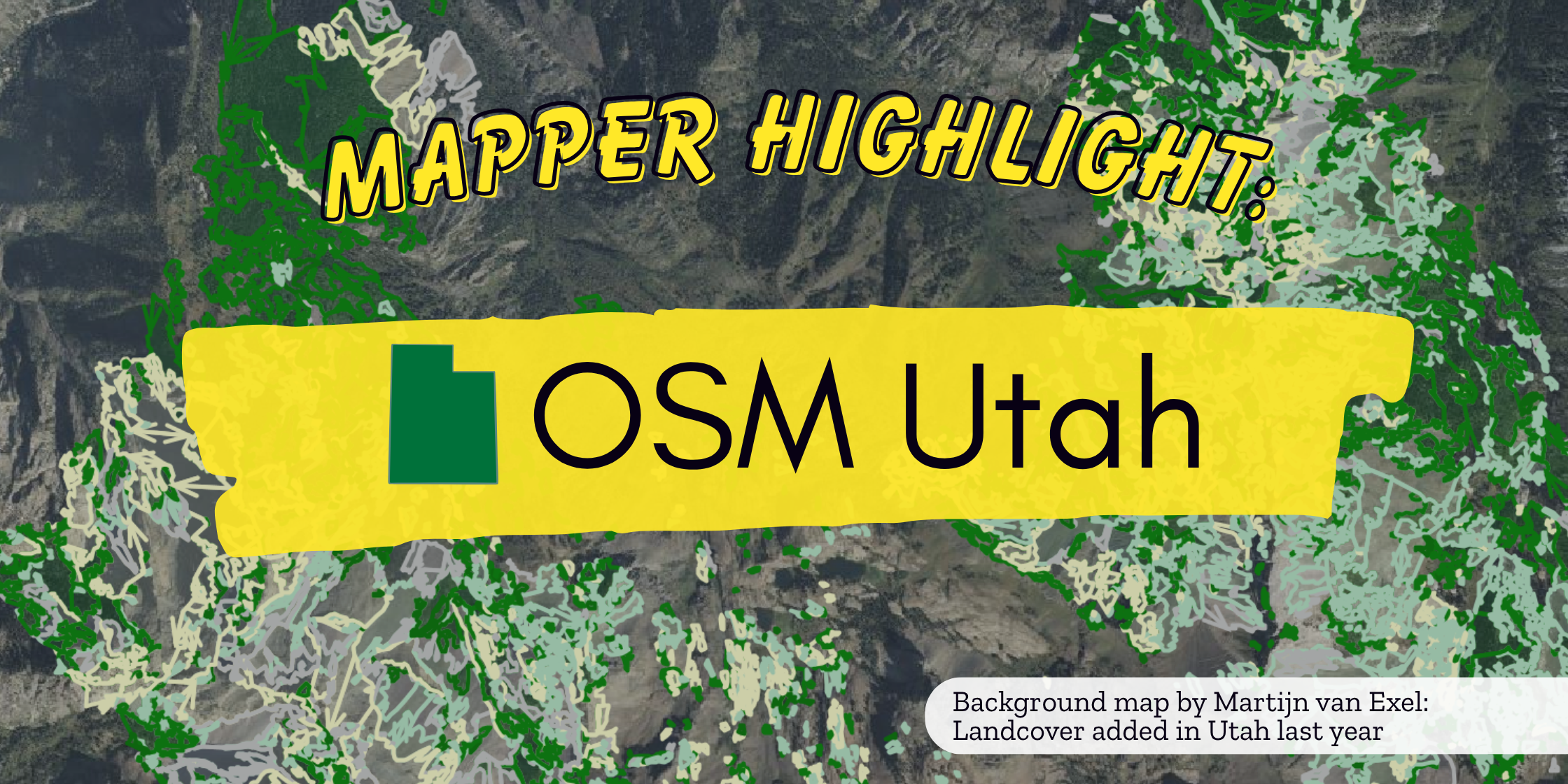
This is the second blog post in our Mapper Highlight series, celebrating the individual mappers and local groups who make up the OpenStreetMap US community. Thank you to Martijn van Exel, Jessie Pechmann, Da...| openstreetmap.us
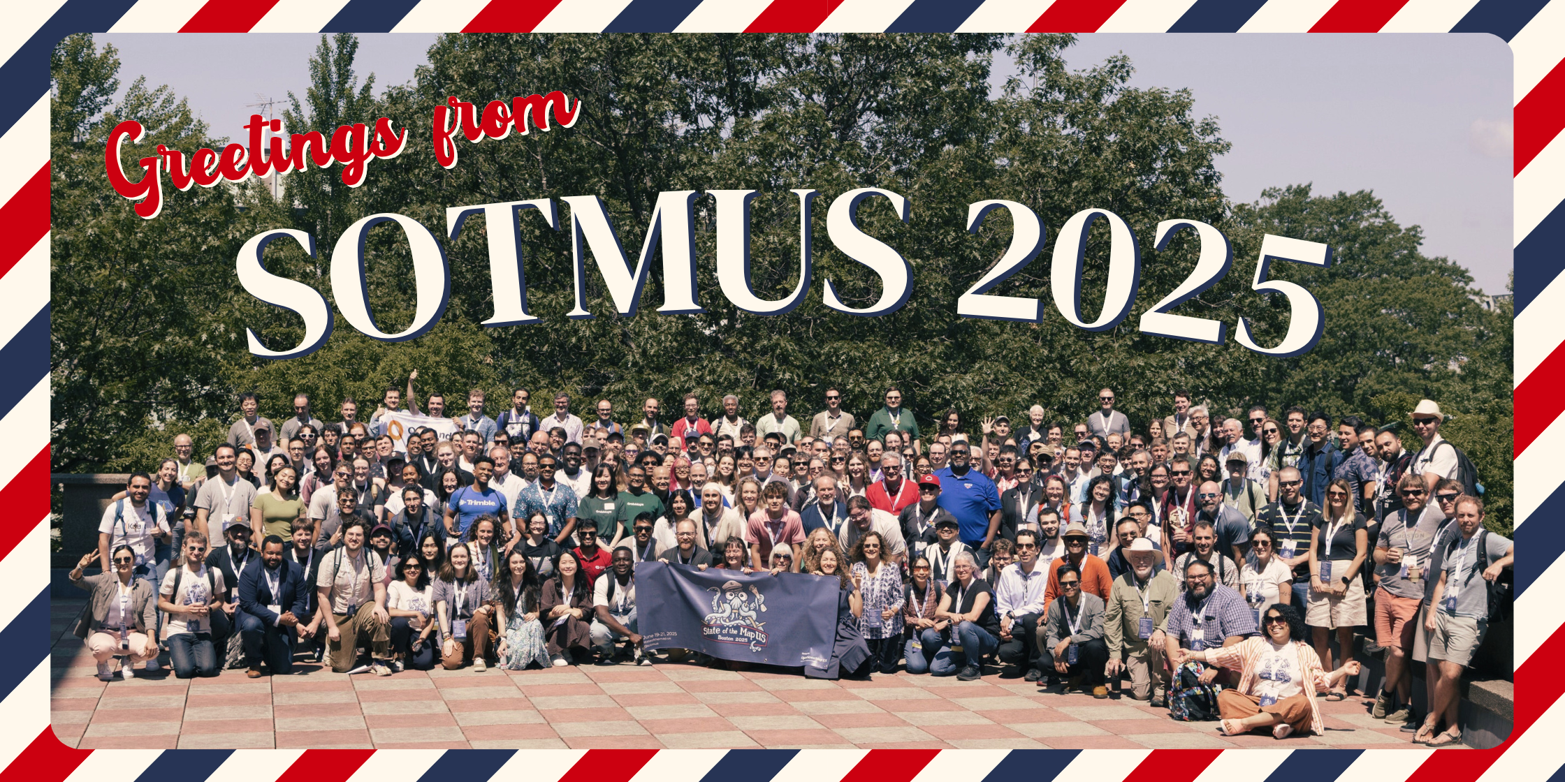
Another year another State of the Map US! Over 300 mappers gathered in Boston, Massachusetts in late June for OpenStreetMap US’s 13th annual conference, and to celebrate the organization’s 15th anniversary.T...| openstreetmap.us
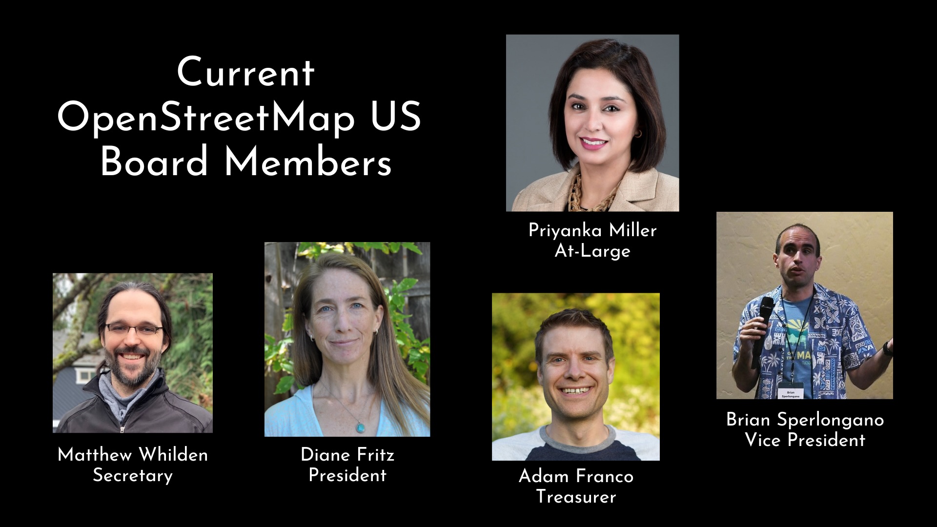
It’s election season at OpenStreetMap US! Nominations for the OpenStreetMap US Board of Directors will open on Saturday, January 20, 2024, and we hope that you consider running. As a member of the OpenStreet...| openstreetmap.us
OpenStreetMap US and GISCorps are proud to announce the signing of a Memorandum of Understanding (MOU) to formalize our collaboration in creating meaningful volunteer opportunities for geospatial professiona...| openstreetmap.us
We are calling on all members of the OpenStreetMap community to share your ideas and session proposals for the 12th State of the Map US. Whether you are brand new to OSM or a core contributor, we want to hea...| openstreetmap.us
For the entirety of the nearly two decades that OpenStreetMap has operated and changed the availability of global geospatial data, the project has relied on the dedication and innovation of volunteers around...| openstreetmap.us
We are pleased to announce OpenStreetMap US has joined 1% for the Planet as an Environmental Partner! This partnership will advance our impact through the OpenStreetMap US Trails Stewardship Initiative by cr...| openstreetmap.us
MapRoulette has come a long way since starting over a decade ago as a simple tool to fix road imports in the United States. Since its inception, we completely overhauled the design, made it easy for anyone t...| openstreetmap.us
This blog post is an update on the OpenStreetMap US Trails Stewardship Initiative. For past news and additional information on this initiative, visit openstreetmap.us/trails.BackgroundPublic open spaces in t...| openstreetmap.us