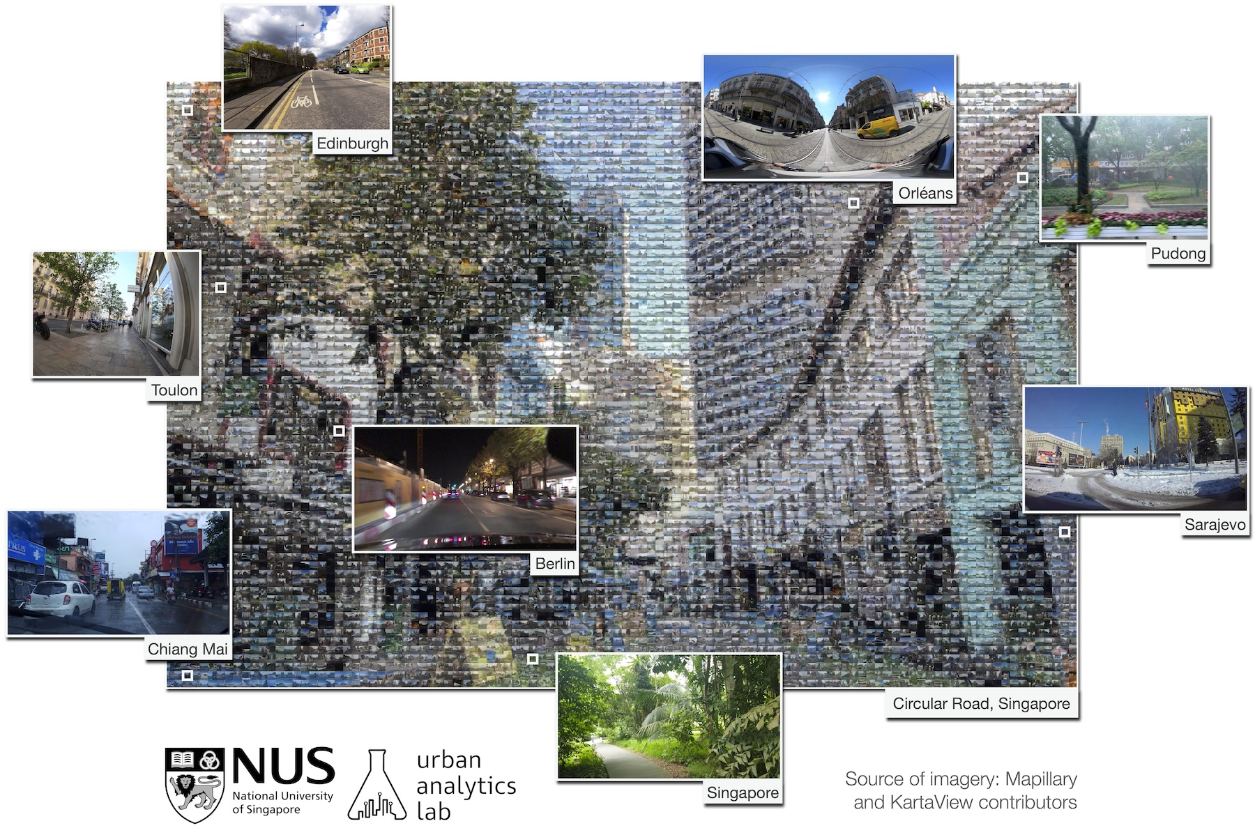
Street view imagery (SVI) is instrumental for sensing urban environments, benefitting numerous domains such as urban morphology, health, greenery, and accessibility. Billions of images worldwide have been made available by commercial services such as Google Street View and crowdsourcing services such as Mapillary and KartaView where anyone from anywhere can upload imagery while moving. However, while the data tend to be plentiful, have high coverage and quality, and are used to derive rich in...| Urban Analytics Lab | Singapore
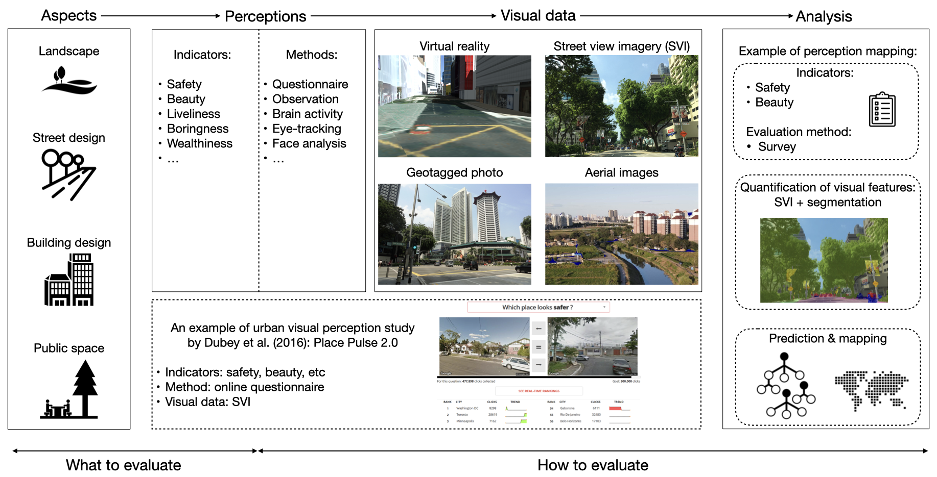
Visual characteristics of the built environment affect how people perceive and experience cities. For a long time, many studies have examined visual perception in cities. Such efforts have accelerated in recent years due to advancements in technologies and the proliferation of relevant data (e.g., street view imagery, geo-tagged photos, videos, virtual reality, and aerial imagery). There has not been a comprehensive systematic review paper on this topic to reveal an overarching set of researc...| Urban Analytics Lab | Singapore
Learn how to navigate and use Street View. Explore the world without leaving your couch and create and add your own images into Google Maps.| Google Maps Street View
Street view imagery has rapidly ascended as an important data source for geospatial data collection and urban analytics, deriving insights and supporting informed decisions. Such surge has been mainly catalysed by the proliferation of large-scale imagery platforms, advances in computer vision and machine learning, and availability of computing resources. We screened more than 600 recent papers to provide a comprehensive systematic review of the state of the art of how street-level imagery is ...| Urban Analytics Lab | Singapore
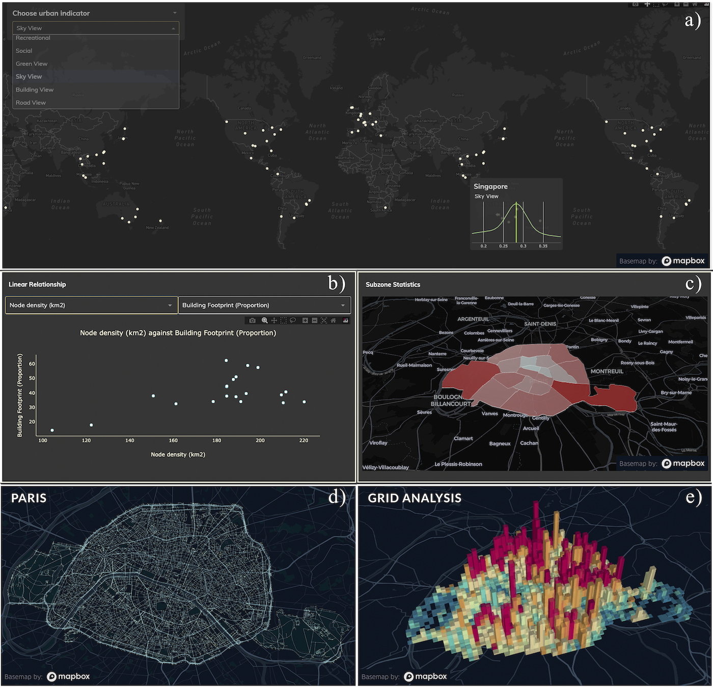
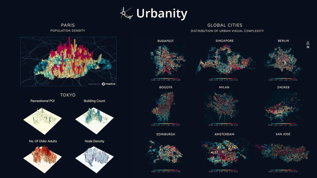
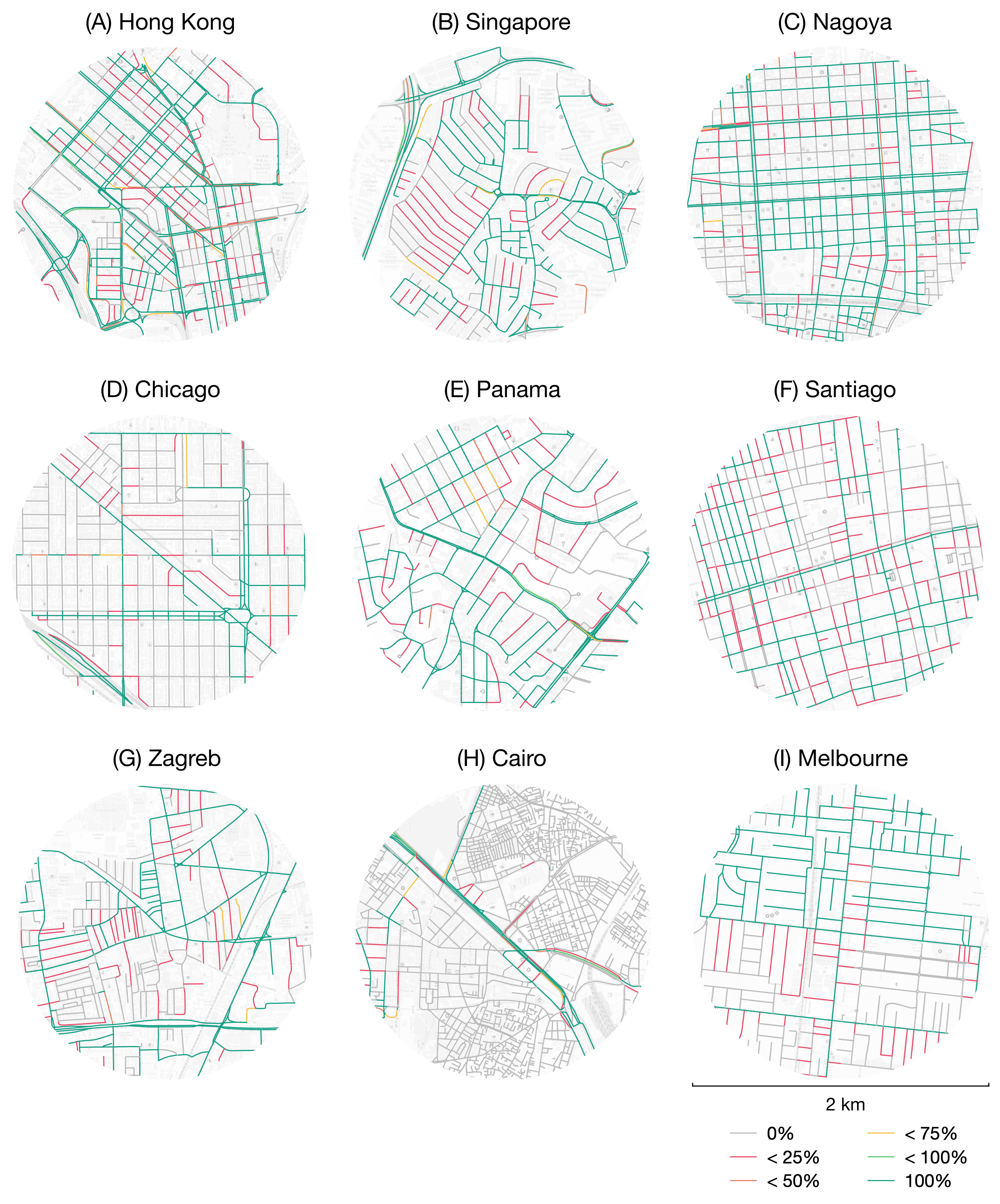
Urban network analytics has become an essential tool for understanding and modeling the intricate complexity of cities. We introduce the Urbanity data repository to nurture this growing research field, offering a comprehensive, open spatial network resource spanning 50 major cities in 29 countries worldwide. Our workflow enhances OpenStreetMap networks with 40 + high-resolution indicators from open global sources such as street view imagery, building morphology, urban population, and poin...| Urban Analytics Lab | Singapore
Urban networks play a vital role in connecting multiple urban components and developing our understanding of cities and urban systems. Despite the significant progress we have made in understanding how city networks are connected and spread out, we still have a lot to learn about the meaning and context of these networks. The increasing availability of open data offers opportunities to supplement urban networks with specific location information and create more expressive urban machine-learni...| Urban Analytics Lab | Singapore
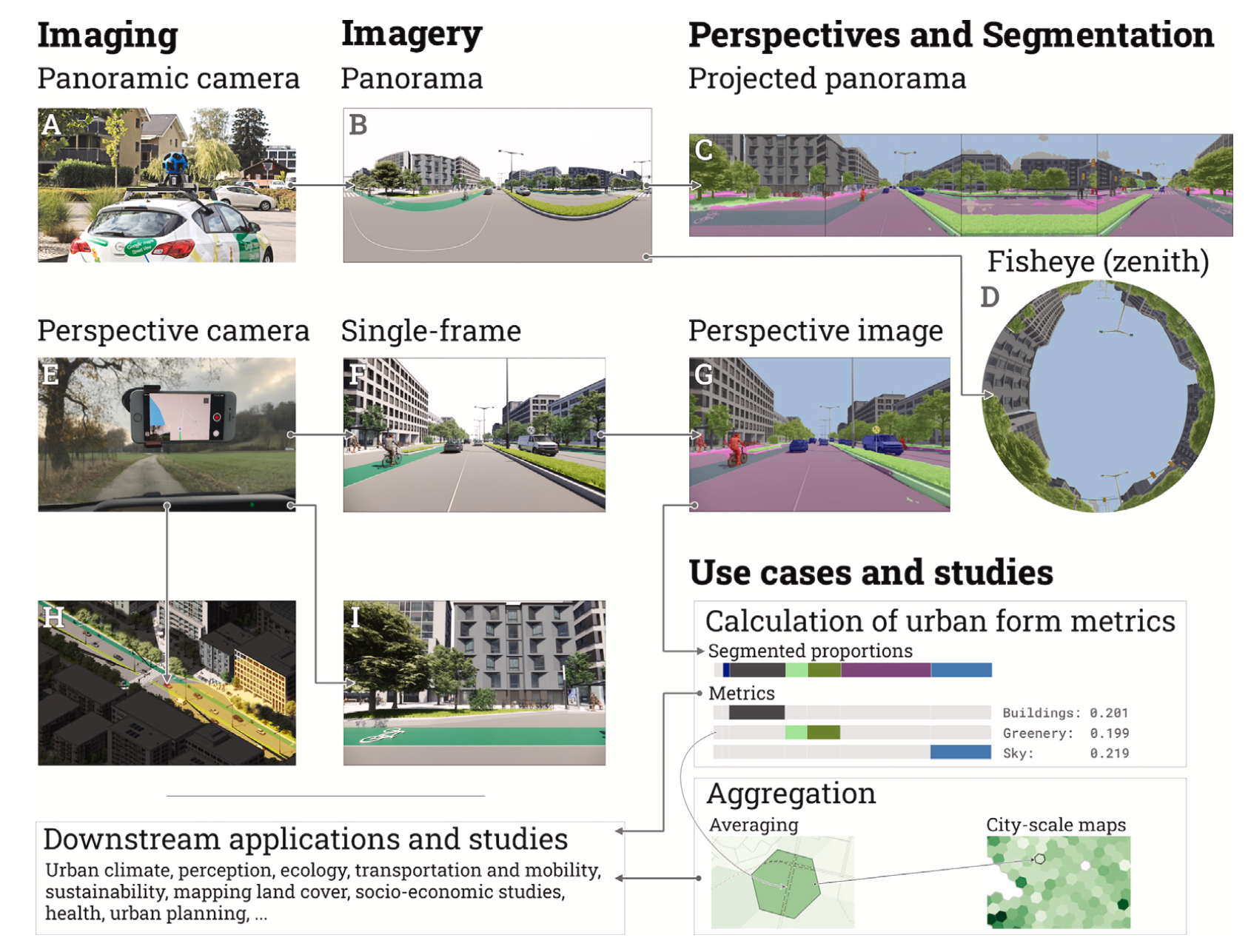
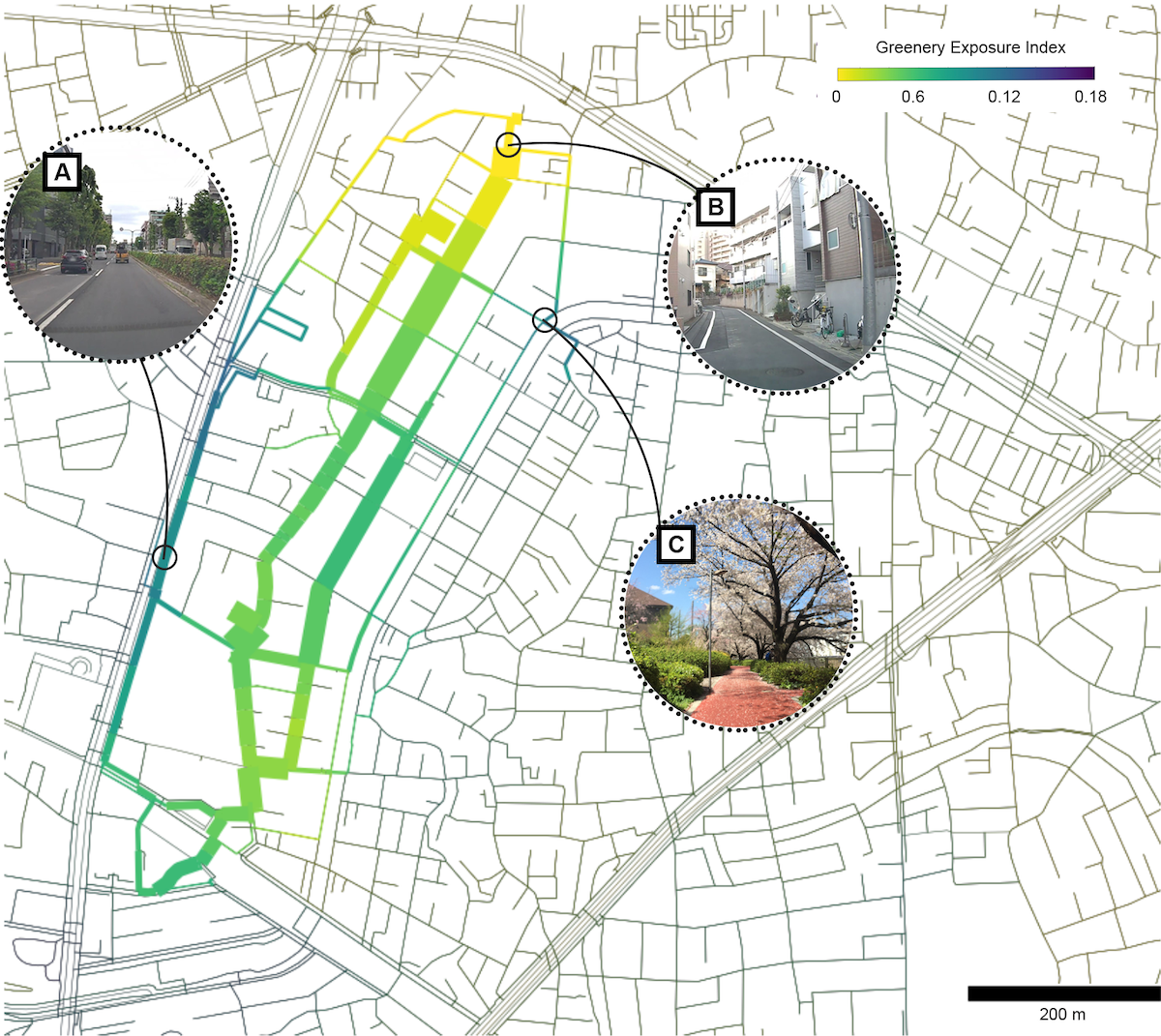
Street View Imagery (SVI) is crucial in estimating indicators such as Sky View Factor (SVF) and Green View Index (GVI), but (1) approaches and terminology differ across fields such as planning, transportation and climate, potentially causing inconsistencies; (2) it is unknown whether the regularly used panoramic imagery is actually essential for such tasks, or we can use only a portion of the imagery, simplifying the process; and (3) we do not know if non-panoramic (single-frame) photos typic...| Urban Analytics Lab | Singapore
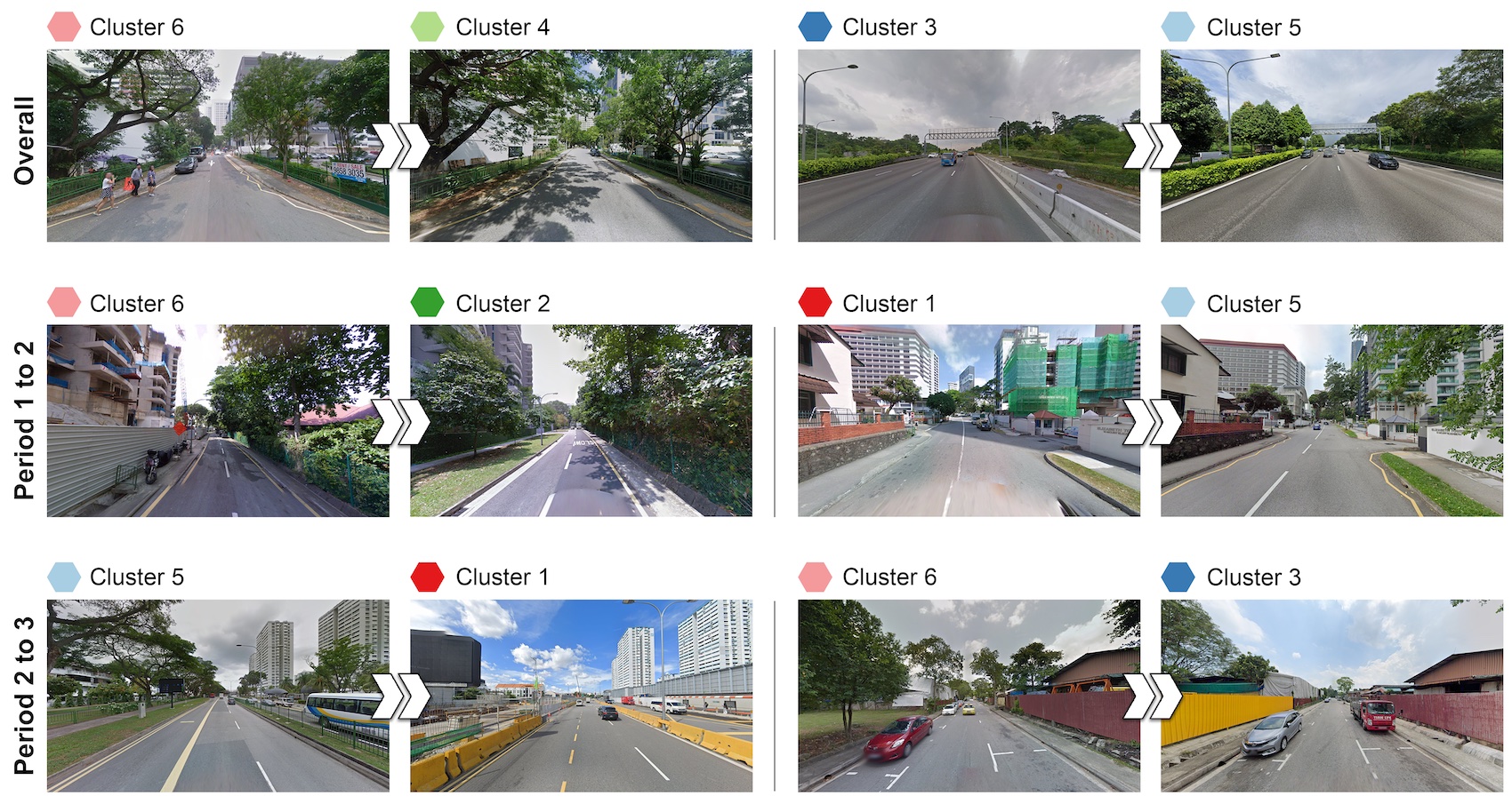
The visual landscape plays a pivotal role in urban planning and healthy cities. Recent studies of visual evaluation focus on either objective or subjective approach, while describing the visual character holistically and monitor its evolution remains challenging. This study introduces an embedding-driven clustering approach that integrates both physical and perceptual attributes to infer the spatial structure of the visual environment, and investigates its spatio-temporal evolution. Singapore...| Urban Analytics Lab | Singapore
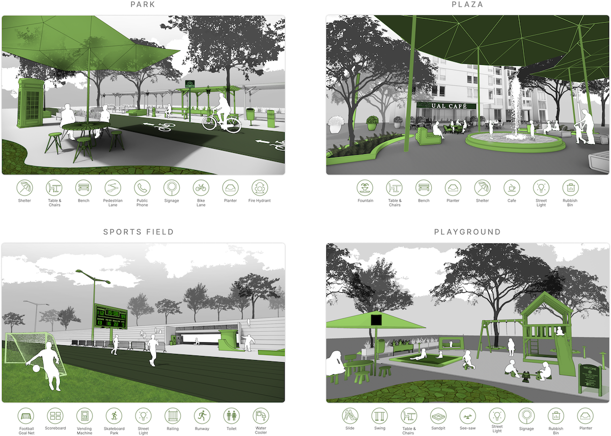
Public open space (POS) is essential to urban areas. Assessing them usually requires tedious approaches such as fieldwork and manual processes. Street View Imagery (SVI) and Computer Vision (CV) have been adopted in some urban environment research, bringing fine granularity and human perspective. However, limited aspects have been subject in these studies, and SVI and CV have not been used for holistic POS assessment. This research introduces a novel approach of employing them in conjunction ...| Urban Analytics Lab | Singapore
Planning for active mobility satisfies many fundamental tenets of good urban design and planning. However, planning for active mobility is a complex endeavour due to numerous local, place-based factors that influence active mobility decisions. Recent advancements in urban data research have demonstrated the effectiveness of deep learning methods in evaluating active mobility potential for urban environments. At present, the incorporation of semantic information from deep learning models and s...| Urban Analytics Lab | Singapore
Street view imagery (SVI) is increasingly in competition with traditional remote sensing sources and assuming its domination in myriads of studies, mainly thanks to the omnipresence of commercial services such as Google Street View. Similar to other spatial data, SVI may be of variable quality and burdened with a variety of errors. Recently, this concern has been amplified with the rise of volunteered SVI such as Mapillary and KartaView, which – akin to other instances of Volunteered Geogra...| Urban Analytics Lab | Singapore
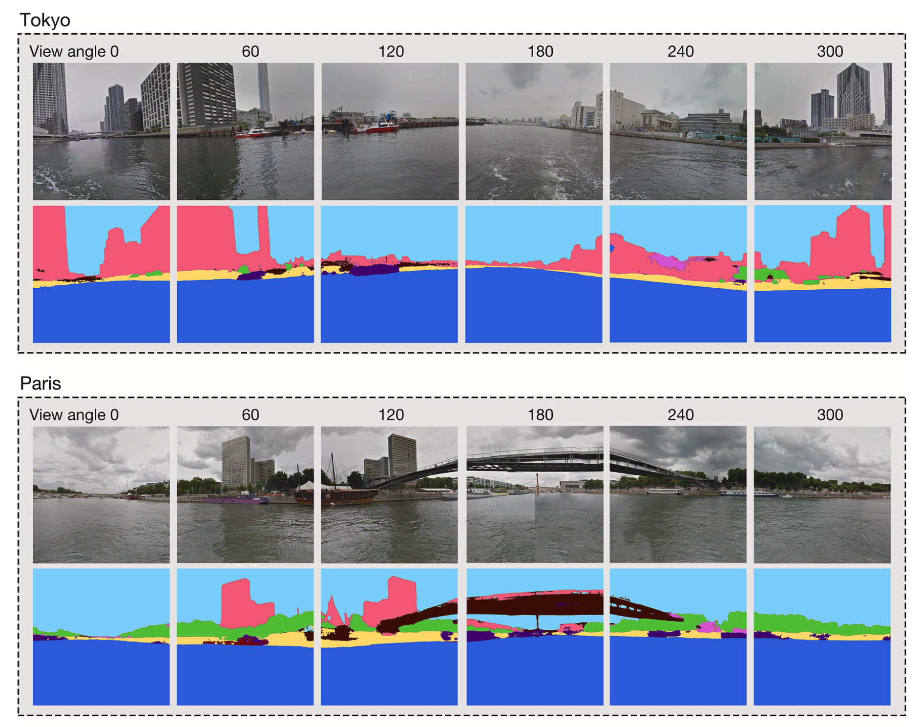
Gathering knowledge about physical settings and visual information of places has long been of interest to a wide variety of fields as they affect the experience of observers. Previous studies have relied on on-site surveys, low-throughput methods, and limited data sources, which especially hinder analyzing waterscape features. Thus, detecting the relationships between the human perception results of large-scale urban water areas and the waterfront features at high spatial resolutions remains ...| Urban Analytics Lab | Singapore
Street view imagery (SVI) has gained prominence in the past decade, offering a new perspective to map and understand cities. It supports numerous studies in the built environment, by replacing or supplementing aerial and satellite imagery, where some studies have not yet been possible with traditional platforms and have now been enabled for the first time thanks to the increasing volume of SVI data. However, the two perspectives are often disconnected and there has not been an overarching pap...| Urban Analytics Lab | Singapore